Tag Archives: Gulf Islands

Woman lies in blue hammock next to sea and forest

Bike Touring Mayne Island

While Mayne Island is just 21 square kilometres, it wants for very little. Fresh produce, locally brewed beer, artisan shops and quiet beaches can all be found on this little lump of rock. Combine this with well-paved roads reaching all four corners of the island and you’ve got yourself a wholesome, cyclist-friendly retreat.

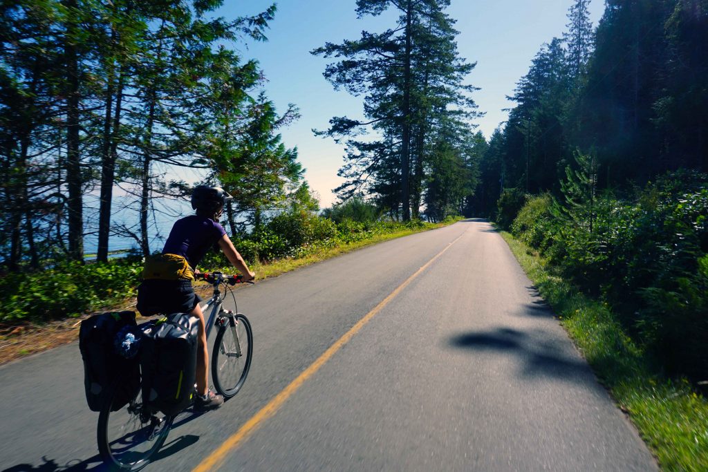
Cycling on Mayne Island

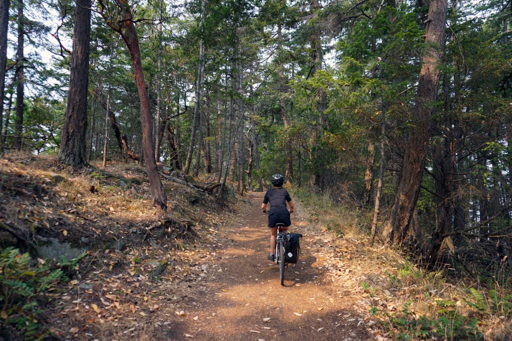
There are lots of different types of cyclists. If you’re of the variety that likes to adopt a leisurely pace, snack on roadside berries and stop for a well-earned beer, then Mayne Island is for you. There’s no hard shoulder or bike lanes, and as always, there are hills a-plenty. But even so, this is a cyclist hotspot. During the summer months you’re guaranteed to see people packing panniers. The traffic is respectful and the roads are all rideable.

Woman rides bike loaded with panniers along road
Cyclist friendly roads on Mayne Island

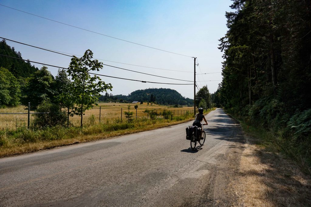
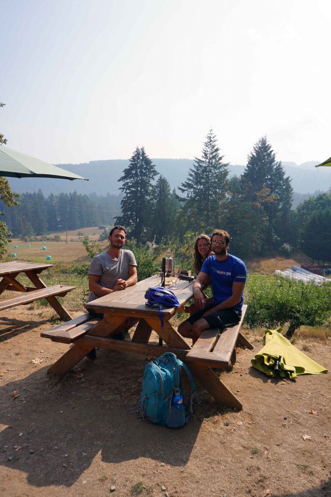
Mayne Island is small enough to cycle around in one day, but it’s also big enough to explore over the course of a long weekend. I was glad to have three days, as I was quickly overcome by the relaxed pace of island life. From May to October, there’s also a calendar of events to keep you entertained. During one August weekend, I stumbled upon the weekly farmer’s market, an outdoor cinema and a live music concert – and I wasn’t even trying to find any of them.

Three-day itinerary

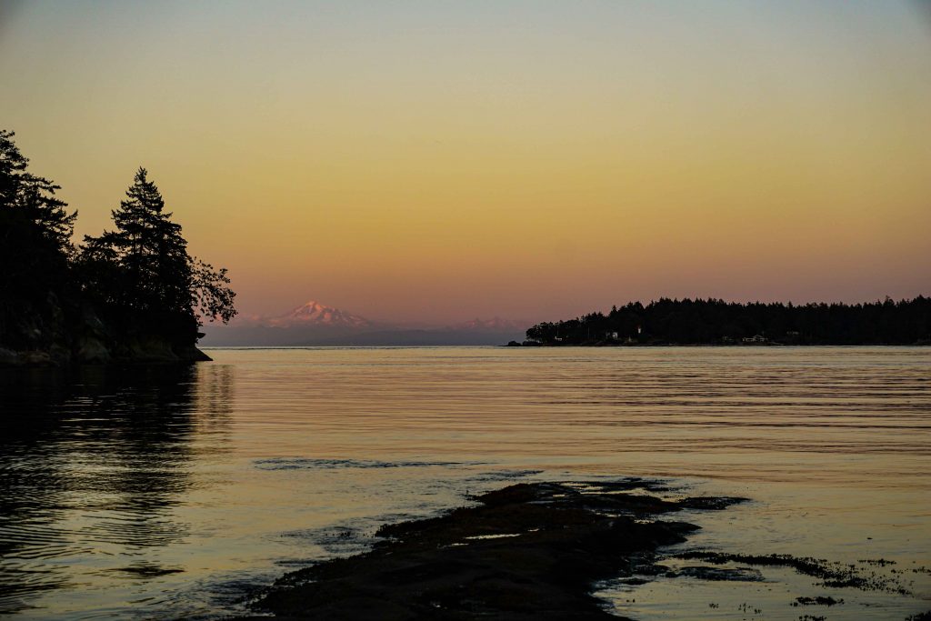
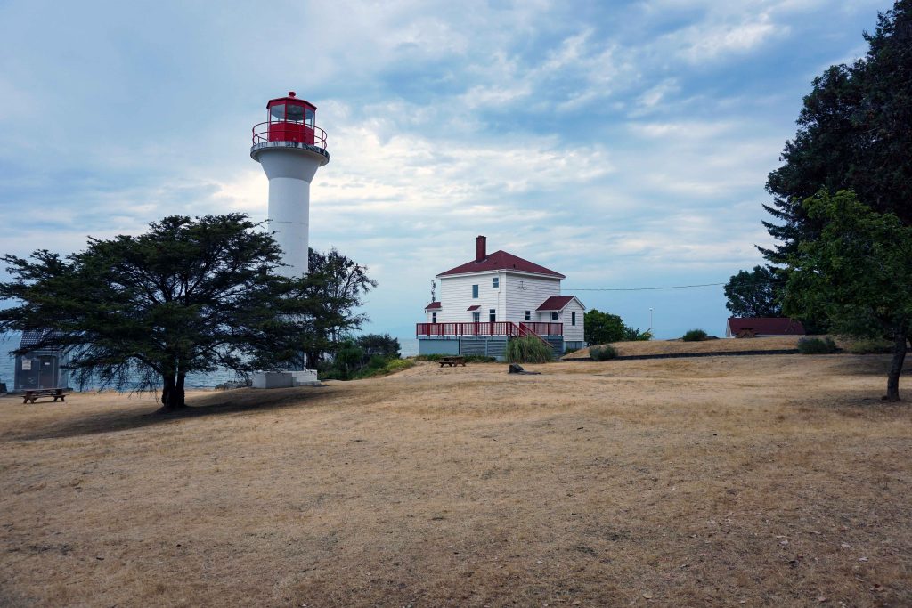
Conveniently, the road system is also circular in nature. This means you can loop around different parts of the island, rather than going back and forth on yourself. On the first day I pottered around the farmer’s market at Miner’s Bay before heading up to Georgina Point Heritage Park and lighthouse. This was followed by a relaxing afternoon on Campbell Bay beach and beers at Mayne Island Brewing Company.

Georgina Bay lighthouse
Georgina Point lighthouse
Campbell Bay on Mayne Island
Campbell Bay

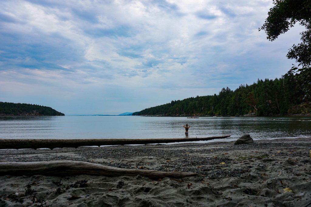
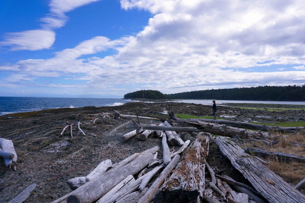
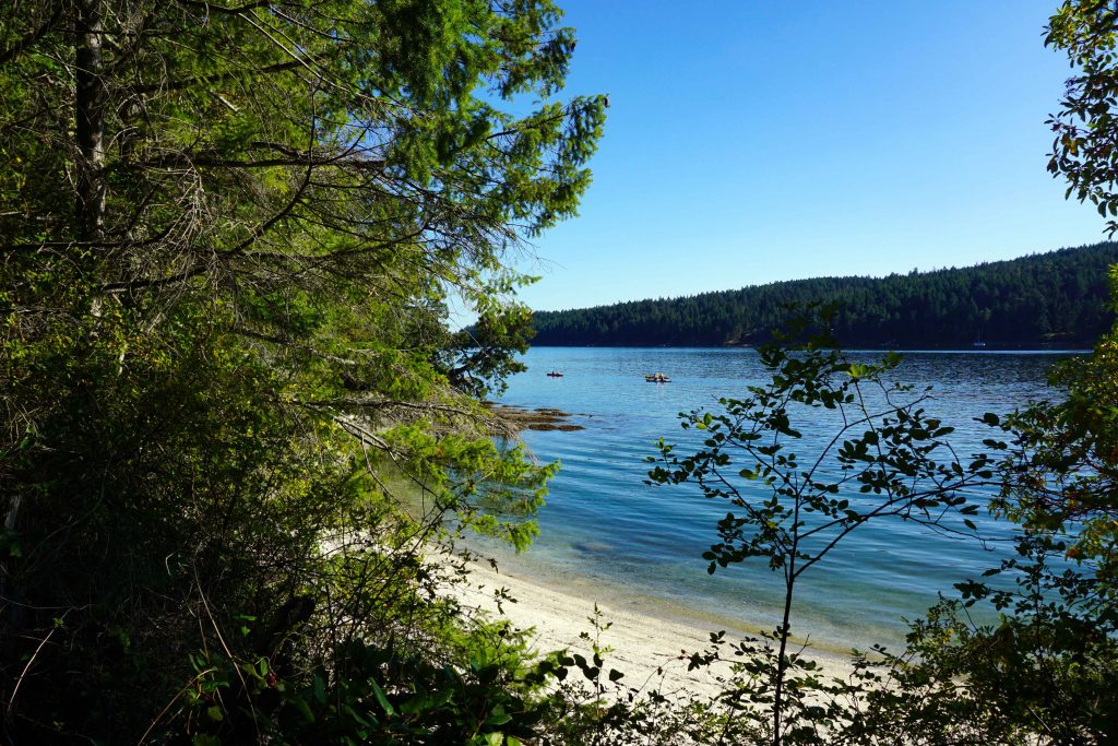
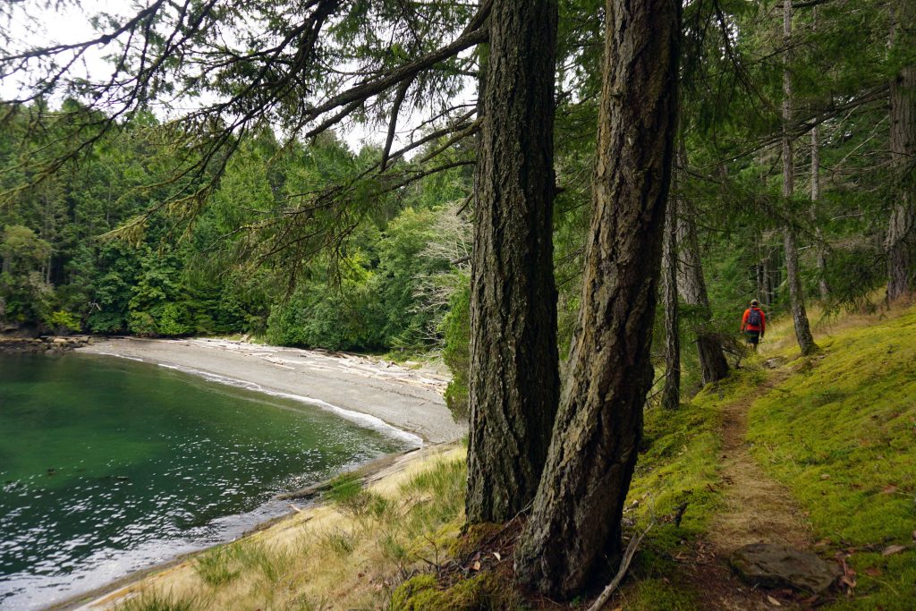
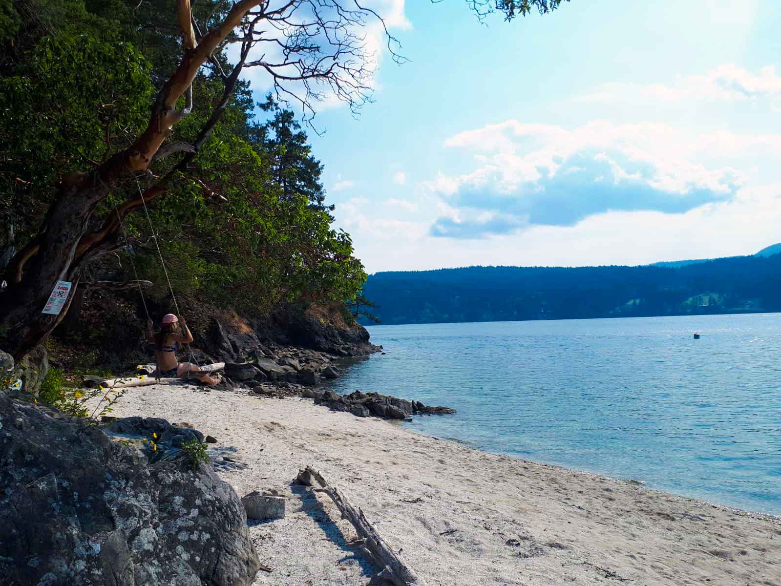
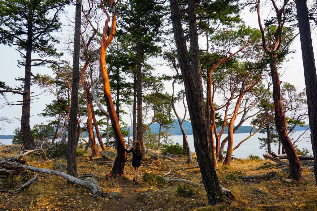
On the second day I stopped for a coffee at the Shavasana café. Once fuelled with caffeine, I made a beeline for Bennett Bay and Campbell Point. Afterwards I cycled to St John Point Regional Park for a stroll amongst the arbutus trees and a nap on the beach. I cycled past the brewery on my way back, so it seemed rude not to stop for a second time.

Arbutus trees on Mayne Island
St John Point Regional Park

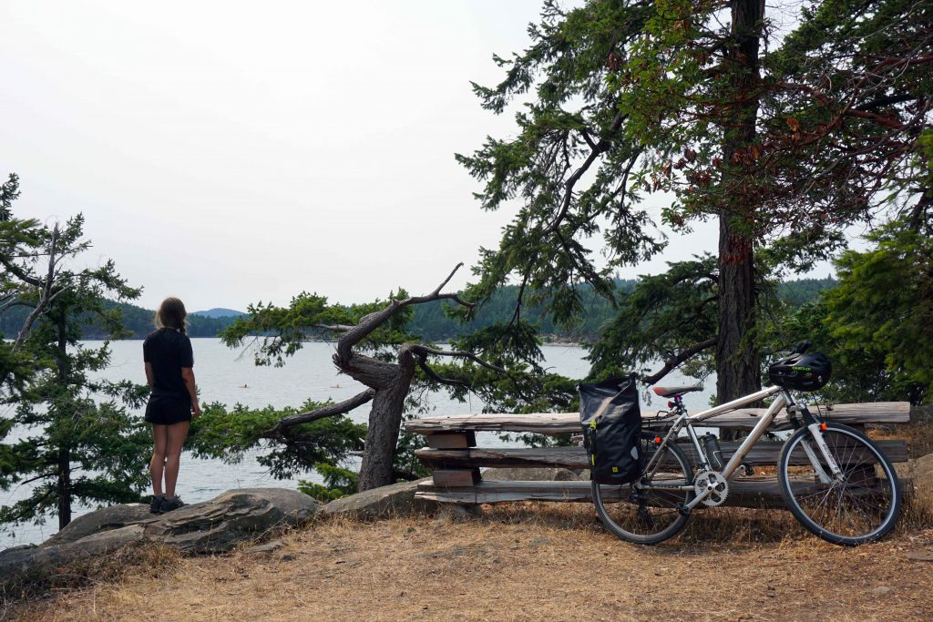
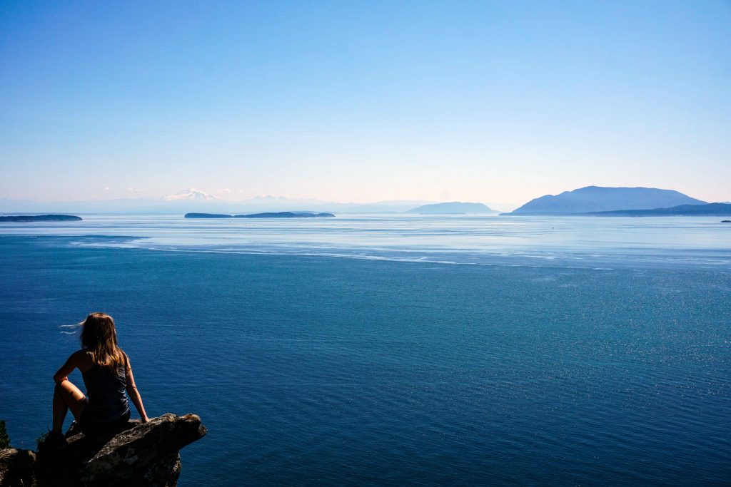
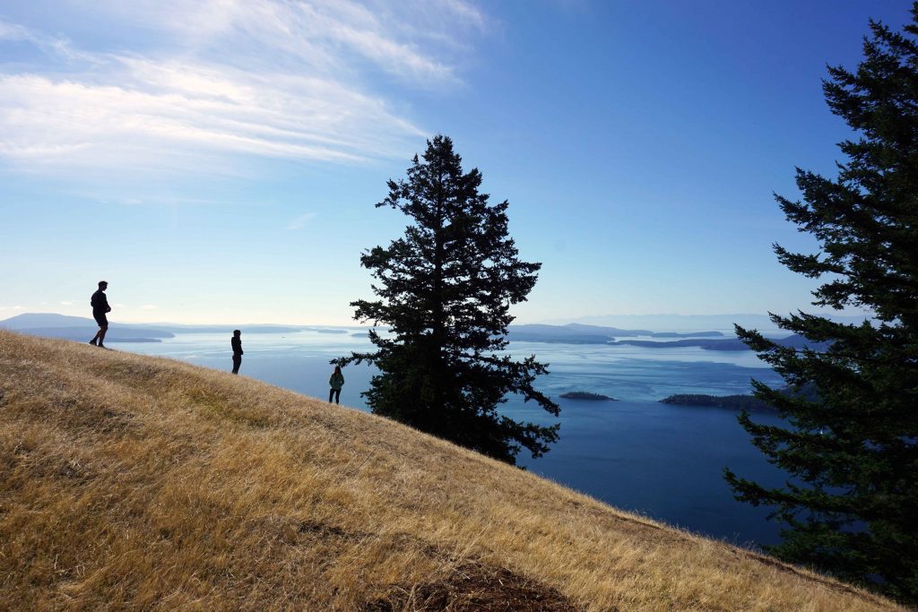
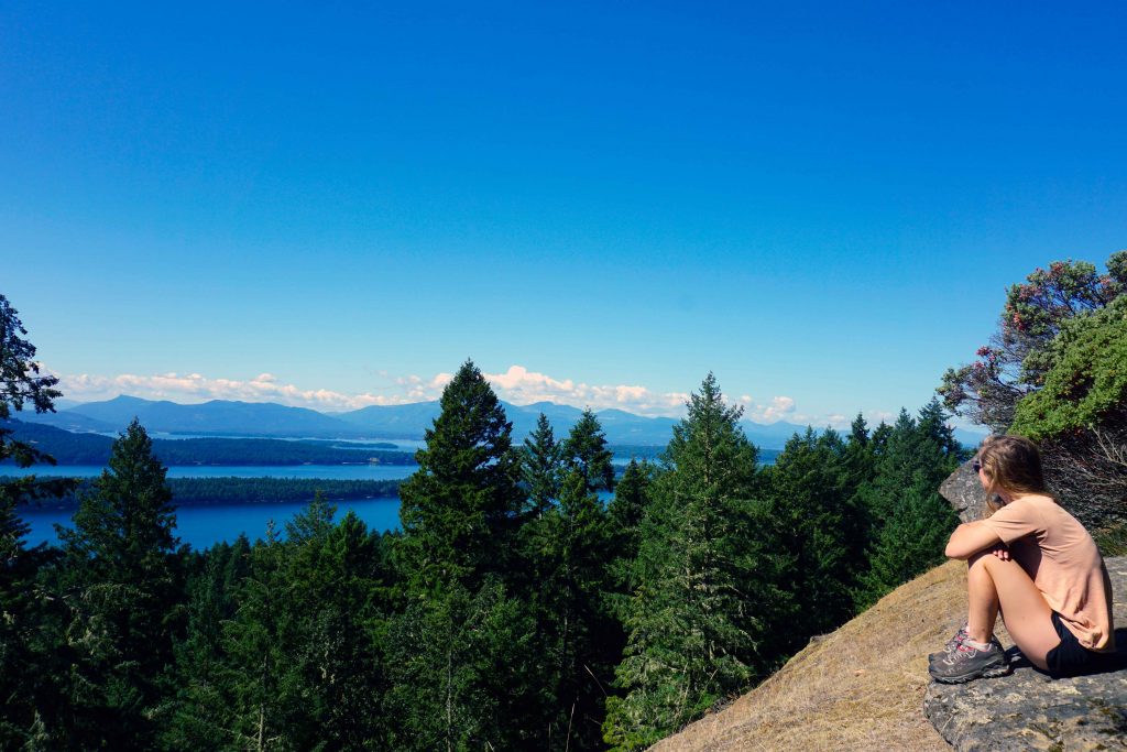
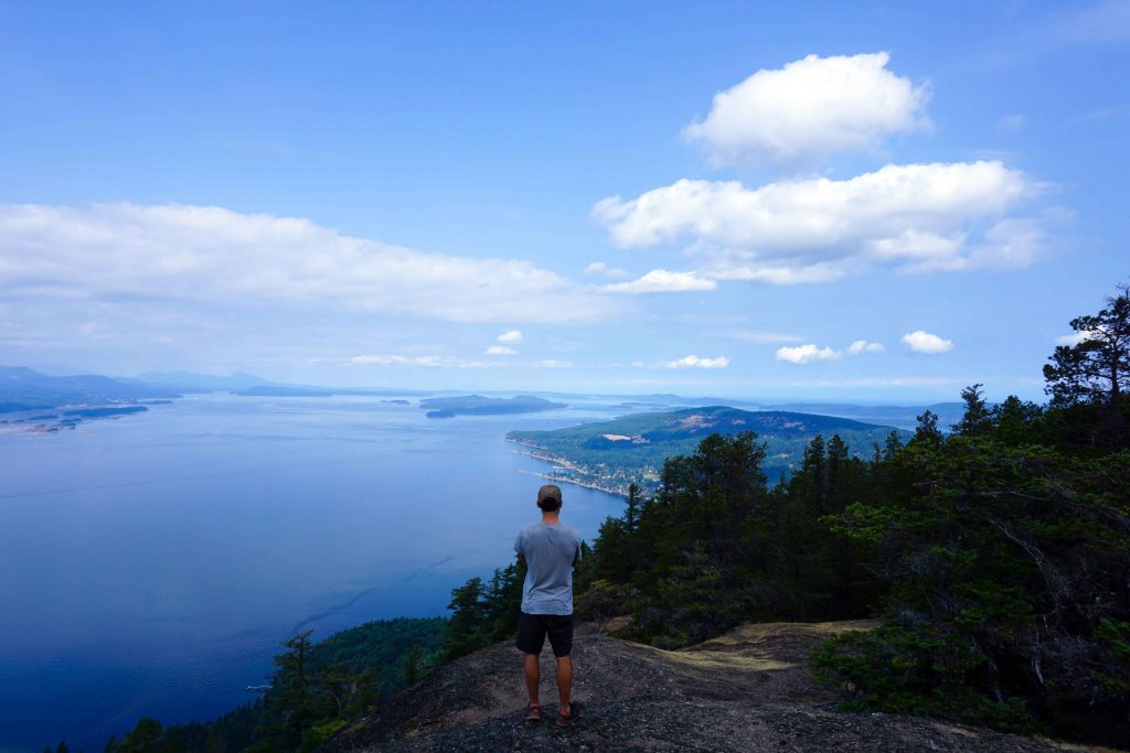
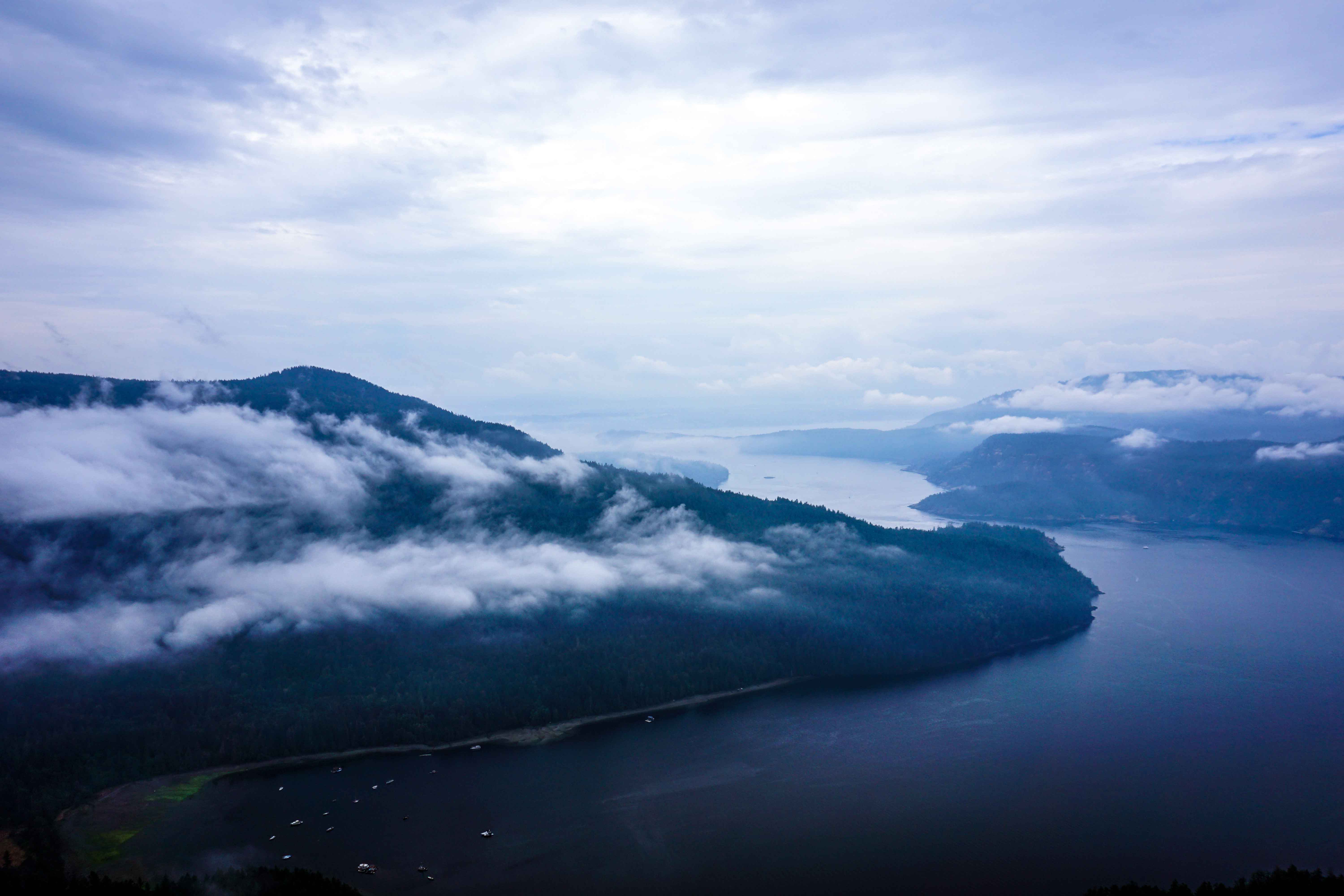
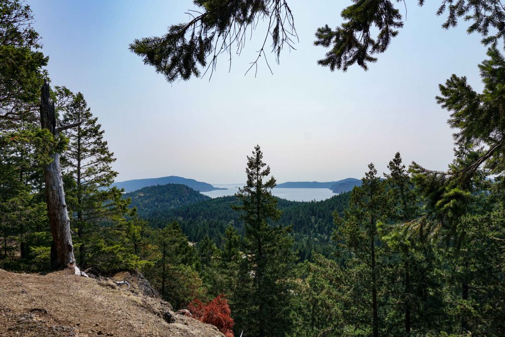
On my final day I headed straight to Mount Parke and hiked up to the viewpoint. Once I was back on my bike, I looped around the south of the island, stopping for a swim at Piggot Bay. Then it was a quick cycle back to Village Bay to catch the ferry.

Mount Parke Regional Park on Mayne Island
Mount Parke Regional Park
Piggot Bay

An artisan island

At all times, my progress was slowed by the relentless onslaught of fresh produce. Vast swathes of Mayne Island are given over to farmland, and they seem to be a prolific bunch. You can barely cycle 100m without another farm stand looming on the horizon. Some offer up flowers, others delicious fruit, veg and eggs, others homemade pickles, chutneys and other bounty. Many have even entered the modern era, allowing you to pay by either cash or e-transfer.

Mayne Island Brewery
Be sure to stop in at Mayne Island Brewery

If you time it right then you’ll find the roadside hedgerows to be bursting with blackberries. There aren’t any bears here, so you can pick at will. If you need further supplies, the small community of Miner’s Bay has two grocery stores, a bakery, a few eateries, a café, a post office, a gas station, an ATM and even a library. More quaint stores can be found further along Fernhill Road, including a second-hand book shop.

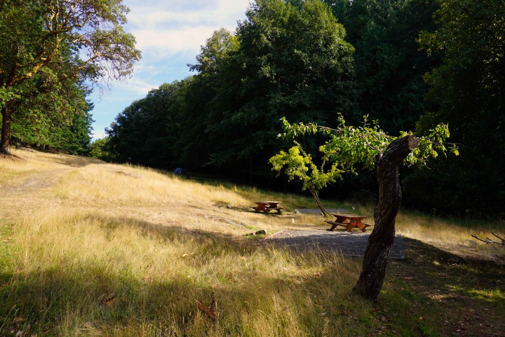
Camping on Mayne Island

While there’s a variety of holiday rentals on Mayne Island, there is just one campground: the privately owned Mayne Island Camping. Located just above Miner’s Bay, it’s only a 12 minute cycle from the ferry terminal and a short pedal to the grocery store. Private pitches and group camping are available.

Subject to water shortages, the campground has a beautiful shower erected amongst the trees (with privacy screens), drinking water and grey water sinks. However, there are no trash cans or recycling facilities. You either need to pack your rubbish out with you, or pay to drop it off at the island’s recycling centre.

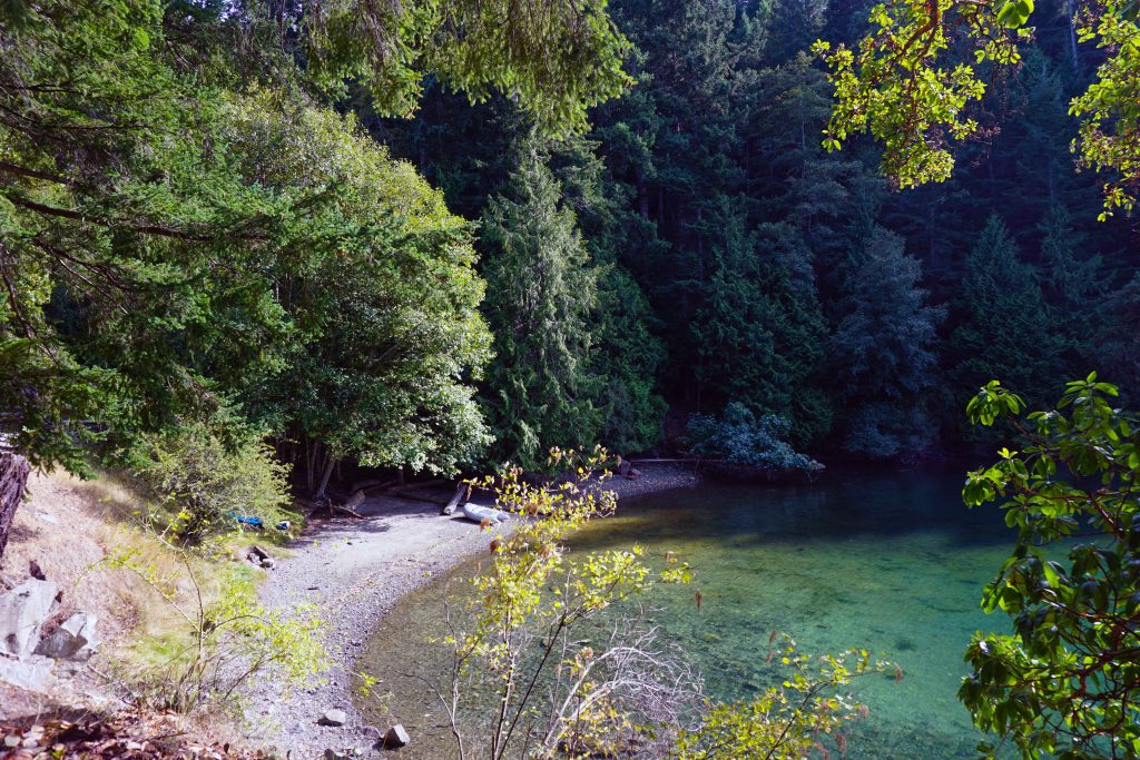
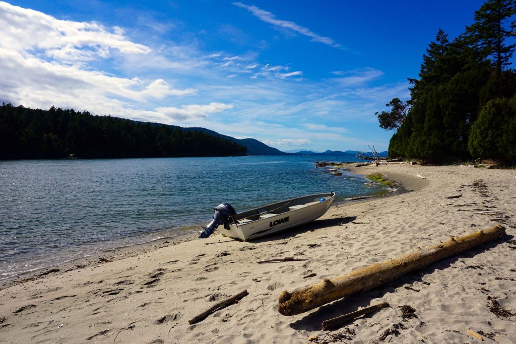
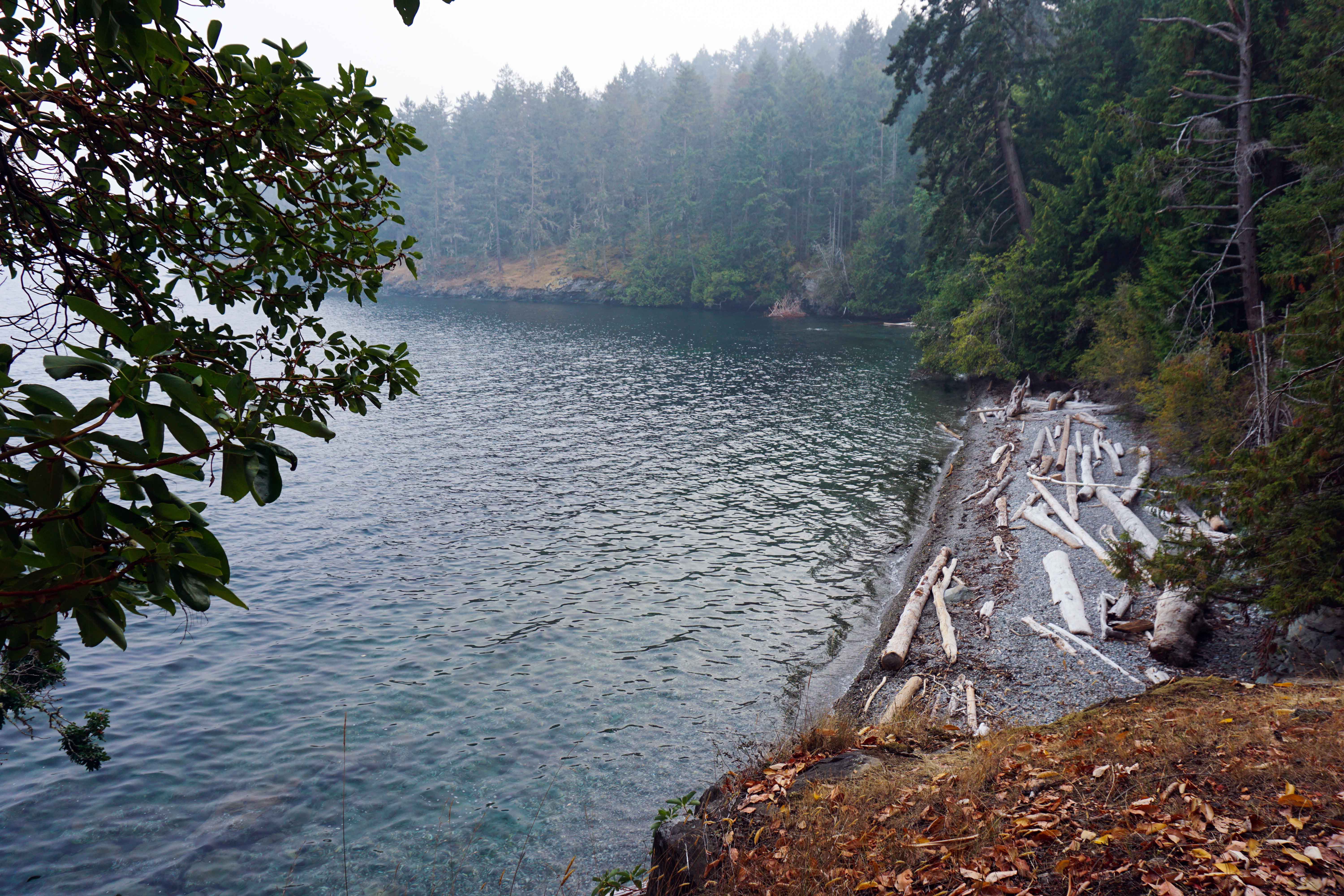
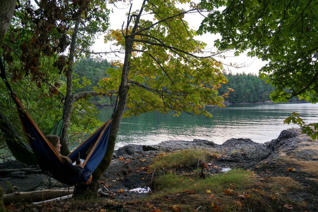
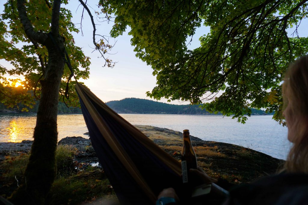
The campground is situated on the water’s edge. It has a little beach and boat launch. If you follow the trail through the forest behind the meadow, you’ll reach another stone beach with beautiful views across the ocean. It’s the ideal place to hang a hammock and kick back with a good book.

Mayne Island

What to do on Mayne Island

  • Visit the farmer’s market, held every Saturday between May long weekend and Thanksgiving, 10am to 1pm, on the grounds of the agricultural hall
  • Stroll around Georgina Point Heritage Park and lighthouse
  • Go for a swim at Campbell Bay beach – there’s a pontoon and the water temperature is manageable!
  • Hike up Mount Parke and enjoy the views. You can make it into a loop by hiking the halliday ridge trail, the old gulch trail and the lowland nature trail
  • Hike into St John Regional Park – my personal favourite
  • Visit Bennett Bay and Campbell Point
  • Take a look around the Japanese gardens
  • Eat your way around the fresh produce stands
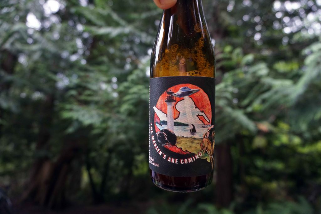
  • Sample a flight at Mayne Island Brewery

Cycling to Mayne Island: know before you go

  • Get to Mayne Island via BC Ferries (Tsawwassen/Swartz Bay to Village Bay)
  • Most of the island’s amenities are centred around Miner’s Bay, including two grocery stores
  • Bring cash for the food stands
  • There is one campsite – Mayne Island Campground. It isn’t open year-round and reservations are needed
  • You’ll probably have to take your trash with you or drop it off at the island’s recycling centre
  • Mayne Island Brewing does bottles of beer to go
  • You can pick up a map of the island on the ferry
  • There aren’t many beach access signs – just follow your nose

Bike Touring Saturna Island

If each of the southern Gulf Islands has its own personality, then Saturna would be the brilliant introvert. Often overshadowed by its more popular neighbours of Salt Spring and Galiano, it sits quietly, largely unnoticed by the masses.

Yet take the time to explore this island, which is just 31 square kilometres in size, and you’ll find it has its own hidden virtues. Beautiful hiking trails, spectacular views, quiet bays and onshore whale watching are just some of the reasons that make Saturna one of my favourite summer-time destinations. There’s even a vineyard for goodness sake.

Those looking for bustling farmer’s markets, a choice of restaurants and a calendar chock-full of events will be disappointed. Saturna is a sleepy, rural island. One half sits within the Gulf Islands National Park Reserve. The other half is home to just 350 full-time residents.

These characteristics, however, make it prime bike touring territory. The roads are quiet but there are enough hills to make it a challenge. I’ve bikepacked to Saturna on two occasions now, and while I’m adamant about visiting new places, I’d go again.

Bikepacking Saturna Island

Perhaps one explanation for Saturna’s isolated existence is that it’s not easy to reach. Ferries run between Saturna and Swartz Bay (Victoria) and Tsawwassen (Vancouver), but passengers typically have to transfer at Mayne or Pender. It’s also possible to get to Saturna from the other southern Gulf Islands, as I recently did after bike touring on Galiano Island.

In terms of accommodation, the island has a range of cottage rentals and B&Bs. For those wanting to sleep under canvas, there are two options available.

Arbutus Point Campground is conveniently located next to the ferry terminal at Lyall Harbour and, I might add, the pub. There are seven reservable sites, potable water and, in non-Covid times, a shower. It’s a short, sharp ride up to the General Store, which is surprisingly well-stocked and reasonably priced. But its proximity to the ferry, and its compact nature, mean this isn’t the most peaceful of sites.

That’s why my preferred choice is Narvaez Bay campground. A backcountry campsite run by Parks Canada, it’s billed as “one of the most beautiful and undisturbed bays in the southern Gulf Islands”. There are seven reservable sites, along with an overflow area that permits a maximum of three tents. There’s no potable water and you’re a long way from the island’s only grocery store. Given this, it’s best to stock up on all the essential items before pedalling the length of Narvaez Bay Road. During the final approach, the road becomes a little looser with more potholes. When you finally reach the end, there’s a 1km walk (or ride, if your bike’s up to it) to the campsite. There’s also a bike rack, should you want it.

Narvaez Bay campground
Narvaez Bay

What to do on Saturna Island

Regardless of whether you camp at Narvaez Bay, it’s well worth a visit. It’s a gorgeous spot and the hiking trails to Monarch Head and Echo Bay are stunning.

Monarch Head

Another must-see destination is East Point. The ride there is an event in itself. Another cyclist I spoke to said it was the highlight of her trip, and she’d been touring all over the southern Gulf Islands. On a clear day, Mount Baker looms large in the distance. Thanks to the geography of the area, sea life here is abundant. The road runs alongside the shore and it’s common to see harbour porpoises, seals, sea lions and otters as you pedal along.

Once you reach East Point, you’ll find a former fog alarm building perched amongst the grass, which is parched golden during the summer months. Inside you can read the harrowing story of Moby Doll, the first orca to be captured and kept in captivity. Afterwards, take a stroll along the whale trail where you stand a good chance of seeing orcas and humpback whales.

For views, nothing beats those on offer at the top of Mount Warbuton Pike. At around 400m high, reaching the summit is an uphill slog on a bike. The road is steep and fairly rough. Once you reach the end, expansive views open up in front of you, spanning all the way across to the San Juan Islands in the United States. The Brown Ridge trail runs parallel to the edge. It’s a relatively flat hike, and one that will have you reaching for the camera time and time again. Eagles and vultures usually soar overhead, and you may also bump into the wild mountain goats that live here.

Views from Mount Warbuton Pike

Other points of interest include Winter Cove, which has an easy 1.5km loop trail through the forest and along the shoreline. Saturna Beach in Thomson Park is great for a picnic and a swim. There’s also the disconcertingly named Murder Point hike, a cliffside trail which continues along to Taylor Point.

Cabbage Island

Should you be fortunate enough to have access to a seafaring vessel, you could ditch your bike for a night and sail, motor or kayak across to Cabbage Island. There are five rustic campsites, a sawdust outhouse and a food cache – erected not for the bears, but for the rapacious racoons. Be sure to take drinking water and cash so you can pay your fees using the self-registration envelopes.

One side of the island is exposed to the elements, and the black volcanic rock is strewn with logs and windswept trees. In contrast, the other side has a white sandy beach with calm waters, making it ideal for swimming. The wetlands and lagoon make this an important area for wildlife, and eagle and oystercatchers often nest here.

The rugged side of Cabbage Island

During peak season, you’ll probably have to share the view with other boaters who make use of the Parks Canada mooring buoys here. But should you get the place to yourself, you’d be forgiven for thinking you’d landed on a desert island. You can’t see any signs of civilisation from the beach, and should the winds pick up – as they did when I went – you might just be marooned here.

boat on sandy beach
The sandy shores of Cabbage Island

I made it off Cabbage Island in the end. But had I missed my return ferry to Vancouver, I wouldn’t have minded too much. I’d be happy to pedal around Saturna with my panniers for a little while longer.

Know before you go

  • Get to Saturna Island via BC Ferries (Tsawwassen/Swartz Bay to Lyall Harbour).
  • There’s only one grocery store on the island – it’s located on Narvaez Bay Road, a 10 minute cycle from the ferry terminal
  • Narvaez Bay campground has no potable water
  • Hiking opportunities include Mount Warbuton Pike and Murder Point
  • The island has some steep hills – you’ll want all your gears!

Galiano Island

Bike Touring Galiano Island

If the Saturday morning ferry from Tsawwassen is anything to go by, the joys of cycling around Galiano Island are no secret. There are bikers of all varieties. Some are ultra-streamlined, carrying only a few snacks about their Lycra-clad bodies. A few have small backpacks, evidently having arranged accommodation on the island – no tent required. While others, like me, are heavily laden with panniers. Everything needed for my survival is strapped to my ancient hardtail, ranging from a sleeping bag to a paltry number of knickers.

Cycling on Galiano Island

This is my first stop on a week-long bike tour around the southern Gulf Islands, during which I’ll visit Galiano Island, Saturna Island and Cabbage Island.

As the ferry prepares to dock, I eye up the road leading from the terminal. Unusually, it doesn’t appear to feature a giant hill. But as I soon discover, there are other obstacles to overcome. Most notably, the array of cafés and shops located in the vicinity. In fact, I only manage to cycle approximately 100m before stopping at the Bowline Café for a coffee and cake. I figure I need the energy.

I finish the last crumbs of my scone and decide I’d better get moving. At 27.5km long and never more than 6km wide, Galiano is long and thin. I’m keen to see as much of it as my legs will bear. I cautiously manoeuvre myself onto my bike. It’s no joke having everything piled atop the back wheel, and my trusty steed is almost impossible to control until I’m sat on the saddle. I’m suddenly thankful for my unscheduled pit stop, as the ferry traffic has now passed by, leaving me an almost empty road to wobble along.

I soon encounter my first hill. And the second. And the third. As it turns out, this island is full of hills. But mercifully, most are fairly short. The only time I’m really gasping is during the climb from Montague Harbour to the Hummingbird Pub. This is all the more galling when the free pub bus passes by, on its way to collect revellers from the campground.

But despite the hills – and the absence of a hard shoulder – I can see why this is a cycling hotspot. Those out for the day can jump on the morning ferry from Tsawwassen, work up a sweat during the 55km out and back ride, before returning to the mainland in the evening. For bike tourers like myself, a more leisurely pace can be adopted. There are various coves, beaches and viewpoints to discover. There are walking trails dotted across the island, with Bodega Ridge and Mount Galiano offering spectacular views across the channel.

Woman looks out from ridge across the sea
Bodega Ridge

Camping on Galiano Island

After a day of exploration, I needed somewhere to pitch my tent. Galiano has two campsites to choose from, both of which are operated by BC Parks.

Montague Harbour Marine Provincial Park

The first is Montague Harbour Marine Provincial Park, which is just 8.3km from Sturdies Bay. The sheltered harbour offers safe mooring to boaters, while clear waters lap against a white shell beach. Across the lagoon, the Gray Peninsula has a gentle 2km loop hiking trail. More white shell beaches line the shores, giving it the feel of a tropical paradise on a hot summer’s day.

There are 28 walk-in/cycle-in sites which can be reserved, along with seven first-come first-serve sites. Campers have access to pit toilets, drinking water and fire rings. With drive-in sites also available, this campground gets busy during the summer, so reservations are highly recommended.

white shell beach
White shell beaches line the Gray Peninsula

Dionisio Point Provincial Park

The other option is Dionisio Point Provincial Park, which is roughly 25km from Sturdies Bay. The park is, in theory, marine access only. However, it can be reached via the eastern foreshore. It seems many people also make use of the private road that leads directly to the park boundary. This begins at the end of Bodega Beach Road and cuts across a hotly contested parcel of land. The details are complicated, but suffice to say that it’s been the focus of a long-running legal battle between the land-owners and the provincial government. Currently, the road remains the property of the land-owners – meaning anyone who uses it without permission is trespassing.

Access issues aside, there are 30 wilderness campsites spread across two campgrounds. Parry Lagoon Campground is closer to the beach and the water pump, while Sandstone Campground features waterfront sites. All are first-come, first-serve and can be paid for in advance through Discover Camping, or in cash upon arrival.

The park has a network of trails that guide you through the rugged beauty of this northerly outcrop. Dionisio Point offers a sweeping panorama of the North Shore Mountains, and the verdant forest contains stands of Douglas-fir, Western hemlock and arbutus. The park also has archaeological sites formerly used by the Penelakut First Nation. It’s a serene spot – a place to sit quietly and watch for herons, seals and deer.

woman sits on rock at sunset
Sunset at Dionisio Point
man walks through forest next to beach
Walking around Dionisio Provincial Park

The gem of the Salish Sea

After a few days spent swimming, hiking, fishing and, of course, cycling, it’s time to head to my onwards ferry. As I’m puffing my way up the final hill, I find Galiano Island has surprised me. Being so close to Vancouver, I expected it to be overrun and noisy. Sure, there are plenty of tourists here during the holidays. But there are pockets of tranquillity, an artisan atmosphere and unadorned natural beauty. The Galiano Island Chamber of Commerce dubs it the gem of the Salish Sea. That, I decide, is fair enough.

sunset across the sea
Views of Mount Baker from Galiano Island

Know before you go

  • Get to Galiano Island via BC Ferries (Tsawwassen/Swartz Bay to Sturdies Bay).
  • Grocery stores and other amenities are clustered in and around Sturdies Bay – stock up once you get off the ferry
  • Hiking opportunities include Mount Galiano and Bodega Ridge – both are beginner friendly and have great views
  • The ecological reserve is good for trail running – although there aren’t any maps, which makes navigating confusing
  • Other places to visit include the Tapovan Peace Park and Lover’s Leap viewpoint
  • Look out for beach access signs. Popular spots include Pebble Beach and Morning Beach

Interested to know more about the southern Gulf Islands? Read about my time bike touring Saturna Island and my Active Guide to Salt Spring Island.

View from Mount Erskine

An Active Guide to Salt Spring Island

Salt Spring Island is the largest of the Gulf Islands and is a firm favourite amongst those looking to escape the hubbub of the city. And with good reason. It’s just a short trip from either Vancouver Island or the Lower Mainland, but once you step off the ferry, island life quickly kicks in. There’s a decidedly laid-back vibe here, with arts, crafts and food being high on the list of priorities.

Food is a particular passion on Salt Spring, especially of the homegrown, artisan variety. Cheese, coffee, salt, meat, vegetables, baked goods, wine, ale and cider – it can all be found here in abundance. The plethora of markets, roadside stalls, farm shops and independent eateries ensure you can never go far without devouring something totally delectable. All locally grown and produced, of course.

But as I found out on a recent visit, Salt Spring Island also has a few treats in store for the outdoors enthusiast. So, here’s my active guide to Salt Spring Island.

Cycling

Salt Spring Island is a popular destination for those touring on two wheels. If you visit in the summer months, it won’t be long before you see a Lycra-clad cyclist lugging a pair of panniers up a hillside.

Upon telling a local that I, too, intended to cycle around the island, his eyes widened and a torrent a warnings quickly poured forth. It was too hilly, he said, and too dangerous. The roads don’t have separate cycle lanes and the drivers aren’t particularly accommodating.

Feeling a little deflated, I made my way to Salt Spring Adventure Company and made further enquiries. The staff allayed my fears, saying that while there are hills, you can always get off and push (or rent an e-bike). And yes, you do have to cycle in the hard shoulder, and yes, some of the roads are busy. However, if you are reasonably confident on a bike, and you stick to the quieter roads, you’ll be just fine. So, I rented a bike and off I went.

There are two recommended routes – the northern loop (approximately 35km) and the southern loop (approximately 50km). If you’re keen, you could do the whole thing.

I opted for the northern loop, heading out of Ganges on the Upper Ganges Road, skirting St. Mary’s Lake, peddling to the northern-most tip before heading back along Sunset Drive for a pit-stop at Vesuvius Café. There was one final hill to conquer before reaching Salt Spring Wild Cider, where it was time to relax in the apple orchards while quenching my thirst.

It cannot be denied that some of the hills are real thigh-burners. And some of the roads are unpleasantly busy. But on the whole, it’s a beautiful way to spend a day. The winding country lanes take you through pastoral landscapes where vines grow and cattle lazily munch. During August the hedgerows were bursting with blackberries, and there’s plenty of quaint cafes, farm shops and roadside stalls to keep you fuelled. If it all gets too much, you can always stop in one of the freshwater lakes for a swim.

Three friends sit at a table in an apple orchard

Enjoying a cider after a thigh-burning bike ride

Swimming

Unless it’s blistering hot outside, sea swimming probably won’t be high on the agenda. The waters surrounding Salt Spring Island are incredibly cold. The warmest waters are up by Vesuvius, but even those are frigid.

But never fear, there is a handful of freshwater lakes around the island, perfect for a dunk. St Mary’s Lake is by far the largest, with Cusheon Lake, Stowell Lake and Weston Lake being other options.

Pebble beach with logs on

Caution – the water is cold!

Hiking

Baynes Point is the highest point on Salt Spring Island. Standing at 602m, you won’t be scaling any mountains during your visit. Nevertheless, there are some great hikes to be had.

A favourite was the hike to Baynes Point from Burgoyne Bay. The steep, steady climb takes you through the heart of Mount Maxwell Provincial Park, one of the largest contiguous protected areas in the Gulf Islands. When you reach the lookout, you are rewarded with stunning views across the sea to Vancouver Island. You can actually drive to this point, but if you ask me, the rewards are greater if you arrive on two feet!

Another good hike is Mount Erskine. It’s not as long, but the walk through the forest is extremely peaceful, and the views are just as breathtaking (although the mill at Crofton, which can be seen across the water, is a bit of an eyesore!) If you have kids with you, they’ll also love the little fairy doors which are dotted throughout Mount Erskine Provincial Park.

View across the sea from Baynes Point

The view from Baynes Point, Salt Spring Island

Trail running

It often follows that where there’s good hiking, there’s also good trail running! Ruckle Provincial Park is particularly plentiful in that department. I was staying at the campsite, so followed the trail up to Yeo Point and back. There’s not much elevation and there are a few little beaches to stop at for a rest (and a swim, if you can brave the cold water).

Man balances on a log

Exploring at Yeo Point

Kayaking

Kayaking is another popular past-time on Salt Spring Island, although you do need to be wary of the ferry traffic. Kayaks can be rented from Salt Spring Adventure Company and they can offer some top tips on destinations to hit up. Or, you can always go on a guided tour.

I decided to paddle over the Chocolate Beach on Third Sister Island, which is a short jaunt from Ganges Harbour. With clear blue waters, a white crushed shell beach and a wooden swing hanging from an arbutus tree, you’d be forgiven for thinking you’d landed on a tropical island.

Tree swing on Chocolate Beach

Chocolate Beach on Third Sister Island