Tag Archives: Vancouver Island

Woman stares out to sea with red tent in foreground

Hiking the Juan de Fuca Trail

The Juan de Fuca Marine Trail is a 47km hiking trail located on the west coast of Vancouver Island. If you’re thinking about hiking it, here’s what you need to know.

Shorter hikes

You can access the Juan de Fuca trail at four different trailheads – Botanical Beach, Parkinson Creek, Sombrio Beach and China Beach. If you’re looking for a day hike, you can park at any of these locations and explore a section of the trail as an out-an-back hike. If you prefer not to turn back on yourself, you could always shuttle cars or catch the West Coast Trail Express back to your vehicle.

For a kids-friendly option, park at China Beach and walk the 2km down to Mystic Beach. To make it longer, carry on to Bear Beach, which is another 7km from Mystic Beach. For something longer still, start at Sombrio Beach and walk all the way to Botanical Beach. From there, get a friend to drive you back to Sombrio or reserve a spot on the West Coast Trail Express from Port Renfrew – just make sure you get to the bus on time!

Bear Beach

Hiking the whole trail

If you want to complete the whole trail, you can do so in one day as a trail run, or as a multi-day hike. The number of days you need is entirely up to you. If you travel quickly, you could do it over two days, spending the night at either Sombrio Beach or Chin Beach. However, this will be a push for many. Also, it would be a shame to rush your way through this beautiful corner of the world.

I hiked it over three nights and four days. I front-loaded the distance, with a long first day followed by three fairly relaxing days. This gave me more beach-chilling time – always a good thing! It also gave me a day each to hike the most difficult sections.

Man lies on beach log next to campfire
Sometimes it’s good to relax!

Camping on the Juan de Fuca trail

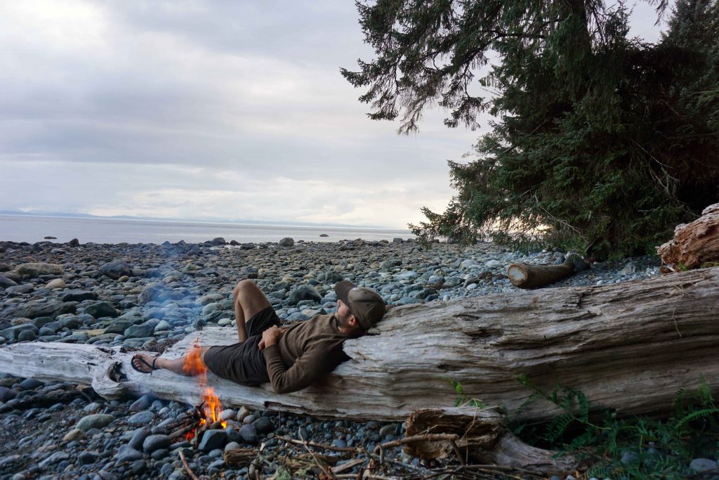
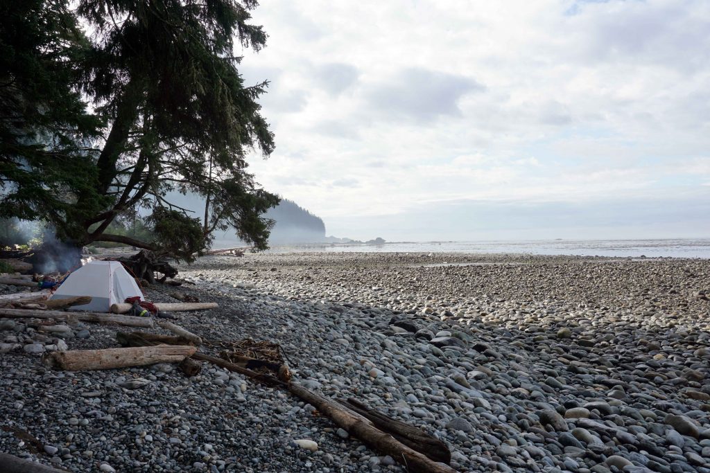
There are six campsites to choose from along the way. No reservations are needed. At each you’ll find bear caches and outhouses. You don’t need a permit to hike the trail, but the campsites cost $10 per night, per person. You can pay online before you go, or take cash and use the self-registration envelopes when you’re there.

The trail is open year-round and can be hiked in either direction. If you hike from north to south, the starting point is Botanical Beach (near Port Renfrew) and the end is China Beach (near Jordan River). If you’re going in this direction, you will reach the campsites in the following order –

  • Payzant Creek
  • Little Kuitshe
  • Sombrio Beach
  • Chin Beach
  • Bear Beach
  • Mystic Beach

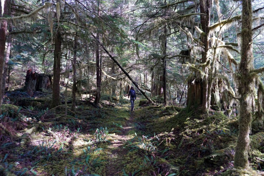
Payzant Creek and Little Kuitshe campsites are in the forest, so can get muddy. Sombrio Beach and Mystic Beach campsites are often busy, as they are readily accessed from the road, making them popular with non-hikers. Chin Beach can also fill up quickly. Because the campsites are first come, first serve, it’s a good idea to leave early in the morning to bag the best spots.

What’s the trail like?

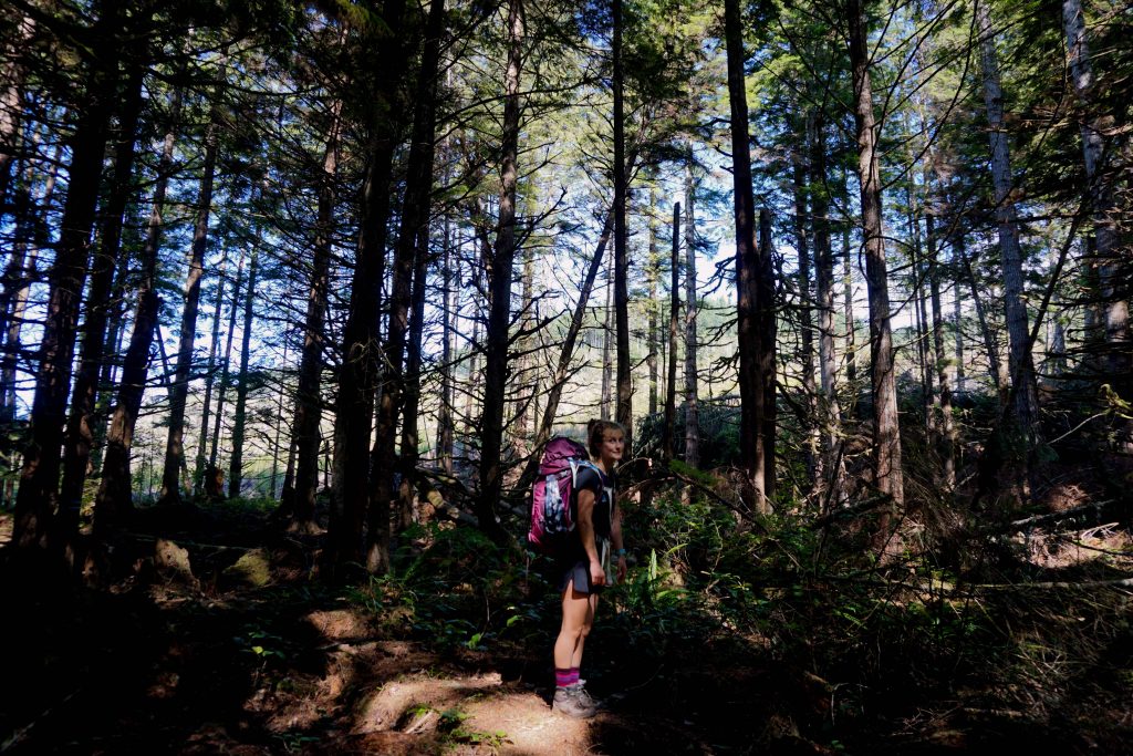
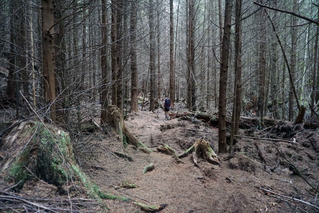
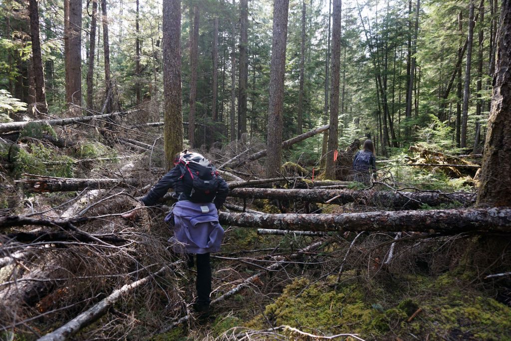
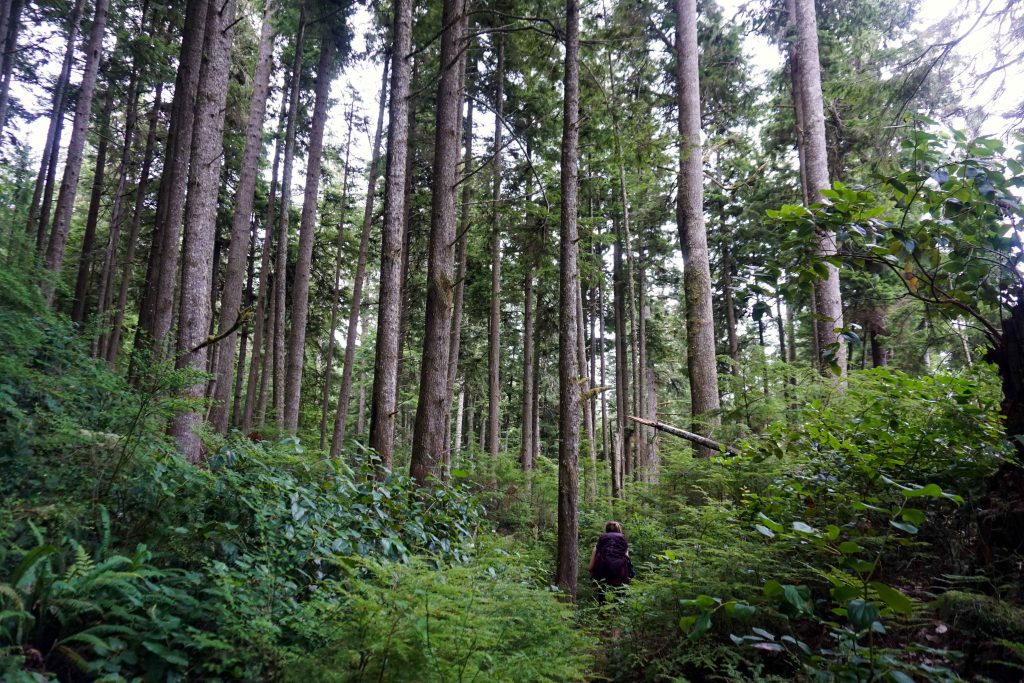
As you might expect from a coastal hike, the trail is undulating. Most of the flat sections are on the beaches. You may have heard of (or even hiked) the Juan de Fuca’s more famous neighbour, the West Coast Trail. While the West Coast Trail is known for its boardwalks and ladders, the Juan de Fuca trail is known for its technical terrain and relentless elevation change.

Hiking through the forest
And along the beaches

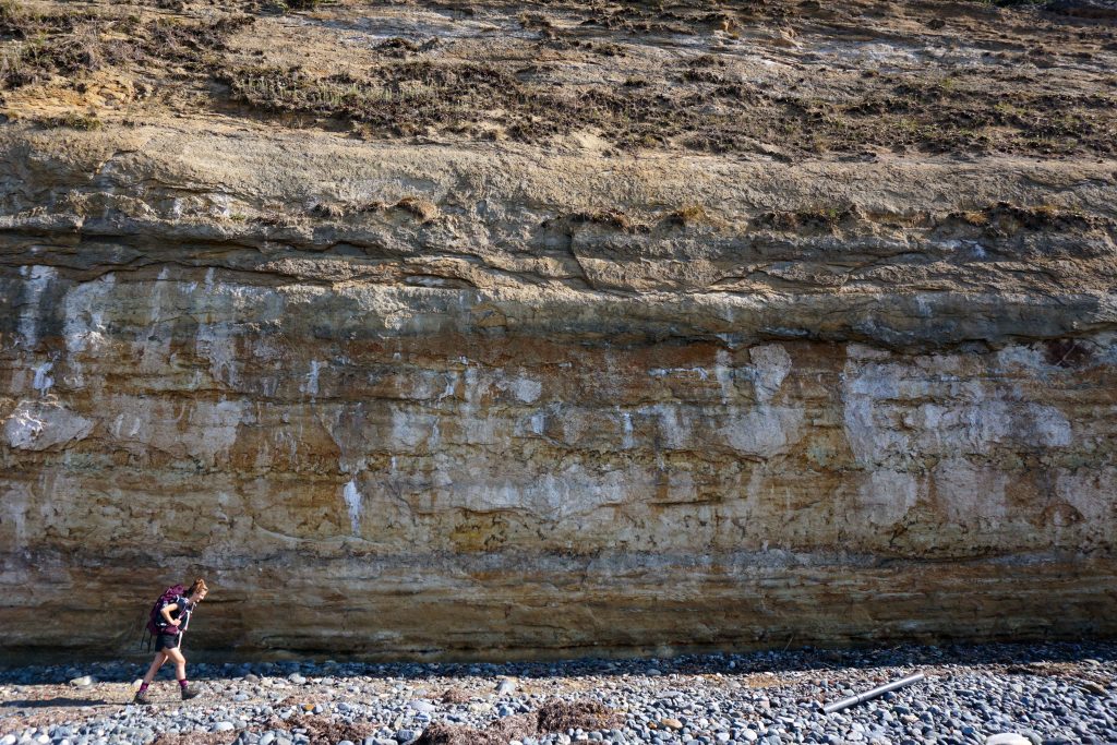
On the trail map, you’ll see that some sections are classed as ‘moderate’, others as either ‘difficult’ or ‘most difficult’. The most difficult section requires you to traverse up and down steep ravines, which can be tiring, especially with a heavy pack on. Thankfully it was fairly dry while I was there, but no doubt it could get very slippery in bad weather. Which brings me on to my next point…

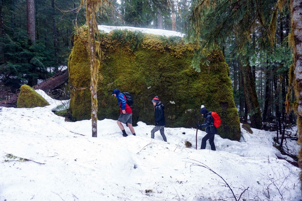
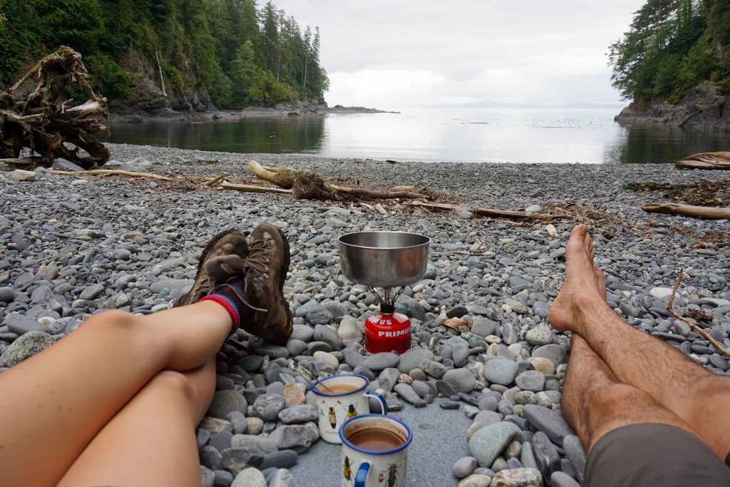
The Juan de Fuca trail is very wet, partly thanks to the number of creeks which pass through it, and partly thanks to its location on the west coast of Vancouver Island. Even at the end of summer there were deep sections of mud. Wet weather gear is a must and gaiters are recommended. The creeks mean you can refill your water pouches whenever you need, although the water should be treated or boiled before drinking.

Here’s how I hiked the Juan de Fuca trail

My boyfriend and I hiked the Juan de Fuca trail at the end of August, opting to go from north to south. Here’s how it went down…

Day 1 – Port Renfrew to Sombrio Beach – 20kms

After sleeping in our car at the Jordan River Regional Park Campground for a night, we got up early and moved the car to the China Beach day use parking lot. Be sure to remove your valuables because break-ins have been known.

I’d reserved a space on the West Coast Trail Express, so waited by the highway for it to arrive at around 8am. I didn’t think it was going to stop, but in fact, it pulls into a rest stop a little further up the road, on the far side of the highway.

After about an hour we reached Port Renfrew. We got off the bus and hiked 2km up the road to the Botanical Beach trailhead, which is the start (or end) of the Juan de Fuca trail. This is a bit of a nuisance, but it’s as close as you can get in the bus. You might want to hitch a lift!

Shortly before Payzant Creek there’s a sign to Providence Cove. This is a lovely spot to have lunch and a swim.

Two people making tea on a portable stove on a stone beach
Taking a lunch break at Providence Cove on the Juan de Fuca trail

We had planned to spend the first night at Little Kuitshe, but made good progress so continued on to Sombrio Beach. This is a long first day at over 20kms, but it made the remaining days much more leisurely.

Tent pitched on empty stone beach
Camping at Sombrio Beach

Day 2 – Sombrio Beach to Chin Beach – 8kms

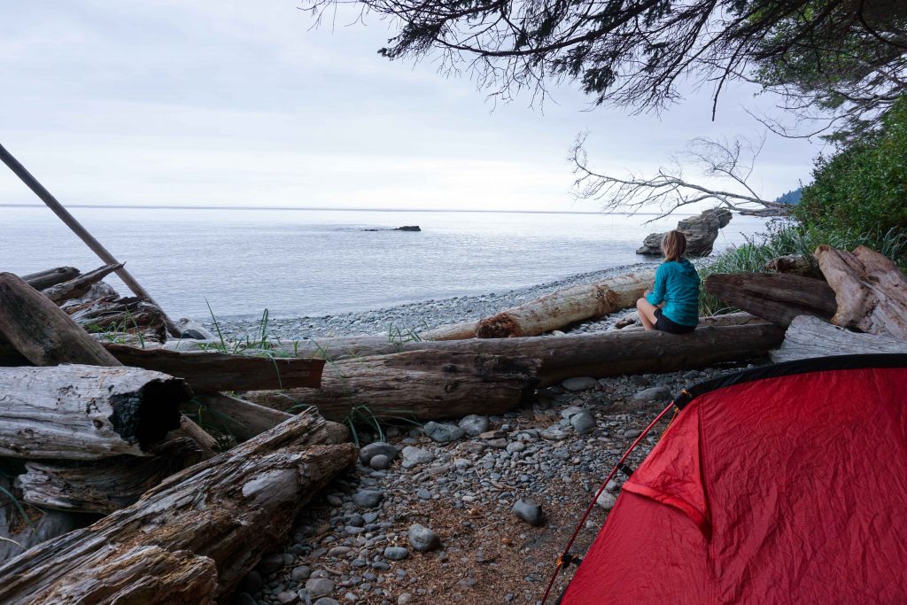
After sheltering from the rain in the morning, we started late and reached our next destination – Chin Beach – in the middle of the afternoon. The delay also meant we caught the tail-end of high tide at Chin Beach, so had to don our sandals and wade through the shallow ocean. Everyone else waited on a rocky outcrop, but I was glad we carried on because by the time we’d put up the tent the campground was full. Better to arrive early on busy weekends!

Day 3 – Chin Beach to Bear Beach – 12kms

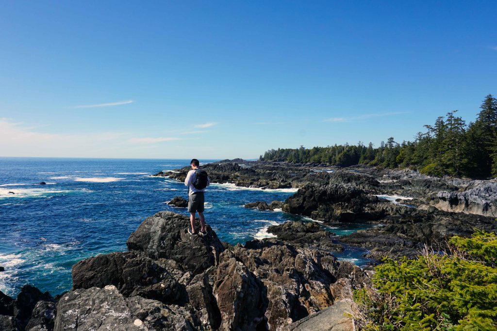
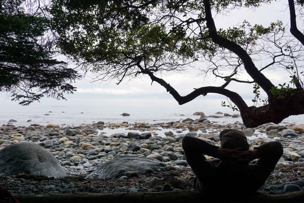
On day three we hiked as far as Bear Beach, which was my favourite campground. It’s a long beach with sites at both the northern and southern end. In my opinion, the southerly end is better. This is the most difficult section of the hike.

Man stares out to sea
Camping at Bear Beach

Day 4 – Bear Beach to China Beach – 9kms

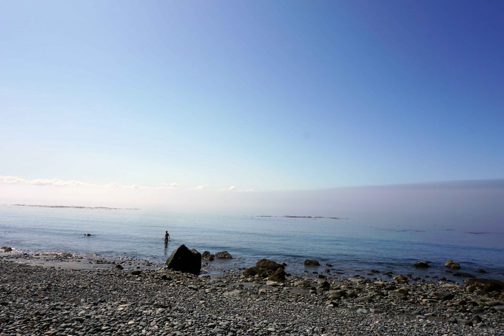
On the final day we hiked back to the car at the China Beach day use parking lot, although not before a final dunk in the ocean at Mystic Beach. I was glad to finish at my car, rather than worrying about making the bus on time.

Woman swims in sea
Swimming at Mystic Beach

If you’re hiking it in this direction, I would say this is a fairly standard itinerary, as we often saw the same faces at each campground.

What you need to know before you go

If you’re planning on hiking the Juan de Fuca trail, here’s what you need to know before you go –

  • If you don’t have two cars to shuttle then you can book the West Coast Trail Express. It can pick you up at Victoria, Sooke, China Beach, Sombrio Beach, Parkinson Creek or Port Renfrew
  • You don’t need to reserve anything other than the West Coast Trail Express (if using)
  • You don’t need a permit but the campsites are $10 per person, per night
  • Some campsites – particularly Chin Beach and Mystic Beach – fill up quickly, so leave early in the morning to get the best spot
  • Remember to camp above the tideline
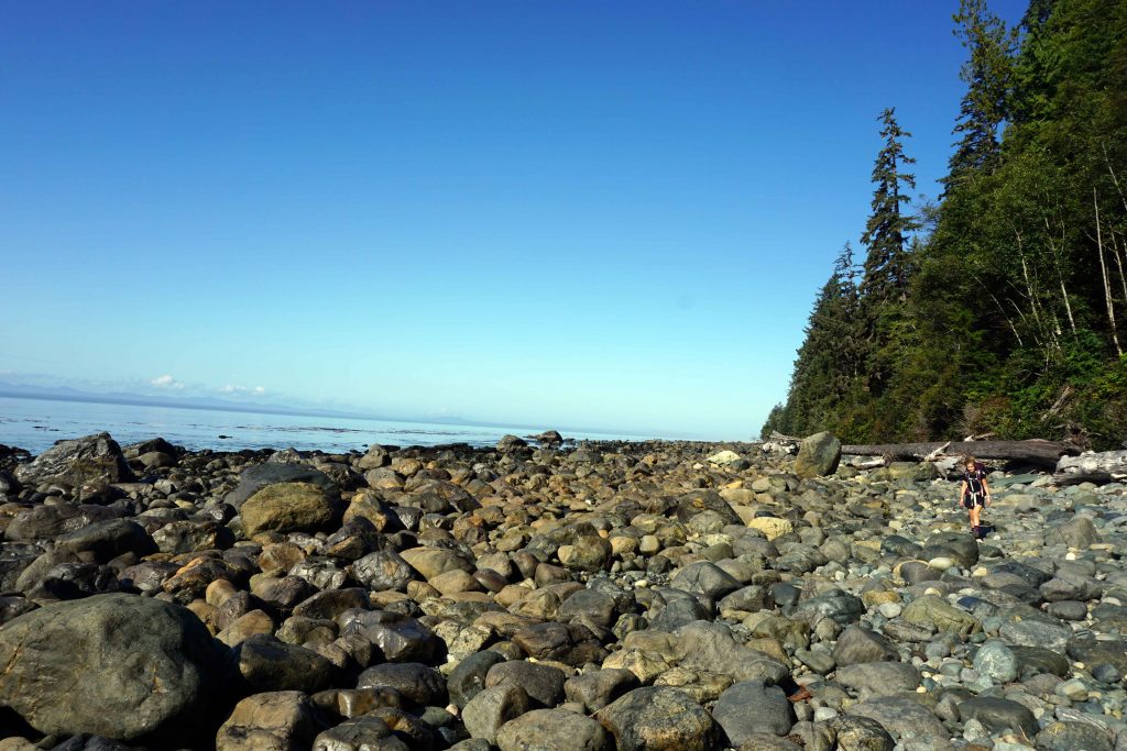
  • Certain sections of the trail are cut off at high tide – check the tide times and plan accordingly
  • There are lots of bears in the area – be bear aware
  • The trail is very well-marked and has km markers along the way
  • There is no phone reception in the area
  • Dogs are allowed on the trail
  • It can get very muddy so gaiters are recommended (but not essential)
  • You don’t need to take much water as you can fill up along the way. The water must be boiled or treated before drinking

My thoughts on hiking the Juan de Fuca trail

If you want to try a multi-day thru-hike, the Juan de Fuca trail is a great place to start. At 47kms, the trail isn’t overwhelmingly long, but it still presents challenges. Although there isn’t any cell reception, it also feels quite safe. You aren’t too far from a road and there’s four access points along the way, meaning you can opt out if you need. It’s also much cheaper than the West Coast Trail, for which you need to buy a permit.

Everyone has a different idea of what is ‘difficult’. A trail runner told me that, pound for pound, the Juan de Fuca trail is harder than the West Coast Trail. Why? Because of the terrain. There’s lots of big step-ups and step-downs, logs to clamber over and mud to negotiate. You have to constantly watch your footing, or the tangled web of tree routes will trip you up. And the constant elevation change can be a killer on the joints.

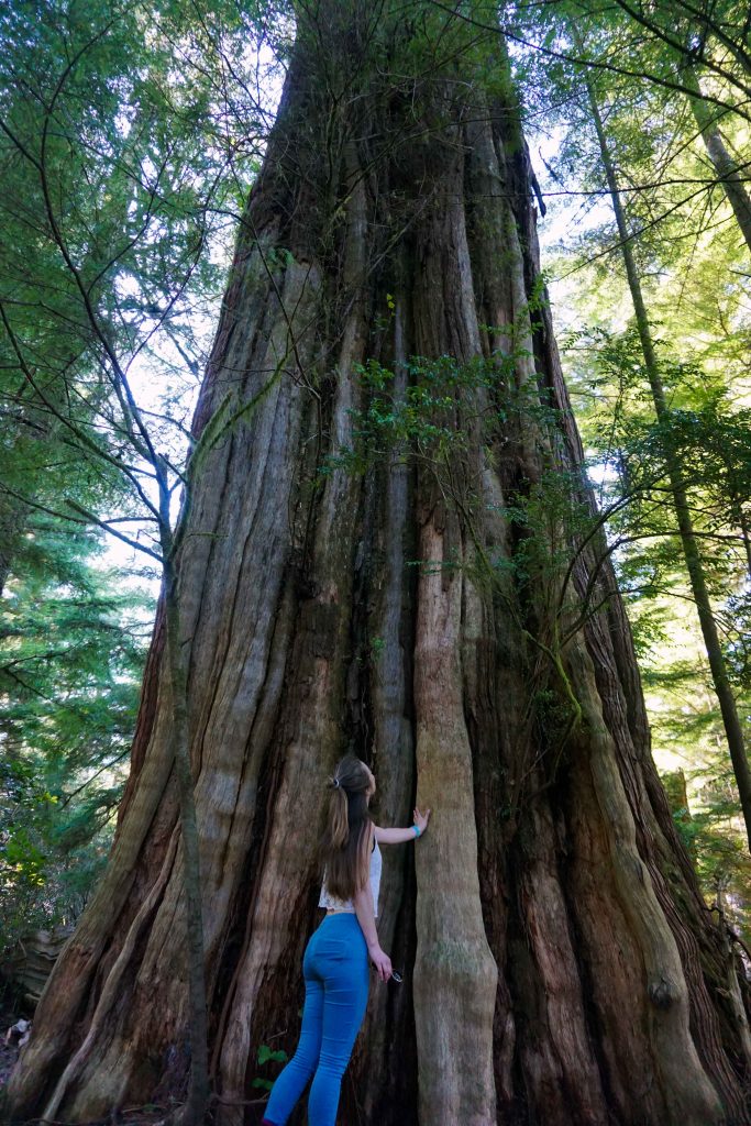
Terrain aside, I didn’t find the hike too difficult. For me, the biggest negative of the Juan de Fuca trail is the proximity of the logging industry. Cutblocks go right up to the trail, and in certain sections the second growth forest looks like it’s dead. But perhaps it’s important to see – that way, we can better appreciate the old growth forests that still remain. And anyway, four days of forest wandering, beach camping and tree hugging is always a joy.

In some sections the cutblock goes right up to the trail
Some of the forest looks like it’s dead

Did you like this post? Save it for later!

A Vancouver Island Road Trip

Vancouver Island is the ultimate playground for the outdoors enthusiast. From skiing in Mount Washington to surfing in Tofino to hiking the West Coast Trail, the possibilities are endless. There’s just one problem. It’s big. Like, really big. To put it into context for those Europeans amongst you, Vancouver Island is comparable in size to the Netherlands.

So when planning a two-week road trip around the island, that posed something of a conundrum – how to fit everything in? In the end, I conceded that it just wasn’t possible. Instead of a whistle-stop tour, I decided to pick and choose a few destinations and take my time exploring them.

Here’s how my Vancouver Island road trip panned out.

Days 1 to 4 – Ucluelet and Tofino

The first stop on the itinerary was Ucluelet, or ‘Ukey’, located on the west coast of the island. We took the ferry from Horseshoe Bay to Nanaimo, driving to Ukey via Coombes Old Country Market for some supplies. The drive is incredibly scenic, and it’s well worth stopping off at Cathedral Grove en route for a quick walk amongst the old growth forest.

Ukey is not so famous as its neighbour, Tofino, but it’s a great base if you’re visiting the area. The Wild Pacific Trail is right on your doorstep, offering two different coastal walks. There’s the shorter Lighthouse Loop, at 2.6km, and the longer there-and-back trail between Brown Beach and the rocky bluffs.

Woman sits on tree looking out to sea
The Wild Pacific Trail
Woman looks up at tall tree
An ancient cedar on the Wild Pacific Trail

Along with exploring the Wild Pacific Trail, we hiked up the hill at Cox’s Bay. Thanks to the elevation, you get wonderful views across the rainforest on a clear day. We also hit up the surf at Wickaninnish Beach and Chesterman’s Beach, ending each day with dinner cooked over a beach fire.

For more inspiration about things to do and where to stay, take a look at my Top 5 Reasons to Visit Tofino.

Days 4 to 7 – Campbell River

After leaving Ukey, we drove back across the island, then headed north to Campbell River. The town itself is quite small, but quickly gives way to a vast wilderness. I’d booked a lakefront cabin out of town, so spent a lot of time rowing the cabin’s boat around the lake while my friends attempted to catch some trout.

We also spent a morning at Elk Falls Provincial Park, which is just 2km from downtown Campbell River. There’s a platform where you can view the thundering waterfall and a network of easy trails to explore.

Elk Falls Waterfall
Elk Falls

The following day we spent at Strathcona Provincial Park. Expanding over nearly 250,000 hectares, there are numerous hikes on offer, catering to a range of abilities. After a lot of debate, we opted to do the Elk River Trail. In April, the park is still under a blanket of snow. Due to constant post-holing we progressed at a slow place, so had to turn back before reaching the end of the trail.

Three people hike through snow
Strathcona Provincial Park in April

If you want to ski, snowboard or snowshoe, Mount Washington is also nearby. When we were there the season was coming to an end, so gave it a miss this time.

Days 7 to 11 – Cortes Island

Our next destination was Cortes Island, which is part of the Discovery Islands. To get there, you need to take the ferry from Campbell River to Quadra Island, drive across Quadra Island and catch another ferry to Cortes. This sounds like a lot of work, but it’s worth it!

Unfortunately, a storm blew in the morning we were due to leave, meaning the ferries were cancelled until the afternoon. After drinking a lot of coffee in Campbell River, we managed to get on the ferry to Quadra Island. We were then stuck at Heriot Bay on Quadra Island for several hours, but thankfully, the Heriot Bay Inn does good food and has a pool table.

Old wood cabin surrounded by trees
Cortes Cabin

When we finally arrived on Cortes Island, we settled into our beautiful sea-front cabin. During our stay we did a lot of hiking around Ha’thayim (Von Donop) Marine Provincial Park, Green Mountain and Easter Bluffs. We also took advantage of all the fresh seafood on offer, collecting crabs, oysters and clams straight from the shoreline.

Oysters grill over an outdoor fire pit
Grilled oysters

Read more about my time Exploring Cortes Island.

Days 11 to 13 – Qualicum Beach

Next, we returned to Campbell River (thankfully, not a ferry cancellation in sight) and headed back down the coast to Qualicum Beach. We stayed at Spider Lake which is good for fishing, swimming and kayaking, especially as motorised boats aren’t allowed. There’s also lots of trails around the lake to wander around. Horne Lake Caves is nearby, as is Little Qualicum Falls and of course, Qualicum beach (as the name would suggest!)

Lake surrounded by trees with low lying cloud
A misty evening at Spider Lake

This was the shortest stopover, so it felt like we’d only just arrived before it was time to leave for the final destination – Jordan River.

Days 13 to 16 – Jordan River

Jordan River is located past Sooke, about 67km east of Victoria. There’s not much to it, aside from a café and a smattering of wood cabins. But this little place has two major draws.

Firstly, there’s surf! There’s a point break where the River Jordan meets the sea, which is a known (but seemingly friendly) surf spot amongst locals. One person told me the season typically runs until May. It’s also possible to surf at China Beach, which is quieter but rockier. Be warned. My friend’s board took a beating.

Secondly, Jordan River sits at the southerly end of the Juan de Fuca trail. This 47km hiking trail is often completed as a thru-hike in around four days. However, you can explore sections of it as day hikes. You can access the trail at China Beach, Sombrio Beach, Parkinson Creek and Botanical Beach.

We spent the mornings and evenings surfing so only had time for two short hikes. The first was between China Beach and Mystic Beach, while the second was between Sombrio Beach and Sombrio Point.

Woman stands by cliff next to waterfall
Mystic Beach on the Juan de Fuca trail

If you want to camp, the Jordan River campsite is first-come, first-serve. It only has an outhouse (no water) and you pay at the gate. Camping is also available at China Beach and Sombrio Beach. I’ve previously car camped at Jordan River, but this time we stayed in a tiny wood cabin with an outdoor shower and toilet. A truly rustic, west coast experience! Find out more by taking a look @rusticwestcoastcabin

Three people playing Jenga near a campfire
A tense game of outdoor Jenga at our rustic west coast cabin

It’s useful to know that there is very little mobile phone reception in this area. It’s close to the US border, so your phone may also pick up US networks. You might want to turn off your data roaming.

Back to Vancouver

And just like that, our Vancouver Island road trip had come to an end. We were only an hour from Victoria, so on our final day we pottered around the city before taking the ferry from Swartz Bay to Tsawwassen.

After two weeks on Vancouver Island, I feel like I’ve barely scratched the surface. We didn’t make it to the north of the island at all, and there’s so much still to see and do in the regions we did visit. Even so, hopefully this has provided some useful information if you’re planning a Vancouver Island road trip.

If you have any suggestions of your own, I’d love to hear them!

Did you like this post? Save it for later!

Woman looks out to sea while the sun sets

Exploring Cortes Island

My first morning on Cortes Island, I open my eyes tentatively. Thanks to gale force winds and a string of cancelled ferries, we arrived the previous day much later than planned. This is my first glimpse of our cabin in the daylight.

I sit up in bed and find I haven’t pulled the blinds. Outside the window, an American Robin flutters around a golden arbutus tree. Beyond that is the sea, now calm and inviting. There’s an oyster farm and I watch as the owner chugs his boat across the inlet. We soon grow accustomed to his singing, a new tune marking the start and end of each working day.

I creep downstairs and assess my surroundings. I quickly conclude that it’s my dream home. This cabin has obviously been built with love. Everything is made from wood, and every piece of timber looks like it’s been carefully selected and skilfully handled. Even the sawdust toilet is a work of craftsmanship.

Woman looks over sea while the sun sets with a fire in the foreground
Living the good life on Cortes Island

The open plan living space is full of quaint, cosy furniture with a wood-burner to boot. The large windows provide sweeping views across Gorge Harbour. In the distance, you can make out the snow-capped mountains of Vancouver Island. It makes you want to sit here all day, staring out to sea.

If you did, you’d soon realise that this is a prime spot for bird-watching. Twitchers will be delighted at the variety of birds that visit the area, with everything from hummingbirds to vultures. Seals also make a frequent appearance in the inlet and seem completely unfazed when we launch ourselves off the rocks to swim, fish and kayak.

Woman looks through binocular while sitting in wood cabin
Bird-watching from the cabin

After making a pot of tea, I spot something else on the horizon. It’s my boyfriend, who’s taken the canoe out to drop a crab pot. As it turns out, our equipment is surplus to requirements. You can walk to the shoreline below the cabin and scoop out red rock crabs with a net, along with oysters the size of your hand.

Man holds four large oysters
Oysters the size of your hand

During our stay, fresh seafood becomes a daily staple. Every evening we stoke the fire in the outdoor pit, grill a few oysters and crack open a crab claw. If we’ve been to Manson’s Landing, we’ll also cook up a pot of butter clams on a bed of pine needles, conveniently collected from the foot of a nearby tree.

Man and woman cook oysters and clam on an outdoor fire
Cooking up oysters and clams

It’s an idyllic way to live, sourcing food from your doorstep and cooking it as the sun sets over the Salish Sea. Self-sufficiency is a way of life on Cortes Island, it seems. There’s a strong counter-culture vibe here, too, with a focus on community spirit. People even wave to you while driving, no matter that you’re a tourist.

Dinner spread on an outdoor table
Dinner of freshly caught oysters and clams, served with homemade pickles and bread

In April, it’s also extremely quiet. I hear the island gets busy during the summer months, even if it does take three ferries to get here from Vancouver. At this time of year, the only other visitors appear to be boaters – a frequent sight amongst this smattering of islands in Desolation Sound, known collectively as the Discovery Islands.

By day we explore the island. The hikes up to Easter bluffs and Green Mountain are relatively short, but provide beautiful views across the region. We enjoy mostly good weather. It’s either luck, or the fact that the southerly half of Cortes Island is in the rain shadow of Vancouver Island, making it drier and warmer.

Woman sleeps on mossy rocks
Chilling at Easter Bluffs
Two women stand on high elevation rock
Green Mountain

The day we head to Ha’thayim (Von Donop) Marine Provincial Park, however, it pours. We delay our start, meaning we don’t have time to reach our destination of Cliff Peak. It’s slow going in the forest, as fallen trees block your path, forcing you to clamber up and under the debris. Even so, it’s a magical place – ancient, remote and full of wolves.

Two women make their way over fallen trees in a forest
Clambering our way through Ha’thayim (Von Donop) Marine Provincial Park
Woman walks through an overgrown forest
Walking in wolf country in Ha’thayim (Von Donop) Marine Provincial Park

As our five-day trip comes to an end, I can see how people might come here to visit and stay forever. It’s that place you move to in search of the good life. The atmosphere is laid-back and friendly. There’s a vibrant community, should you want it. But there is wilderness too, full of Mother Nature’s finest produce.

If I could just get a wood cabin here, I’d be as happy as a butter clam.

How to get to Cortes Island

If you live on the mainland, getting to Cortes Island requires three ferries and a healthy dose of dedication.

Firstly, get to Vancouver Island. Then take a ferry from Campbell River to Quadra Island, which has a crossing time of 10 minutes. Drive across Quadra Island to Heriot Bay. Take the ferry from Heriot Bay to Whaletown on Cortes Island, which has a crossing time of 45 minutes.

Alternatively, you can access Cortes Island via plane or seaplane.

Top tip – if you’re on Quadra Island waiting for the ferry, enjoy a drink and a game of pool at the Heriot Bay Inn. Don’t forget that ferries may not operate in adverse weather conditions.

Where to stay on Cortes Island

The main settlements on Cortes Island are Whaletown, Manson’s Landing and Squirrel Cove. If you have a car, it is very easy to drive around the island, which opens up your options in terms of accommodation.

There’s lots of rental accommodation available – just search on AirBnB.

Camping is available at Gorge Harbour Marina Resort and Smelt Bay Provincial Park.

What to do on Cortes Island

  • Hike to Easter Bluffs and Green Mountain
  • Hike through Ha’thayim (Von Donop) Marine Provincial Park and have lunch at Von Donop Inlet. Continue to Cliff Peak if you have time. Keep an eye out for wolf poo!
  • Get a chocolate brownie from Cortes Natural Food Co-op
  • Collect butter clams at Manson’s Landing at low tide – be sure to get a fishing licence, take only what you need, and be wary of red bloom.
  • Eat some local oysters
  • Get a kayak and explore the coves, inlets and beaches

Things to know

  • Most of the island’s amenities are found in Manson’s Landing
  • You can get groceries at Cortes Natural Food Co-op and Cortes Market, which also sells alcohol
  • The island is 25km long and 13km wide, so you could survive on a push bike, although there are most definitely some hills
  • People will wave to you while driving – it’s a thing, just go with it