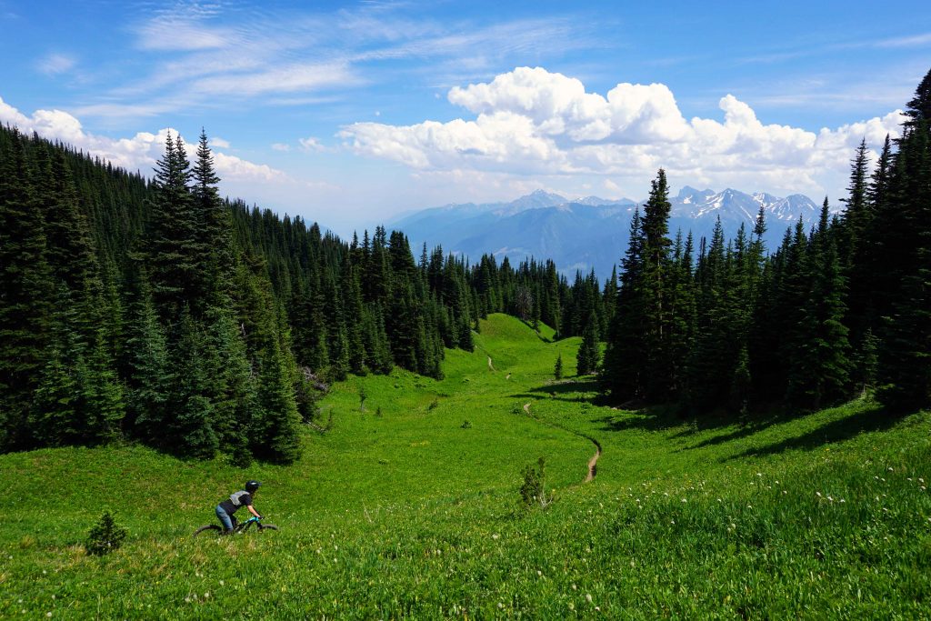
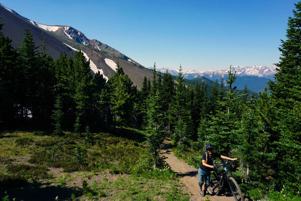
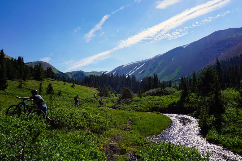
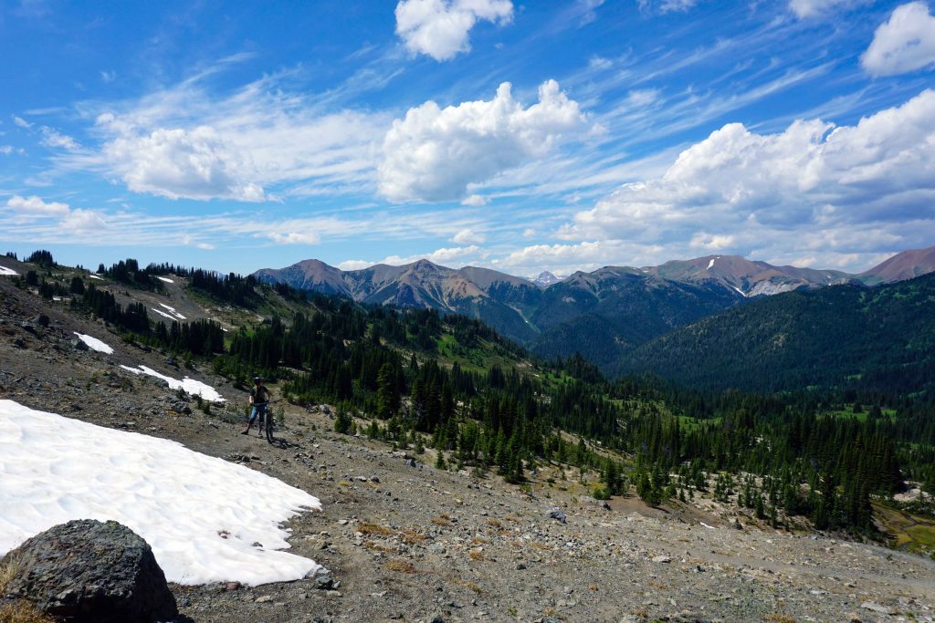
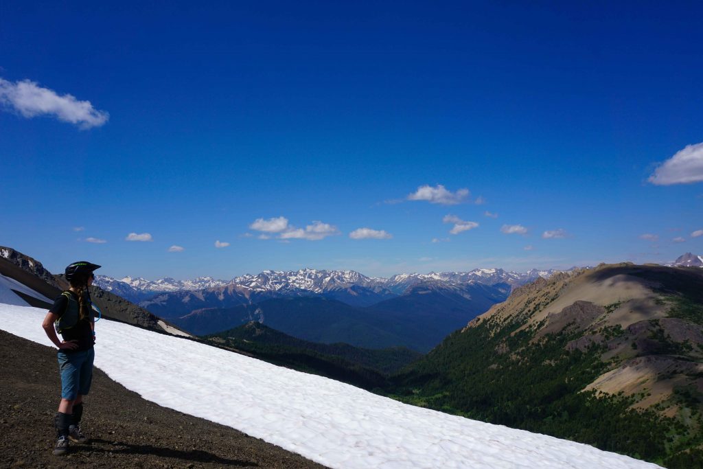
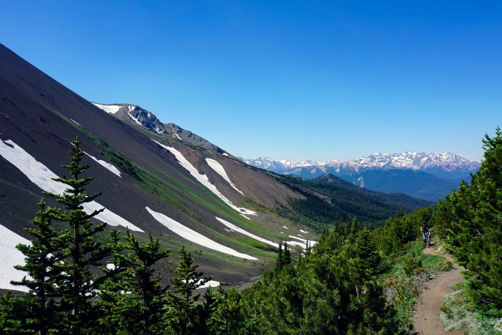
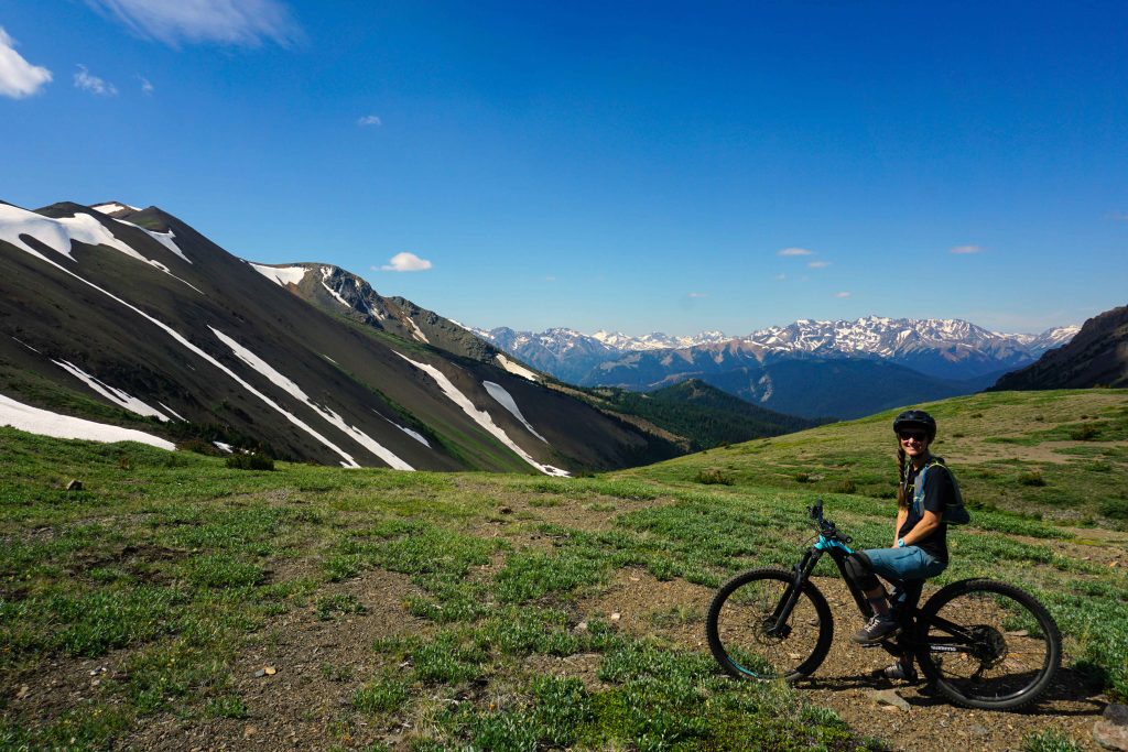
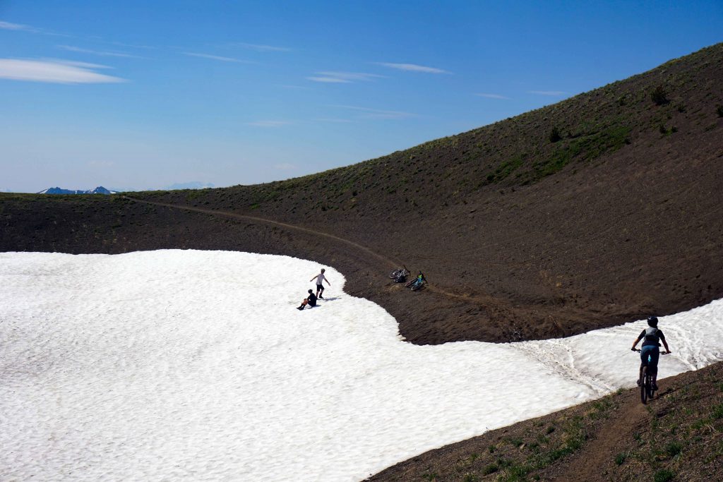
As I haul my bike up an impossibly steep slope, furiously waving away black flies and gasping for air, I wonder what the hell I was thinking. I’d done this trip the previous year and vowed that once was enough. But then I pause and look around me. The South Chilcotin Mountain Range extends for miles in every direction. Above me I can see the barren alpine, where black volcanic rock is dotted with summer snow fields. Below are verdant meadows, full of wildflowers, marmots and crystal-clear streams. There is no sign of civilisation: just mountains. That, I remember, is why I’m here. For the views. For the adventure. For the promise of some of B.C.’s finest singletrack.
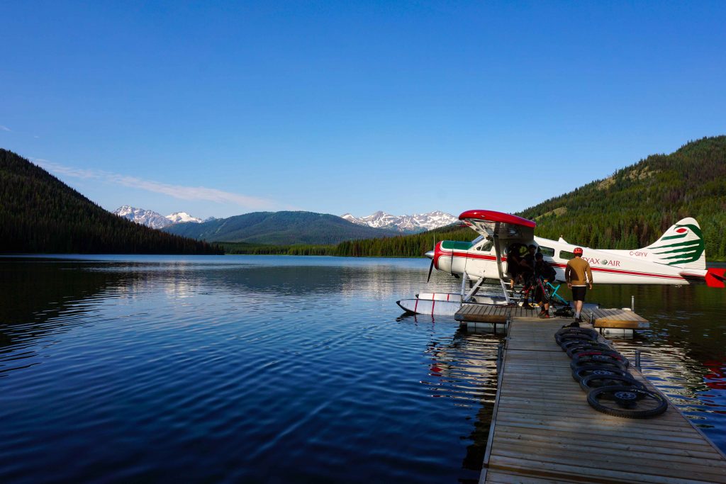
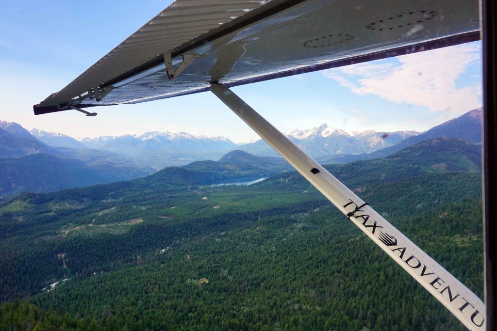
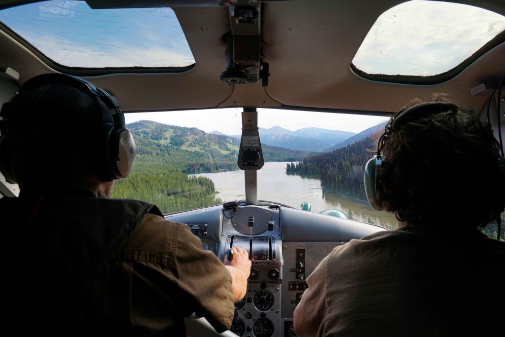
And singletrack there most certainly is, with over 200km of trails to enjoy. But my god, do you have to work for it. For two years in a row, I’ve boarded a floatplane at Tyaughton Lake and been dropped on the shores of Spruce Lake. The transport comes courtesy of Tyax Adventures – who, by the way, are not the same people as Tyax Lodge. From here, I’ve taken the Spruce Lake Main Trail and joined onto the High Trail, which winds its way to viewpoint at the top of Windy Pass. The views are absolutely amazing, but in all honesty, getting there is an uphill struggle – literally and metaphorically.
Wilderness singletrack
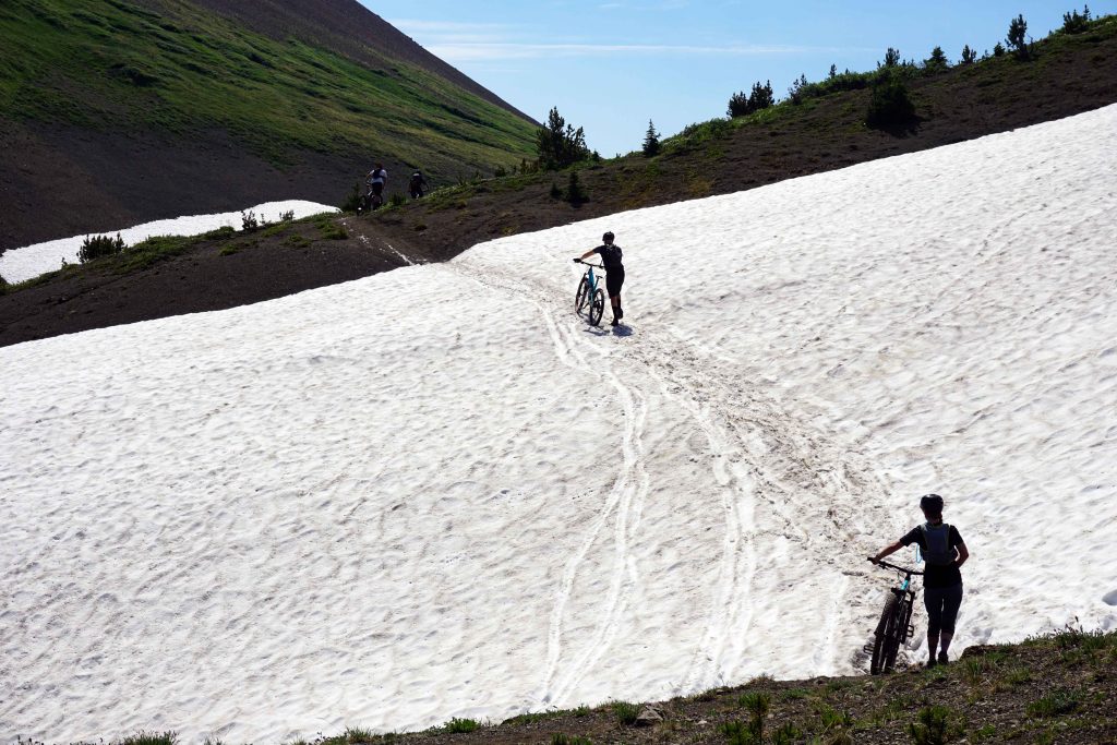
The thing about the South Chilcotins is that the trails aren’t regularly maintained. These are old horse pack trails, used to service the mining industry in days gone by. You can expect steep gradients, windfall, roots, rocks and snow (depending on the time of year). The climbs are not 100% ride-able. At points I’d be dismounting from my bike so often that it made sense to remain on foot. In the run-up to my second trip, my friends were asking how best to prepare. Was their fitness good enough? What climbs might it compare to on our local trails? Really, your best training regime would be to do a full body workout at altitude.
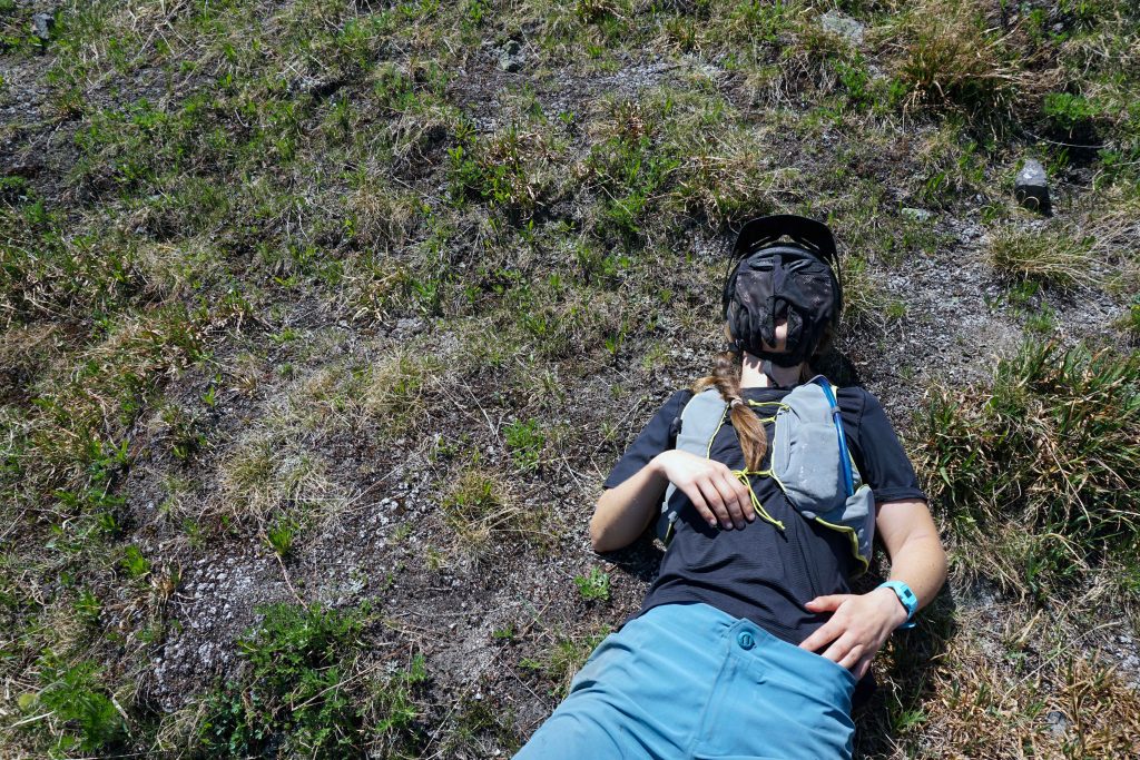
The long distances and the need to hike-a-bike make these physically demanding days. On both occasions, my shoulders were burning just as much as my legs. Living at sea level for 99.9% of the year doesn’t help either. Spruce Lake is at 1,500m, and depending on what route you do, you can climb to well over 2,000m. Hills that I’d normally cruise up became mammoth efforts as my body struggled to suck in enough oxygen. Some people don’t notice the effects of altitude at all. Unfortunately for me, I’m not one of them. This secured my position at the back of the pack, where I’d regularly stop ‘to admire the view’ (but was actually just trying to die in private).
Windy Pass and Camel Pass
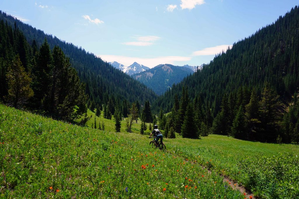
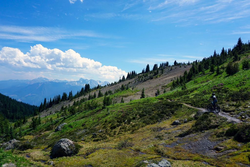
But as they say, what goes up must come down. And for most mountain bikers, it’s the down they’re really after. By taking the High Trail, the first taste of this much-famed singletrack comes after the top of Windy Pass. The trail (still the High Trail) wraps around the side of the mountain, gradually descending through the alpine meadows. It’s fast and flowy. The wildflowers whip past your peripheral vision as more mountainous peaks loom in the distance.
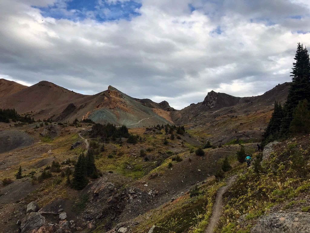
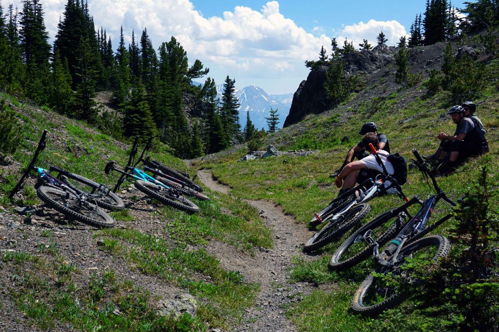
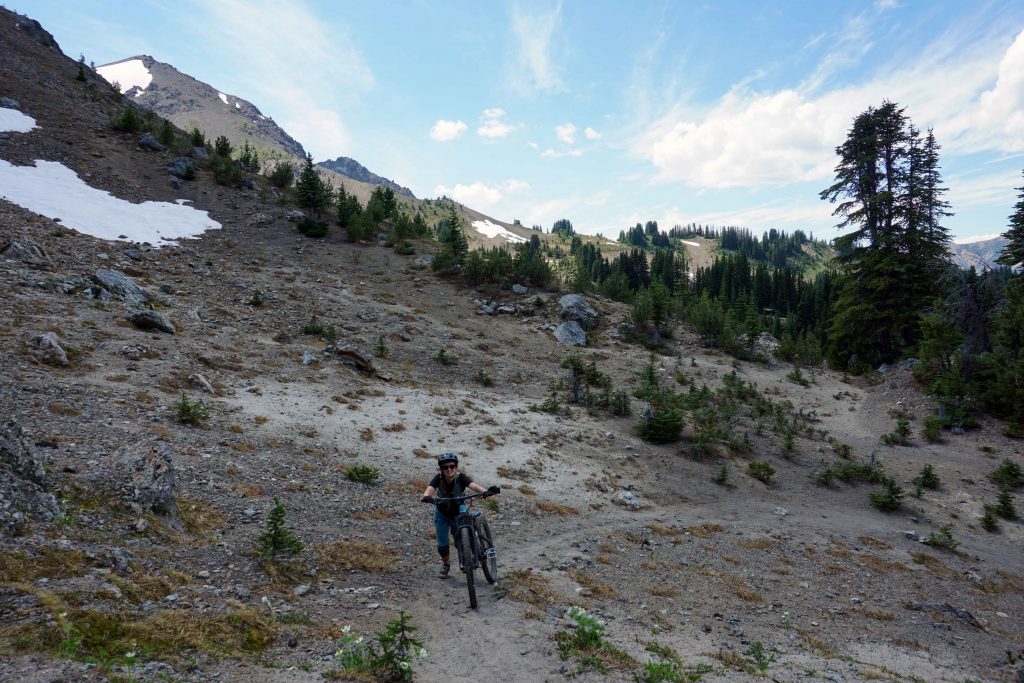
On my first visit, this descent was short-lived as we cut off towards Camel Pass. To my horror, it involved another climb at an even greater elevation. The landscape increasingly began to resemble Mars: red, rocky and seemingly devoid of life. We passed through a scree field and pedalled uphill once again to a viewpoint. The wind was really blowing, so we quickly began the long descent down the Camel Pass Trail, briefly joining back onto the High Trail before finishing up with Molly Dog, Pepper Dog and the Freiburg Trail. The terrain changes rapidly, from the rock-infested alpine, down through the meadows and back into the forest. Once amongst the trees, the soil is much sandier, making bike control a lot harder.
I reached the end feeling shell-shocked. Was that the best or worst six hours of my life? I’d been riding for less than a year and I’d found it tough. Crossing the scree field was particularly terrifying as there is no margin for error. But it was also incredible, a day of adventure with some really high highs and jaw-dropping scenery. Still, I decided that I probably wouldn’t return to the South Chilcotins until I was a better rider – like, a much better rider. So when, a few months later, some friends ask if I’d be willing to go again, I wavered. I don’t like to be left out, but then again, the last time I had cried. In the end, the decision was made for me: I’d been booked onto the float-plane.
Take two
So it was that over a blisteringly hot Canada Day weekend, I was back in the South Chilcotins – despite having sworn I’d never do it again, ever, ever, ever. After some last-minute research we decided to give Lick Creek a go. Once again, the day began with a flight to Spruce Lake followed by the gruelling ascent up the High Trail. This time I was better equipped mentally for the first part of the ride. The climb was just as difficult, but at least I knew I could make it – and that the pain would stop after around two hours. We got to the top and I assumed (unlike my previous excursion) that the climbing was done and dusted.
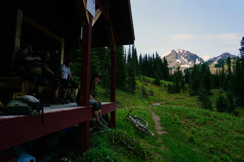
That turned out to be a mistake. After a while the High Trail takes an upwards turn once again as we searched for the High Trail Connector. Although it’s shown on Trailforks, the trail is entirely overgrown and we had to retrace our steps to High Trail South. By now I was pretty hangry and I wasn’t happy about the unnecessary climb, even if it was only about half a kilometre. We got back on course and reached the Eldorado Cabin, which is owned by Tyax Adventures. After inhaling some food, we made the final push up the Lick Creek Trail. This was the hardest part for me. Fatigue had set in and the relentless XC nature of the day thus far was frustrating. Everyone was wondering when the climbing would end and the fun would begin.
Lick Creek Trail
Finally, we reached the point where we couldn’t go any higher. It was time to go down once and for all. Unfortunately, I was so completely bushed by this point that my riding fell seriously below par. We’d been whizzing along for about a minute when my handlebars clipped a tree and I went OTB. Not a great start. We then descended through an alpine meadow where a narrow trail is carved into the ground. It’s beautiful, but also tricky as the grassy banks are above pedal height. You can’t veer off-course for fear of catching a pedal, meaning it’s a bit like riding a skinny for a couple of kilometres. The trail is very dry and exposed in parts, with a few tight, loose corners. The sandy trail bed can also make for a sketchy ride if you’re not used to it.
We returned to the lodge after eight hours. I felt like I’d survived an arduous but epic journey, which in a way, is exactly what I’d done. Just like before, I couldn’t work out if I was elated or traumatised. I’d gone over the handlebars twice. I’d wondered if I was physically capable of pushing my bike up another mountain. The Lick Creek Trail had also been beyond my ability in parts. But I’d also laughed, said ‘wow’ about a million times, and traversed a spectacular landscape. When you ride in the South Chilcotins, you have to accept that it’s a type 2 kind of fun, where misery and joy go hand-in hand. You do it for the adventure, with the singletrack descents being a juicy bonus.
Sitting in the lodge that night, physically and mentally drained, I was adamant that I wouldn’t return for a third year in a row. Will I go back on my word? Absolutely.
Mountain biking in the South Chilcotins – what you need to know before you go
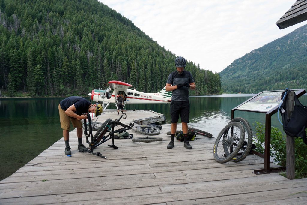
Getting a plane drop
Plane drops are arranged through Tyax Adventures. You can be dropped at Warner Lake, Spruce Lake or Lorna Lake. Trips to Warner Lake may be diverted to Spruce Lake in bad weather. Try to bag an early flight – the more time you have, the better. You can fit five people in a plane if you all take both wheels off your bikes. However, there is a weight limit. Arrive early enough to dismantle your bikes. Be prepared to put them back together again after landing at your chosen lake.
Getting a guide
You can pay extra for a guide if you want. This provides peace of mind as you don’t have to worry about navigation. However, I’ve never used a guide and have navigated using Trailforks perfectly well. I take extra battery packs to ensure my phone doesn’t run out of juice.
Not getting a plane drop
You can ride in the South Chilcotin Mountain Range without the assistance of a plane drop. You can pedal up from Tyaughton Lake or you can shuttle trails such as North Cinnabar.
The weather
You are at the full mercy of the weather. The higher elevations have zero shade. On hot days take sunscreen and sunglasses. It can be much colder (and windier) higher up, so layers are essential. It can sleet or snow in the mountains, even during the summer months. Be prepared!
The backcountry
Riding in the South Chilcotin Mountain Range is a true backcountry experience. You have to be self-sufficient in terms of food, water, mechanicals and safety gear. Get someone in your group to take a GPS communications device. A set of walkie talkies can also be useful. You’ll need a backpack or a trail running vest for your gear.
Bear country
Grizzly bears are very common in the South Chilcotins. Two weeks before my first visit, the Spruce Lake Trail was closed due to a bear attack. Make noise, take bear spray and know how to use it.
Food and water
Fuel is absolutely essential out here, as is water. It’s exposed and water sources are few and far between. During my second visit, B.C. was experiencing an unprecedented heat wave. I carried a water bottle and a 1.5 litre hydration bladder, and both ran dry before the day had ended.
Choosing a route
There are lots of routes to choose from. Take a look at Trailforks for inspiration. If you go to Warner Lake, the most direct route down is the Spruce Lake Trail, which is a blue square. Options such as the High Trail and Camel Pass are much harder but deliver on views.
How long does it take?
The amount of time it takes obviously depends on the route you do. I recommend starting as early as possible and taking lights, just in case. The Windy Pass/Camel Pass route took us six hours.
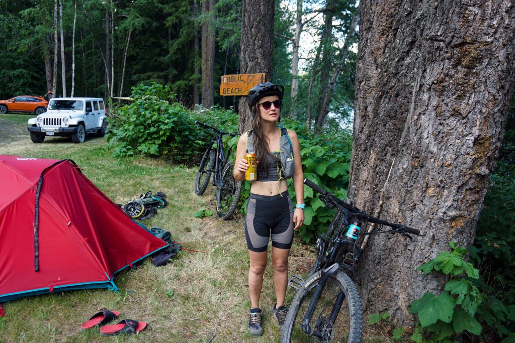
Where to stay
Tyax Lodge is located on Tyaughton Lake, which is a short pedal to Tyax Adventures (where you get the float-plane). They offer rooms and camping. If you camp, I suggest booking the serviced sites closest to the lake, as these are the only ones with shade. Being a guest means you can use the lodge’s amenities, such as the stand-up paddle boards and kayaks.
There are also some free recreation sites nearby. The closest to Tyax Adventures is Friburg Rec Site, which has a couple of nice pitches down towards the left-hand side if you’re looking at the lake (go down what looks like a road to someone’s house!) There’s also Mowson Pond Rec Site and Gun Creek Campground. Gold Bridge is the closest town.
Even if you don’t stay at Tyax Lodge, you can drop in and make use of their bar/restaurant. It’s also the only place you’ll get WiFi.
Note that Tyax Adventures and Tyax Lodge are not the same company.
Phone signal
There is no phone signal in the area.
Bugs
Black flies, horse flies and mosquitoes were a real issue when I visited the South Chilcotins in July, but not so much in September.
Getting to the South Chilcotin
Getting to the South Chilcotins can be an adventure in itself. From Vancouver, the most direct route is to drive to Pemberton and take the Hurley River Forest Service Road. This connects Pemberton Meadows to Gold Bridge. It’s a long and bumpy ride, and you should check the road is actually open on the gov.BC website before you travel. Your other option is to go via Lillooet on Highway 99. Google Maps does not always recognise when roads are closed, so do your research before leaving home.