The Wendy Thompson Hut is located in the Marriott Basin north of Pemberton, British Columbia. You’ll need a reservation to stay in the hut, or you can camp nearby – and tick off all those backcountry objectives while you’re at it.
Winter camping in the Marriott Basin
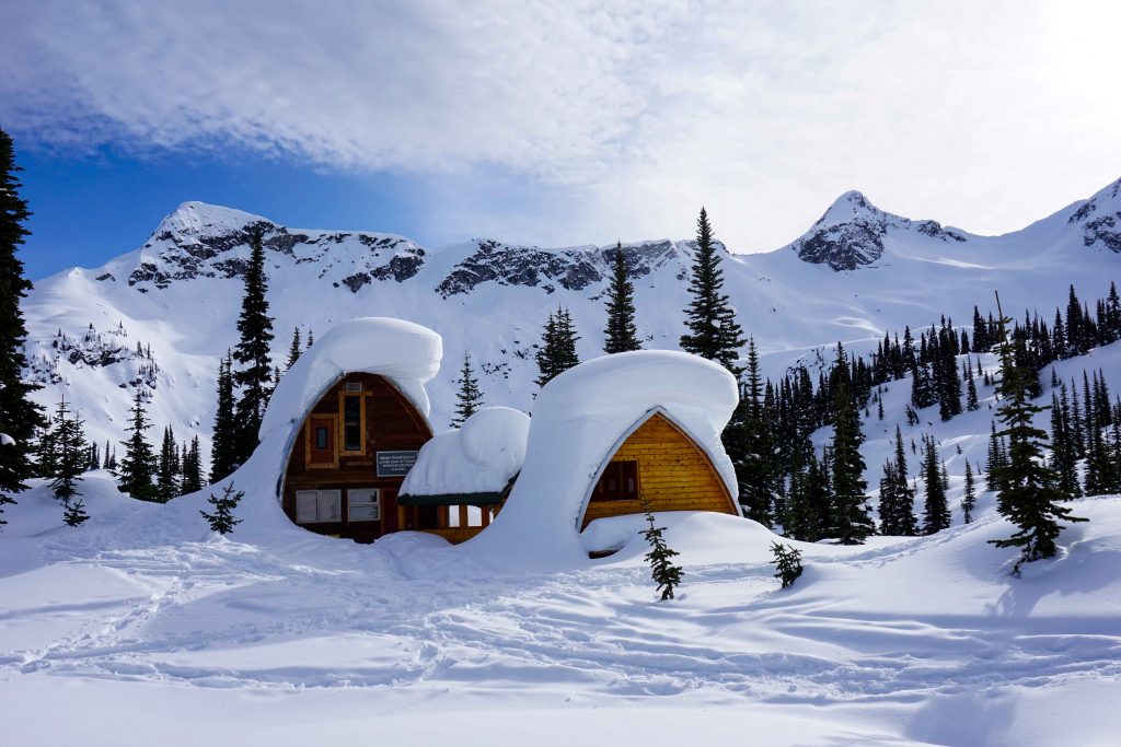
There’s an area in British Columbia known to the locals simply as ‘the Duffey’. The Marriott Basin is located within this region and it has an extra special draw – a picture perfect backcountry hut, built in memory of local paramedic Wendy Thompson.
The hut is operated by the Alpine Club of Canada (ACC). When it’s open, you need a reservation to bag one of the 16 sleeping spots. It tends to get booked up very quickly, so if you miss out, you could pitch a tent nearby instead. Either way, you’ll be treated to spectacular scenery and huge amounts of terrain. Ski tourers and split boarders will find lines a-plenty, with everything from mellow glades to larger objectives, such as Mount Marriott and Pk 2300.
What you need to know before you go
If you’re planning a winter camping trip to the Marriott Basin, then here’s what you need to know before you go.
Driving and parking
The parking lot is located on Highway 99 north of Pemberton. If you’re heading north, drive past the Joffre Lake trailhead and continue over a bridge signposted Cayoosh Creek. Shortly after you will see a salt shed on your right-hand side. There is a parking lot opposite (on the left-hand side), and another small lot further along the road (on the right-hand side). The spaces are limited, so if you’re visiting on a weekend, be sure to arrive early to avoid disappointment.
Note: if you’ve visited this area in summer, you may have driven along the access road and parked there. However, this isn’t possible in winter. You will need to park in the ploughed area just off the highway.
The route
Most people ski tour to the hut, but if you want to hike then you will need snowshoes and spikes.
In winter, you have to hike/skin along the full length of the access road before you actually reach the trailhead. If you’ve driven from Pemberton, then the access road is just before the larger parking lot on the left-hand side. It can be seen on both Trailforks and Google Maps.
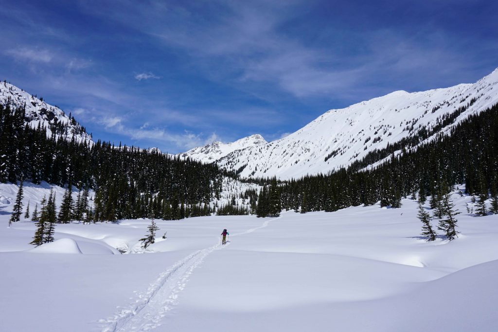
The road is fairly flat with a few lumps and bumps in. At about the halfway point there’s a fork and you need to stay on the lower left-hand spur. After about 2kms, you’ll reach the actual trailhead. You’ll know you’ve arrived because there’s an avalanche terrain warning sign.
From here, you enter the forest and begin to gain elevation quickly. The winter route is not marked and navigation is not easy. It can be tempting to follow other people’s skin tracks, but these won’t necessarily go towards the Wendy Thompson Hut. Instead, take a compass and a map of the area, such as John Baldwin’s “Duffey Lake” map which has the hut marked on it.
You will see orange markers, but these indicate the summer hiking route along the Marriott Basin Hiking Trail. This is not always practical to follow in winter. However, if you keep the markers in sight then you can feel confident that you’re on the right course. There is no phone service in the area, but it can be useful to download the Trailforks app in advance and set it to ‘hike’ mode. You can then check your location against the trail.
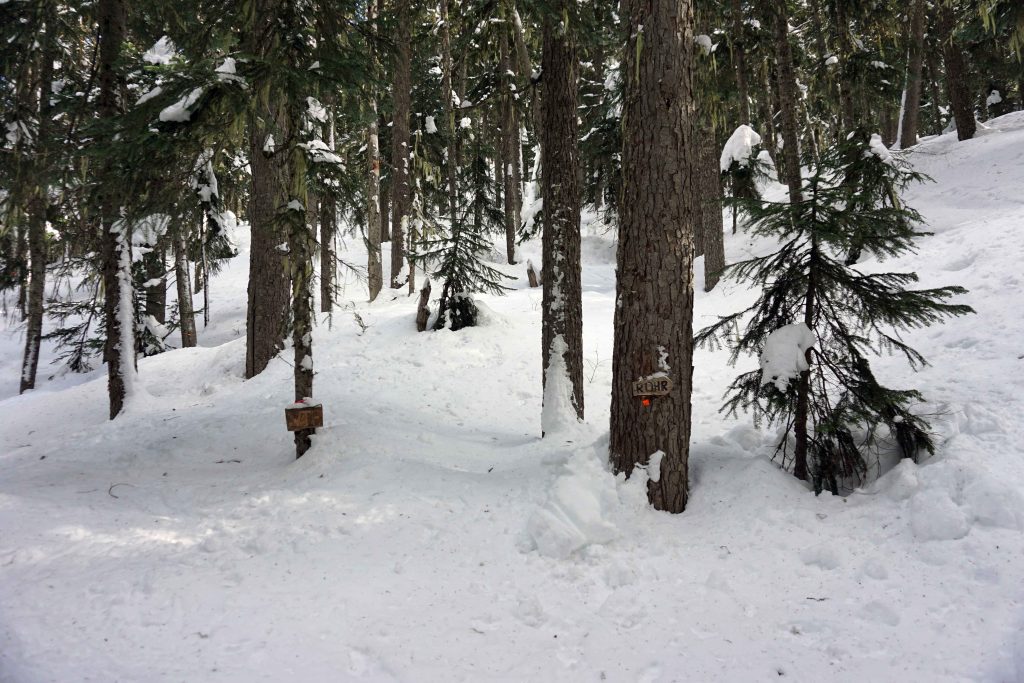
Continue through the forest until you reach a junction with two wooden signposts nailed to two trees. One says ‘Rohr’ and the other says ‘WTH’. Go left towards the Wendy Thompson Hut. After gaining more elevation you’ll eventually come to a flat, snow-covered meadow. The orange markers disappear at this point so you’ll need to rely on your navigation skills.
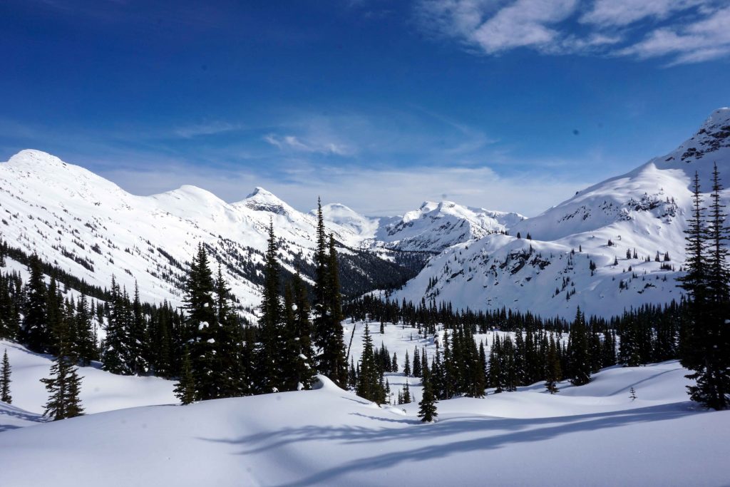
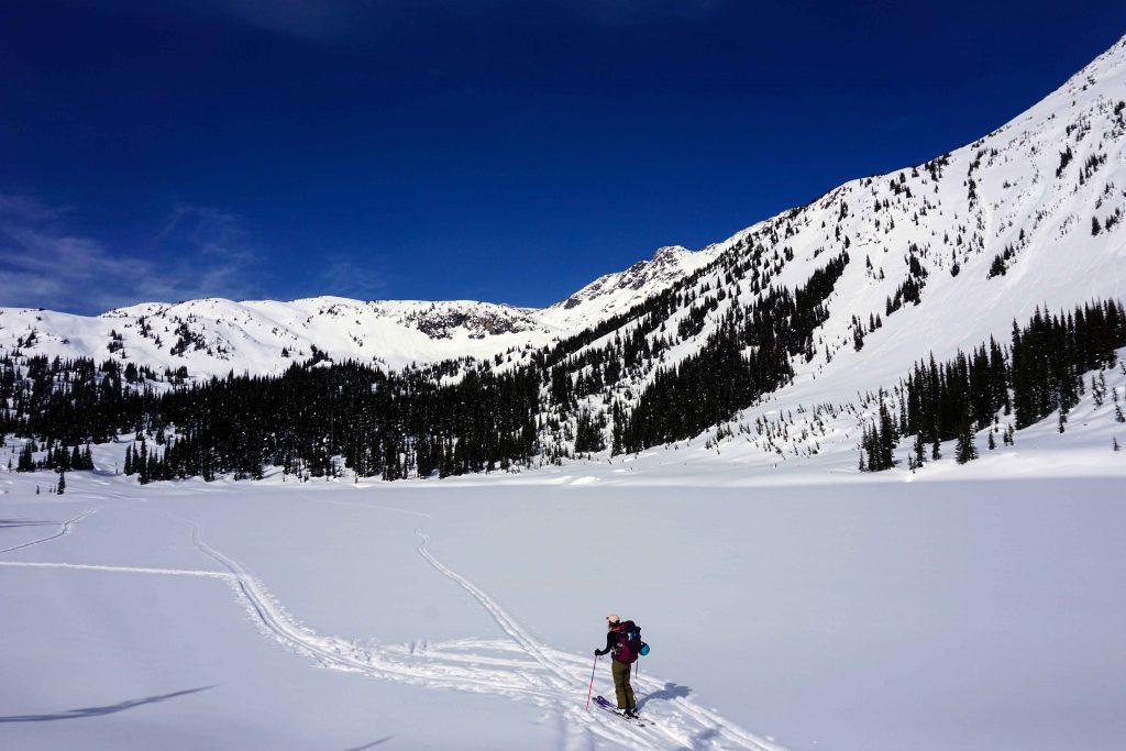
Go straight across the meadow in a northwesterly direction. You are now on a fast, flat section that runs alongside a creek. The area has far fewer trees, meaning you can enjoy the incredible views of the surrounding mountains for the first time. Take care because you are passing underneath an avalanche path, as evidenced by the scarred slopes above you.
Next, you’ll go up and over some snow-covered boulders, after which you’ll come to Marriott Lake. This is frozen in winter; if not, you’ll need to traverse around it. Head to the other end of the lake. From here, the trail snakes around to the right and back into the trees. The final push is a short, sharp uphill section. Continue to climb to 1,860m and the Wendy Thompson Hut appears before you.
The Wendy Thompson Hut
The Wendy Thompson Hut is operated by the Alpine Club of Canada (ACC). It sleeps 16 people (plus four custodians) and is stocked with sleeping mattresses, a large kitchen with four sinks and three food prep stations, solar lighting on both levels, USB chargers and a common area. There’s also an outhouse.
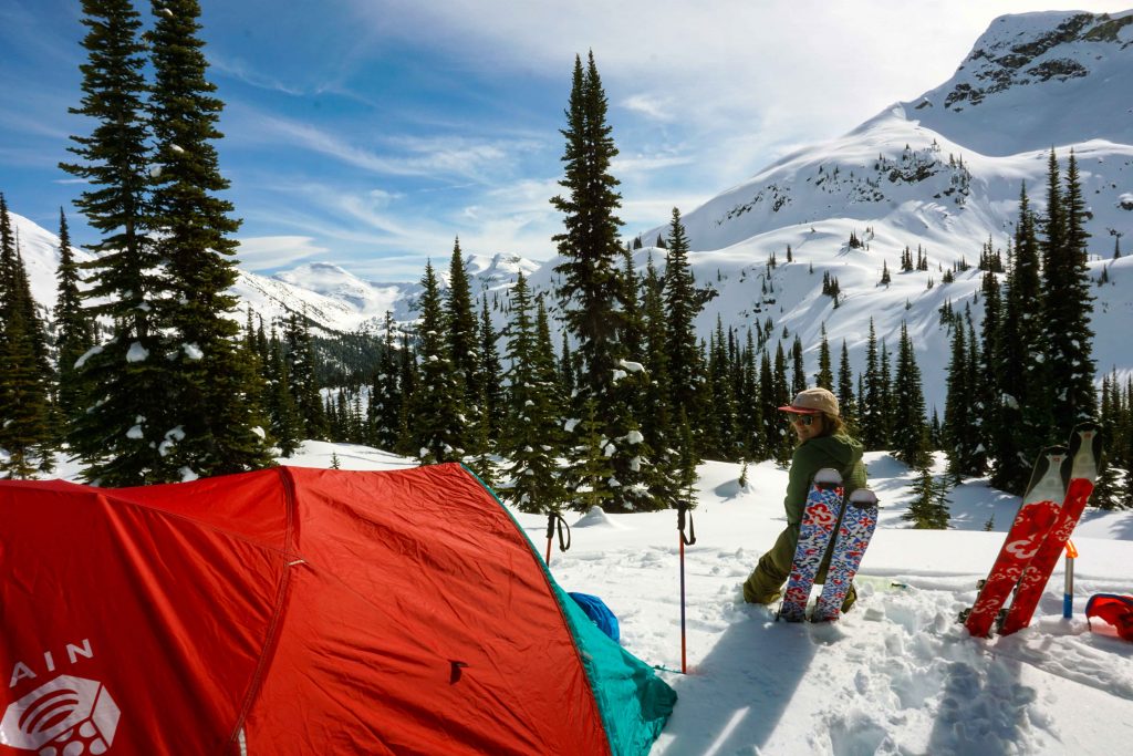
Winter camping near the hut
If you don’t bag a spot in the hut, or the hut’s closed, then you can camp nearby. The ACC prefers that you camp in the meadows or further from the hut to reduce the environmental impact.
Reservations and fees
If you want to stay at the Wendy Thompson Hut then you must make a reservation. The hut is incredibly popular, particularly during winter weekends, so you’ll need to book well in advance of your trip. You can do this via the ACC’s website.
If you camp, the ACC requests that you pay a fee because you are still using the amenities, such as the outhouse.
There are discounted rates for ACC members and children.
Avalanche safety
This route is located in avalanche terrain, so you need to have the necessary training (AST 1 minimum) and the correct avalanche safety tools, including a transceiver, beacon and probe.
Other useful information
- There is no phone service – take a satellite communication device with you.
- The first half of the trail is steep and heavily treed.
- Navigation is difficult – be prepared for this.
- The ACC suggests it takes around two to three hours to reach the hut. However, this may be a bit optimistic for those who do not know the way and/or have a heavy pack on. Leave yourself plenty of time, you might just need it.
- The total distance is around 12km with over 500m elevation gain.