Tag Archives: backcountry cabins

Hiking in Tetrahedron Provincial Park

If you love a backcountry cabin, then Tetrahedron Provincial Park is for you. With four maintained huts to choose from and a network of hiking trails to explore, it makes for a perfect weekend adventure.

Tetrahedron Provincial Park is located on the Sunshine Coast, near Sechelt. In winter it’s a haven for backcountry skiers, who skin up to Mount Steele and Panther Peak in search of fresh lines. Come the warmer months, hikers hit the trails – although not in any great numbers, it seems. When we visited on a sunny Friday evening in August, ours was the only car in the parking lot.

The hiking here isn’t difficult, if you don’t want it to be. You gain a significant amount of elevation when you drive up the logging road to the trailhead. From then on, you can weave your way along undulating trails, past subalpine lakes and boggy wetlands. If you prefer more of an ascent, the hike to Mount Steele is available and is around 8kms (one way) to the summit.

Chapman Lake

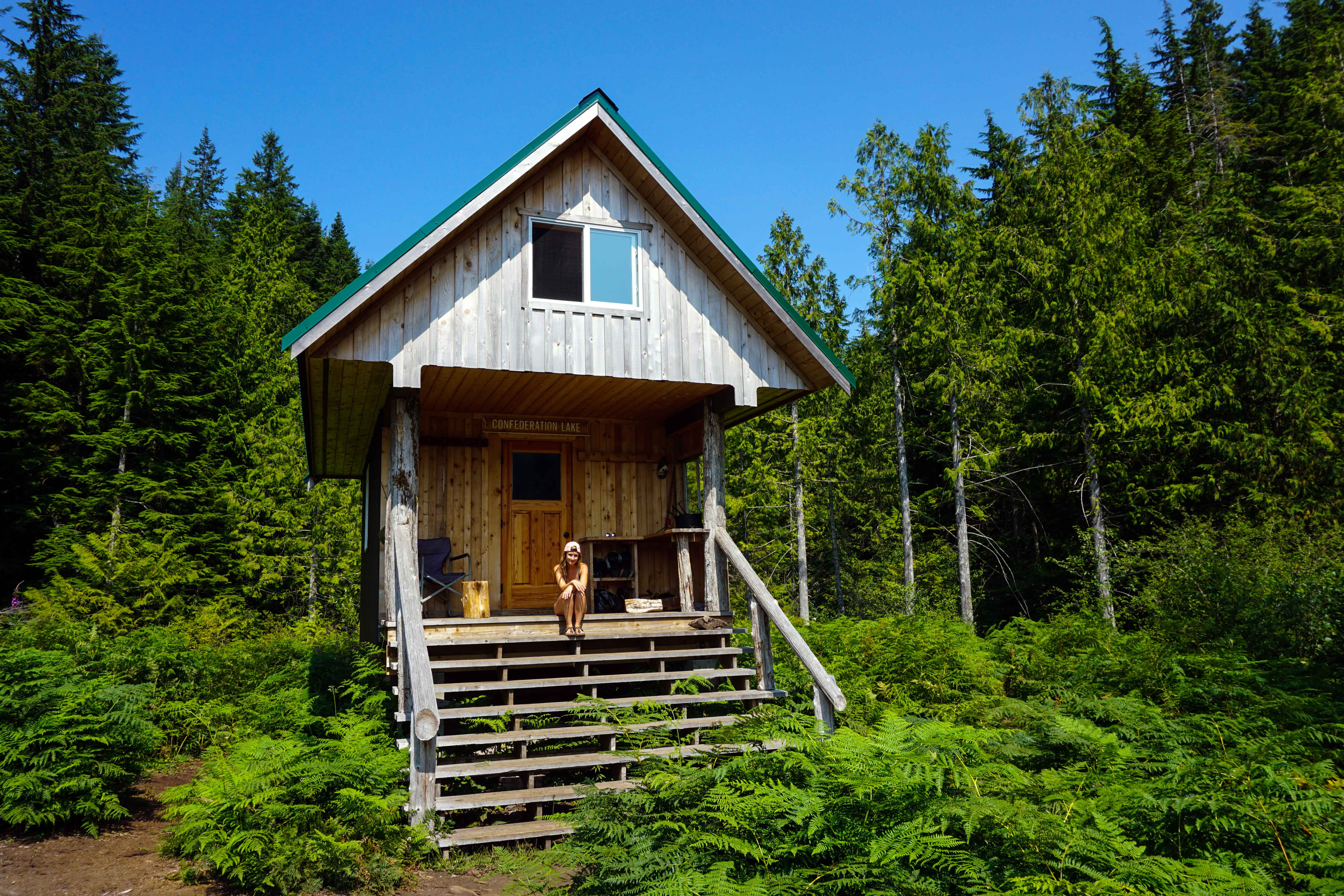
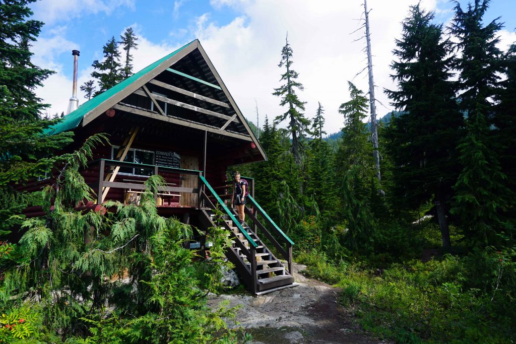
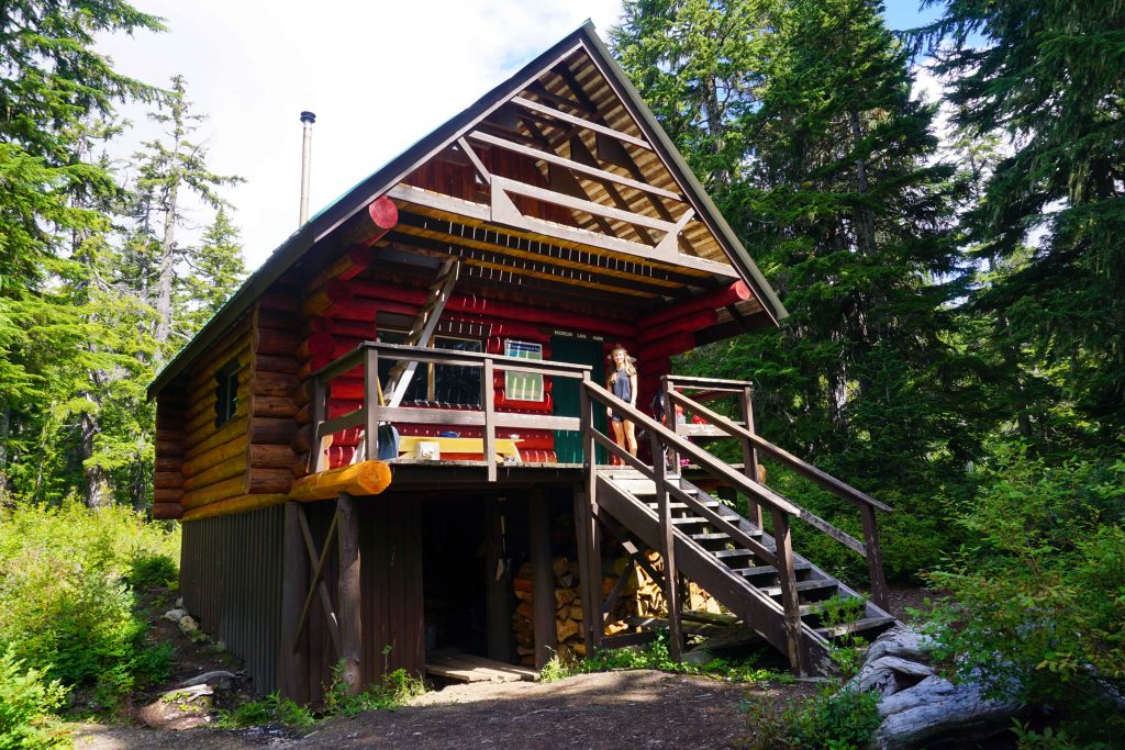
There are four backcountry cabins in the park, making this an ideal opportunity to stay overnight. While the cabins are rustic, they are brilliantly maintained by volunteers at the Tetrahedron Outdoor Club. Each has a stove stocked with firewood, a sink and grey water bucket (but no running water), a dining table and benches, an outhouse and a range of survival equipment. Even comfy sleeping pads are provided.

You cannot reserve these cabins – they are first come, first serve. You have to be prepared to share. The upstairs sleeping quarters are cosy, so you might want to take some ear plugs. In theory, the only other items you need are your sleeping bag, cooking equipment, water, toilet roll and dishwashing soap. I always recommend taking a tent, just in case the cabins are full. And you must pack out what you pack in – including food waste.

The hiking route

The great thing about hiking in Tetrahedron Provincial Park is that there are numerous options open to you. I wanted to see as much as possible in 48 hours, so devised a loop that incorporated all four cabins.

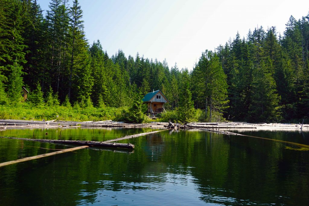
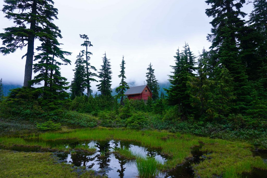
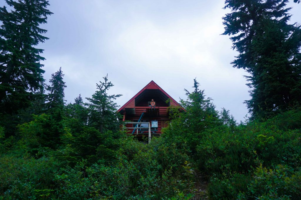
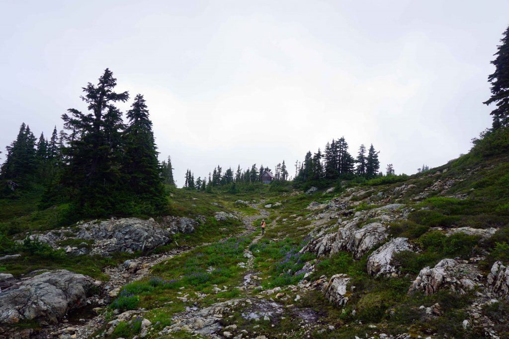
From the parking lot, we hiked the 4.5kms to Edwards Lake cabin. The first section is along an old logging trail, which if truth be told, isn’t very inspirational. Then, all of a sudden, you’re deep within the forest. The bushes are teeming with berries in August (and bears!) The terrain is easy-going, so it doesn’t take long until you skirt the edges of Edwards Lake. The cabin itself is a little further along the trail.

Backcountry cabin in the forest
Edwards Lake cabin

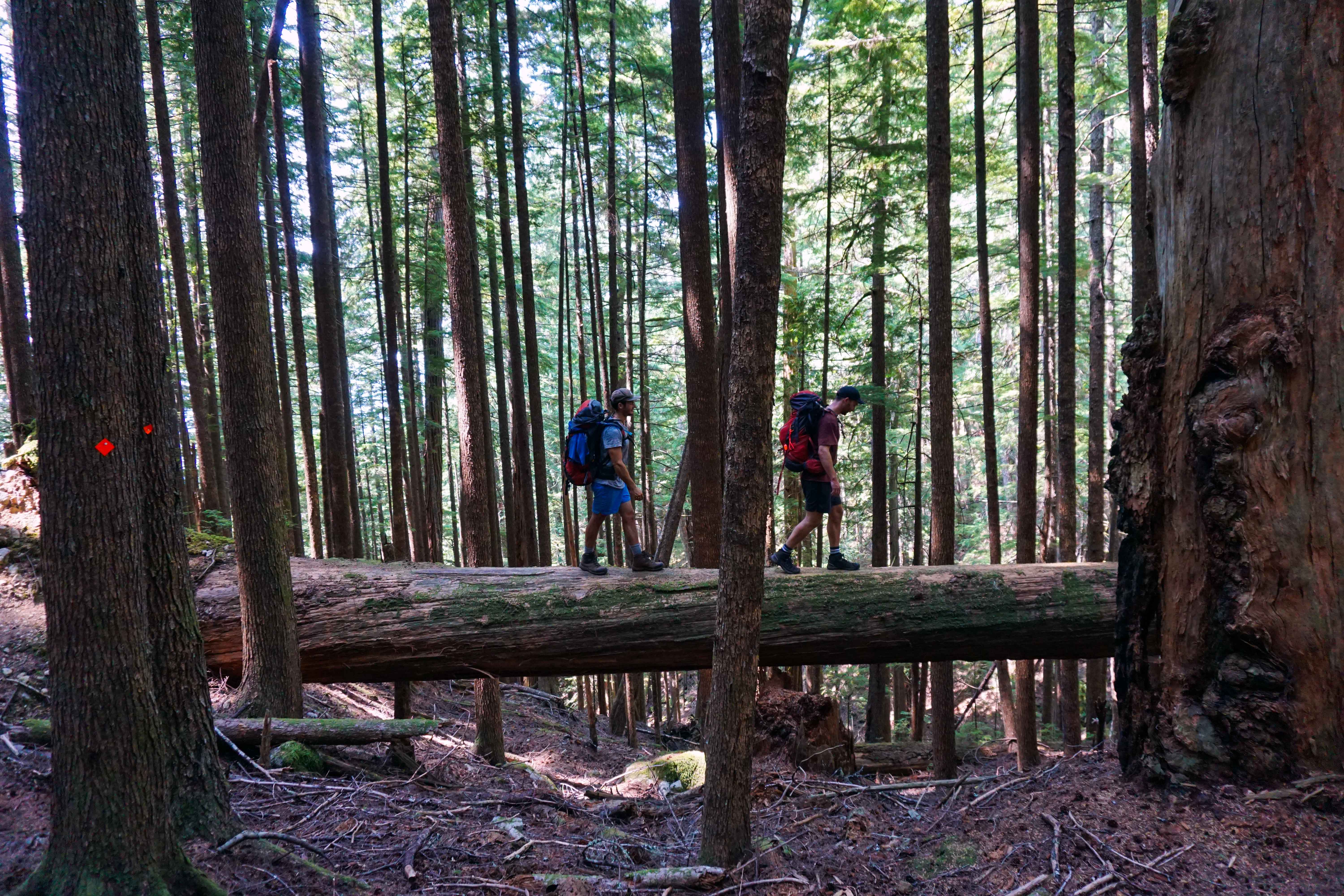
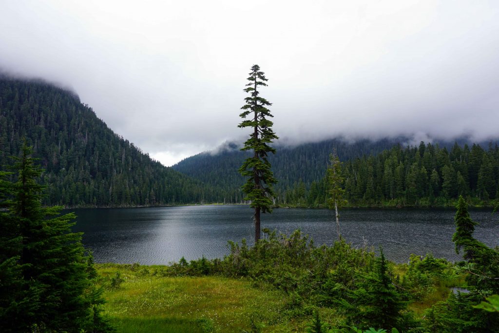
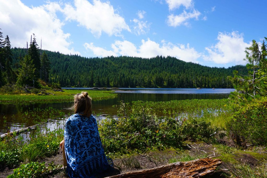
We stayed the night at Edwards Lake cabin, which we had entirely to ourselves. In the morning, we left our big packs behind and put together a day hiking bag. We then headed over to McNair Lake cabin, which is 5kms (one way). The trail rolls up and down, over roots and creeks – some with questionable bridges. As you get closer to Chapman’s Lake, the ground gets wet and boggy. McNair Lake cabin appears shortly afterwards.

Backcountry cabin in the forest
McNair Lake cabin

At this point we still hadn’t seen another human being since entering the park. In fact, we didn’t see anyone else until later that afternoon, when we came across a big group heading to Mount Steele. Walking alone to McNair Cabin was almost eerie, and strange for a Saturday in mid-summer. In Tetrahedron, it feels like you don’t have to go far to achieve a sense of isolation and remoteness.

After eating lunch, we retraced our footsteps almost to Edwards Lake cabin. But instead of turning left to the cabin, we continued upwards to Mount Steele cabin, which from this point is 3km one way. It’s a steep climb, so it’s much easier without a fully loaded backpack. From Mount Steele cabin, it’s a short hike up to the summit. We then returned to Edward’s Lake cabin for a second night, and this time we were joined by a local couple.

Alpine landscape with cabin
Walking up towards Mount Steele cabin

In the morning, we packed up all our belongings and returned almost to the parking lot. However, when we got to Victor’s Landing, we took a left turn towards Bachelor Lake cabin. There’s also a stone arrow on the floor to point you in the right direction. This is not a well-trodden path and is overgrown, so you need to follow your nose. You skirt the edge of the valley before descending down into the forest.

Backcountry cabin in the forest
Bachelor Lake cabin

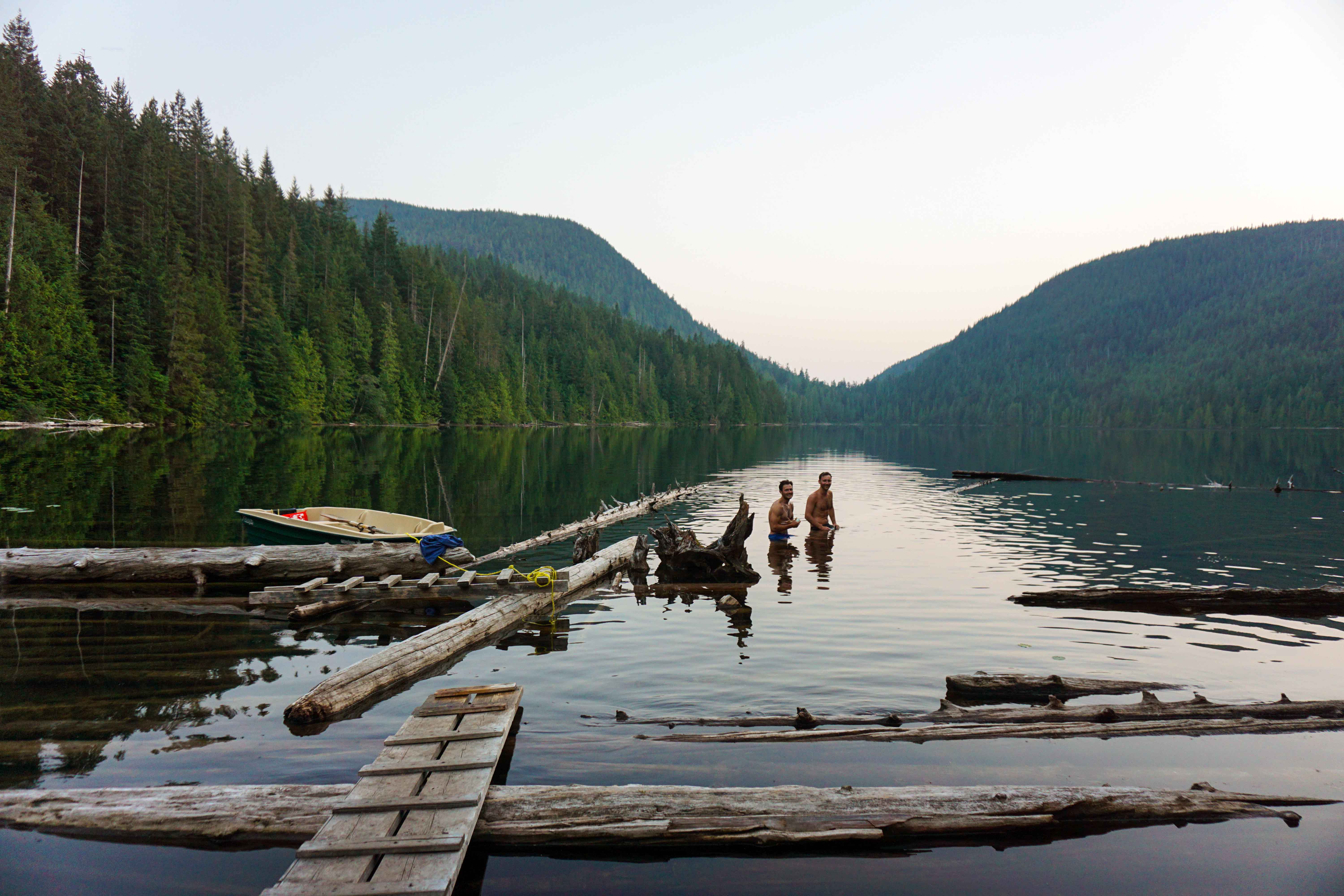
Apparently, Bachelor Lake cabin is the party cabin. We didn’t find any hungover souls, but we did have lunch and a sunbathe by the lake. We then returned to the parking lot via the normal summer trail – just follow the orange trail markers. And there you have it! Two days, four cabins and a few kms under our belts.

Woman sits in front of lake
Bachelor Lake

Of course, you don’t have to follow this route. You can pick and choose which cabins or lakes you want to go to. Some might prefer the out and back to Mount Steele. This seemed to be the preferred destination for the hikers we did meet. Others may opt for the loop from the parking lot to Edwards Lake, returning via Bachelor Lake. For solitude, I suspect McNair Lake cabin is the best bet. It’s entirely up to you.

Know before you go

The road to the parking lot is steep and extremely rough. We just about managed it in a Honda Odyssey – but only just. If you do not have a 4WD with good clearance, do not attempt to make it to the upper parking lot. If you visit in winter, 4WD and snow chains are essential.

The cabins are maintained by volunteers from the Tetrahedron Outdoor Club. If you’re staying, they ask for a donation of $15 per person, per night, or $25 per family, per night. Fees are payable to the Tetrahedron Outdoor Club can be paid online. If you want to send a cheque, there are pre-addressed envelopes in the cabins.

There is no running water in the cabins. In the summer, you can refill at the creeks and the lakes. Water should be boiled or treated. Swimming is prohibited in the lakes and streams within the park because it’s a watershed.

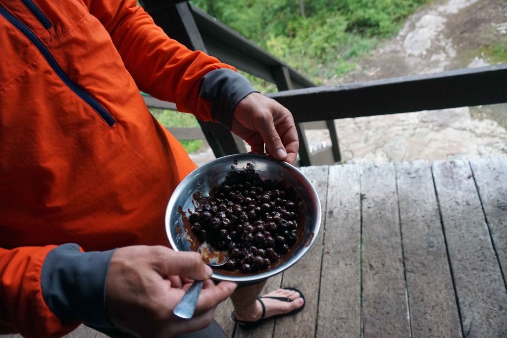
In the summer months the park is bursting with berries. Where you find berries, you inevitably find bears (we saw two). So, be bear aware!

Man holds bowl of berries
Freshly picked berries covered in chocolate

There is little-to-no cell reception in the park.

Conditions are very different in winter. The lakes may be frozen and avalanche hazards exist.

View of Confederation Lake hut from the lake

Hiking from Inland Lake to Confederation Lake

Spanning 180 kilometres, 14 backcountry huts (with another in the pipeline) and beautiful yet varied terrain, the Sunshine Coast Trail (SCT) is one heck of a hiking experience.

The history of the Sunshine Coast Trail

The idea was conceived in 1992 by two gents called Eagle Walz and Scott Glaspey. Their motivation was to save the area’s remaining old growth forests. They believed that if more people could access this section of B.C’s backcountry, the more chance there was of saving it from the talons of the logging industry.

A year later a group of volunteers known as the Powell River Parks and Wilderness Society (PRPAWS) was formed. They worked for eight years to create a hiking trail that spans the length of the northern Sunshine Coast, from Sarah Point in Desolation Sound, to Saltery Bay. The rest, they say, is history.

Nowadays the group continues to maintain the SCT, including both the trail itself and the huts. That means that any information shared here may well be out of date in years to come. But as it stands today, the SCT’s claim to fame is that it’s the longest free hut-to-hut hiking trail in North America. No fees, no reservations, and if you want, no tents necessary. Pretty good, right?

My brief encounter with the Sunshine Coast Trail

While planning a trip to the northern Sunshine Coast, I invariably stumbled upon a bounty of information about this epic hut-to-hut trail. Unfortunately, I didn’t have time to do the whole thing. After all, I was only going to be on the Sunshine Coast for five nights, and I had a lot of other activities on the agenda.

But not wanting to bypass it completely, I settled on the notion of doing an overnight hike. We only had one car between us, and a 2WD at that, so it would have to be a there-and-back hike with an easily accessible trailhead. After scouring the internet for information with little success, I contacted the good people at Tourism Powell River and asked for their recommendations.

After approximately one hour (I’m not kidding), a lovely lady called Tracey replied to my email with the following suggestions –

  • Park on Malaspina Road and hike north to Manzanita Hut
  • Park at Saltery Bay and hike into Fairview Bay Hut
  • Park at Inland Lake and hike into Confederation Lake
  • Park on Malaspina Road and hike south to Rievely Pond Hut

In the end, I plumped for option 3 – Inland Lake to Confederation Hut.

Inland Lake to Confederation Hut

After spending a night at the Inland Lake campground, we drove our car all of 20 metres to the day-use car park, filled our water receptacles at the pump, and set off into the unknown. Actually, that’s not entirely true, as the first couple of kilometres skirt the edge of Inland Lake. Seeing as we’d done the 13km loop around the lake the previous day, we sort of knew the way.

Shortly after the totem pole, a sign pointing right directs you to Confederation Lake. It’s uphill from there. Yep, there’s no two ways about it – this section of the Sunshine Coast Trail is steep. If you’ve got an overnight pack on, and it’s 30°c outside (which is was), then it’s pretty hard work.

Two men walk along a fallen tree

The Valley of Fatigue

Even so, the beautiful old growth forests provide a robust shelter from the sun, not to mention something awe-inspiring to look at as you heave yourself through the Valley of Fatigue – yes, that’s it’s given name! As you reach the shores of the lake, a sign informs you that it’s another agonizing 2km to the hut. From here the trail becomes more technical and begins to undulate.

At this point, with mounting anticipation and increasingly sore and sweaty bodies, we began to speculate on our chosen destination. What would the hut be like? How many other people would be there? Would the lake be nice to swim in? Wouldn’t it be good if there was a boat?

And then we arrived.

Expectations were exceeded. There was even a bloody boat. The Valley of Fatigue was forgiven.

Confederation Hut

As it turns out, there was just one other resident of Confederation Hut that night – a Slovenian called Mike. He had hiked all the way from Sarah Point and dutifully told us that Confederation Hut was the best hut he’d stayed in on the Sunshine Coast Trail to date. So nice, in fact, that he’d decided to stay an extra night.

A gorgeous wooden edifice with a green tin roof to boot, this is THE spot for anyone harbouring Swiss Family Robinson fantasies. Downstairs is equipped with a wood dining table and benches, a wood pellet burner, and a food preparation area. The sleeping quarters are upstairs in the rafters, with a few blankets and mats for anyone in need. Further sleeping spots are available underneath the hut itself.

Woman sits in front of Confederation Lake hut

Cabin porn

Once a thorough inspection had been completed and our spots staked out upstairs, we did what any hot-blooded human would have done – stripped off and threw ourselves in the lake. We quickly realised this was no freeze-your-wotsits off alpine lake. You could luxuriate in this all day.

Our swim was swiftly followed by a lap in the rowing boat, complete with life jackets and all. How this boat got here and by whose hand we don’t know, but at the time it felt like a gift from on high. As we sat in the middle of the lake, encased by forest, with snow-peaked mountains in the distance and the secluded cabin in the foreground, it was easy to see why our new friend Mike was reluctant to leave.

Two men swim in Confederation Lake hut

Cooling down after a hot hike

After dinner we took the short jaunt to the viewpoint at the disconcertingly named Vomit Vista. Never fear, it’s an easy walk, and there were no bodily fluids in sight. After that it was to bed, where we found the hut to be relatively cool and, thanks to the fly screens, bug free. If only my fellow companions didn’t snore, I would have had a much better night’s sleep.

The following day we forced ourselves to leave this beautiful spot, with the return journey taking about half the time of the previous day’s hike. As I scrambled down the hillside, my thoughts turned to Mike and the delights he would be experiencing as he worked his way to Tin Hat Mountain.

That’s the only problem with doing a short section of the Sunshine Coast Trail – it whets your appetite, and all of a sudden you want to take a week off work and walk the whole darn 180km.

I know that I, for one, will be back.