Tag Archives: hikes near vancouver

Golden larches in Manning Provincial Park

Frosty Mountain Golden Larches Hike

See the golden larches in Manning Provincial Park by hiking the Frosty Mountain trail in late September or early October.

What are the golden larches?

As the season shifts from summer to autumn, there’s one question on every hiker’s mind: have the larches turned golden yet? If you’re wondering what all the hype is about, then let me explain.

You’ve heard of coniferous trees, right? They have needle-like leaves which stay put year-round. Then there are deciduous trees. They turn a riot of colours before shedding their leaves for the season. Well, larches are conifers – but unusually, they also lose their needles. Cool eh?

The result is that for a few precious weeks each year, larch trees around the world turn a beautiful golden colour. Arrive too early and they’ll still be green. Get there too late and the needles will already have dropped, leaving the trees bald until spring.

Just like Goldilocks and her porridge, you’ve got to get it just right.

Golden larches in Manning Provincial Park
Sub-alpine larches turn golden in late September/early October

Where can you see the golden larches?

To get the real wow factor, you’re looking for the sub-alpine larch, known in Latin as the larix lyallii. These are found growing at high elevations where the temperatures are low and the soil is rocky. Stands of sub-alpine larches can be found across Canada and the USA, particularly in the Rockies and the Northern Cascades.

Popular places to see the golden larches include:

  • The Sentinel Pass in Banff National Park, Alberta
  • Chester Lake in Kananaskis Country, Alberta
  • Cathedral Provincial Park, British Columbia
  • Manning Provincial Park, British Columbia
  • Maple Pass Loop, Washington State
  • Cutthroat Pass, Washington State

Golden larches near Vancouver

If you live near Vancouver – and crossing the border isn’t an option (hello Covid) – then the best place to see the golden larches is in Manning Provincial Park.

But here’s the catch: these larches grow high up the side of a mountain. You can’t see them from your car, so you won’t be doing a drive-by photo shoot. Instead, you need to dust off the hiking boots and follow the trail up to Frosty Mountain.

You don’t have to reach the summit of Frosty Mountain, which stands at a considerable 2,408m. In fact, the golden larches plateau is around 2km below the peak. The hike to the plateau is certainly uphill, with approximately 800m elevation gain. But it’s manageable for the intermediate hiker, as the trail ascends gradually during a long series of switchbacks.

Golden larches in Manning Provincial Park
Manning Provincial Park in early October

When to see the golden larches in Manning Provincial Park

The Frosty Mountain hike is typically snow-free from mid-July to early October. To catch the larches at their most vibrant, visit in late September to early October. I went in the first weekend of October and was met with a dazzling array of golden hues.

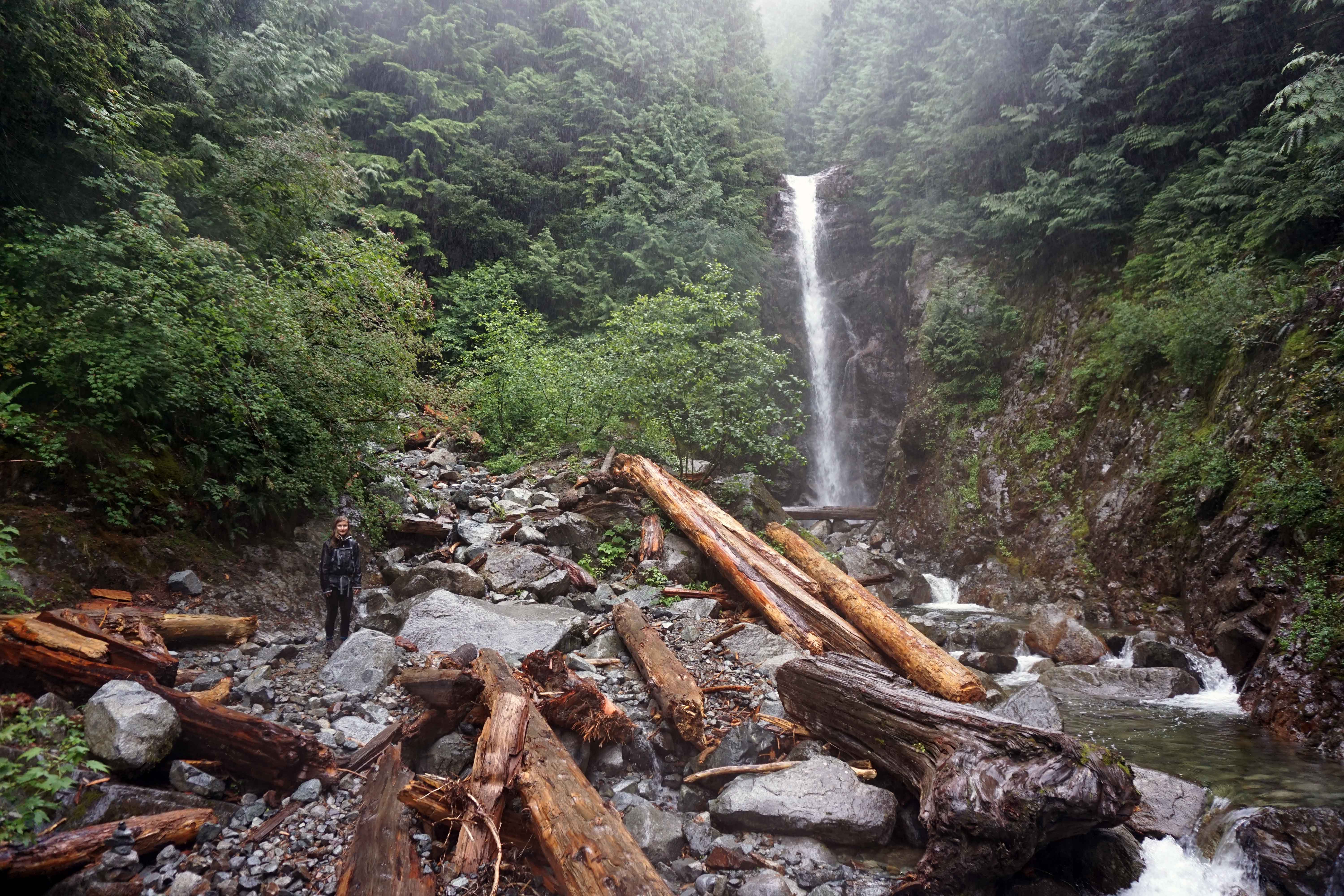
The weather in late September and early October is unpredictable. The larches are extremely high up and it’s very possible that there will be snow on the ground. Take warm layers and micro-spikes for your hiking boots. Oh, and always carry the 10 Essentials!

Top tip – these glorious larches turn golden for a short period, meaning the trail is very busy at weekends during late September/early October. If possible, time your trip for a week-day.

Frosty Mountain hike quick facts

  • Distance: 22km round trip to Frosty Mountain, or 18km to the larches plateau
  • Start: from the Lightening Lake day-use area in Manning Provincial Park
  • Time needed: between six and nine hours, depending on your speed and whether you go all the way to the summit
  • Dogs: are allowed on leash
  • Elevation gain: 1,150m to the summit, 800m to the larch plateau
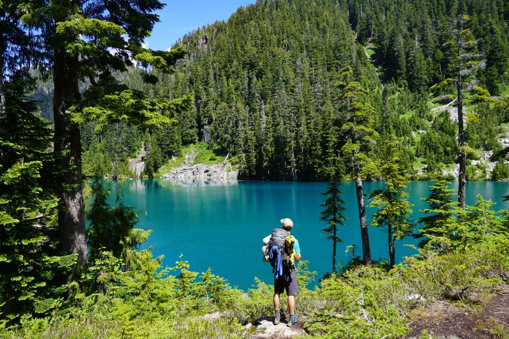
  • Camping: is available if you want to do this as an overnight trip. Frosty Creek Wilderness Campsite is around the 7km mark.
  • Alternative routes: it is also possible to reach Frosty Mountain from the Windy Joe trail. Additionally, you can do a loop trail incorporating Lightening Lake, Frosty Mountain and Windy Joe. BC Parks has more information on the options available.
  • The larches in Manning Park: are, according to John Baldwin in Exploring the Coast Mountains on Skis, ‘up to 2,000 years old and are some of the oldest trees in Canada’. Woah.
Manning Provincial Park
It’s thought that these are the oldest trees in Canada!

Hiking the Frosty Mountain trail

The most popular way to see the golden larches in Manning Provincial Park is to hike the Frosty Mountain Trail. This is the route I’ll describe here.

Travel directions

From Vancouver, head east-bound along Highway #1. After Hope, stay in the right-hand lane as it merges into Highway #3. Turn right immediately after Manning Park Resort onto Gibson Pass Road. There’s a signpost for Gibson Pass ski area. After you’ve made the right-hand turn, you’ll see a sign for Lightening Lake. Continue until you reach a fork in the road. Take the left-hand fork towards the Lightening Lake day-use area. Park here.

The route

Start at the Lightening Lake day-use area. If you’re looking at the lake with the parking lot behind you, head left (east) around the lake, keeping the water on your right-hand side. Cross the dam and you’ll see a trail marker for ‘Frosty Mountain trail’.

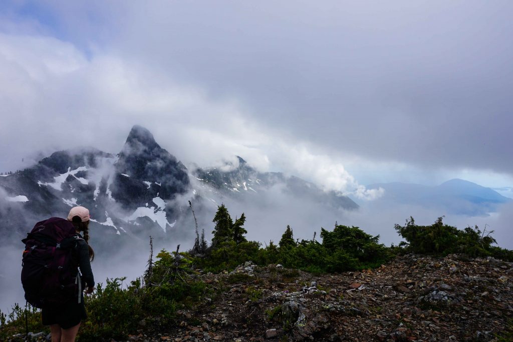
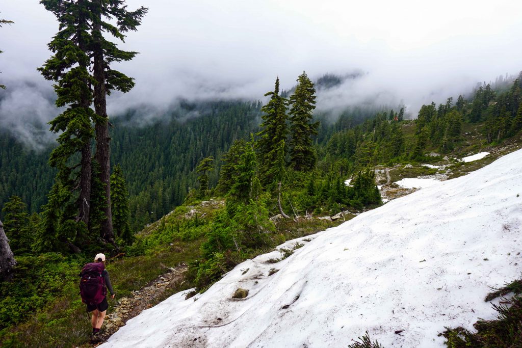
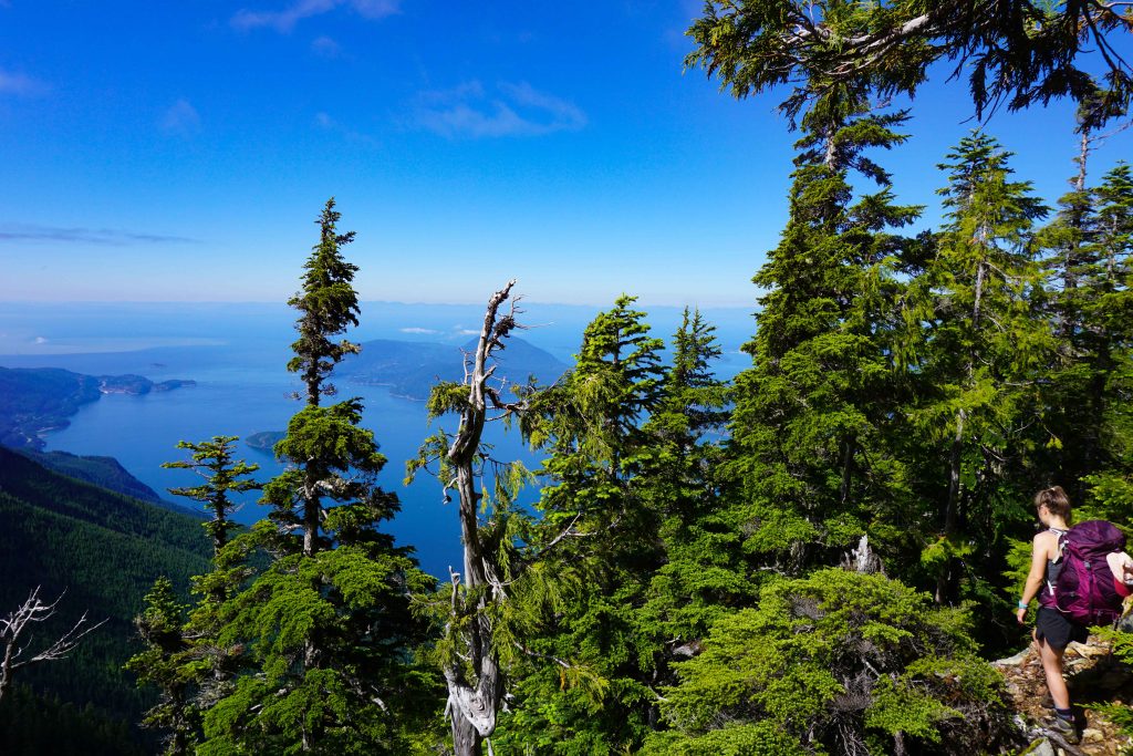
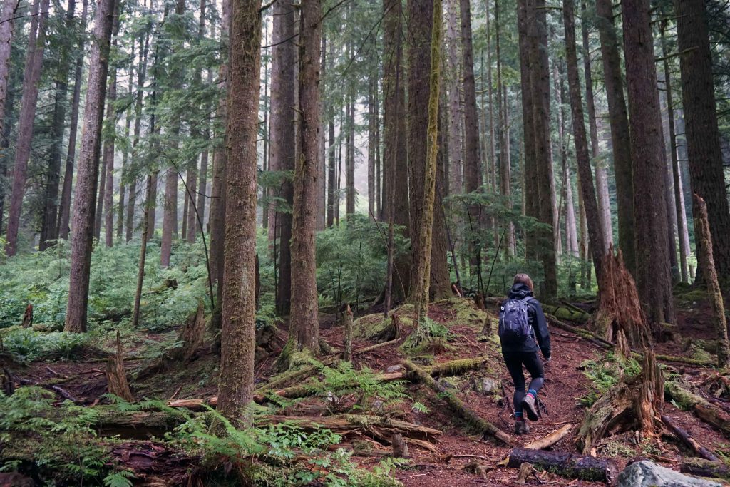
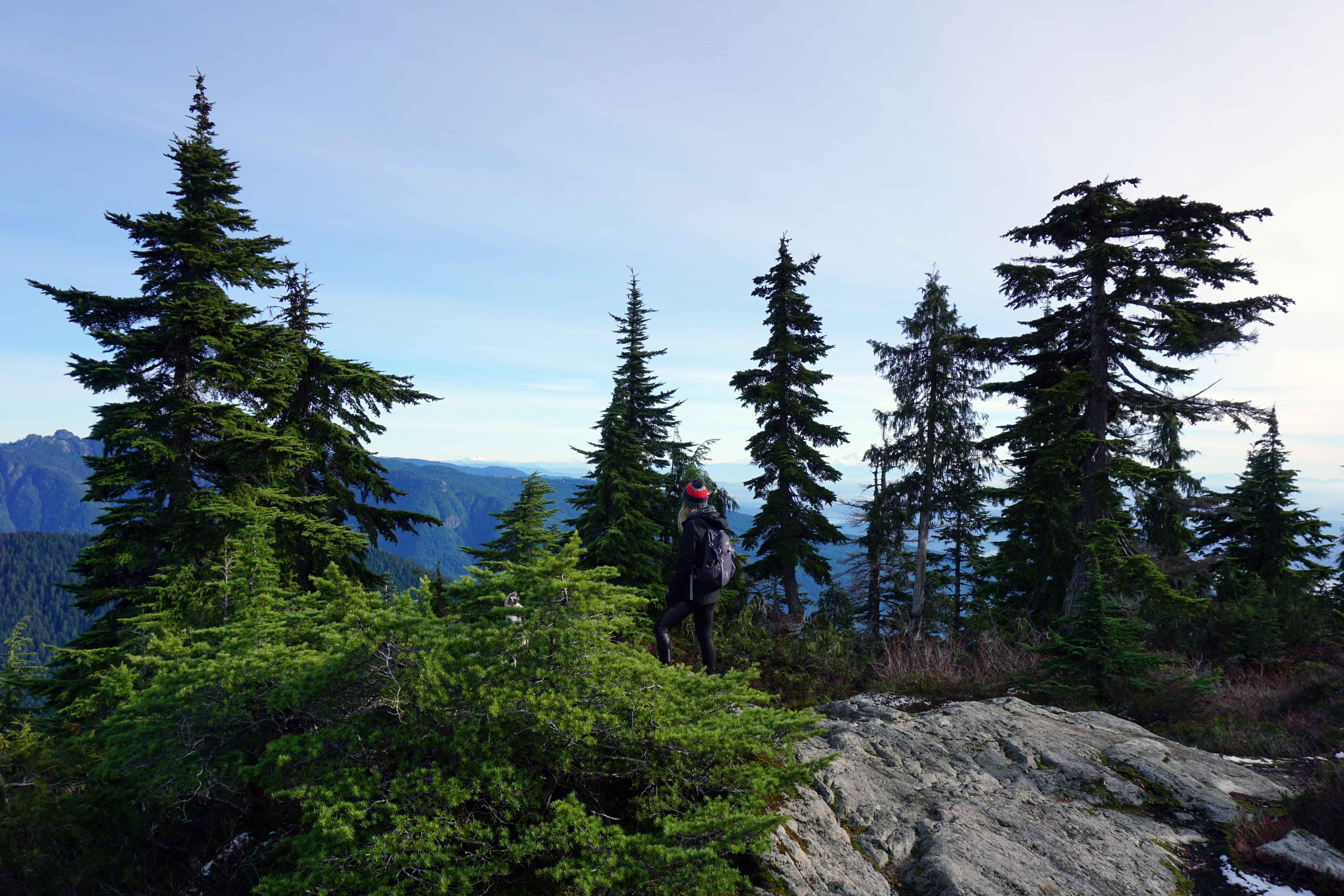
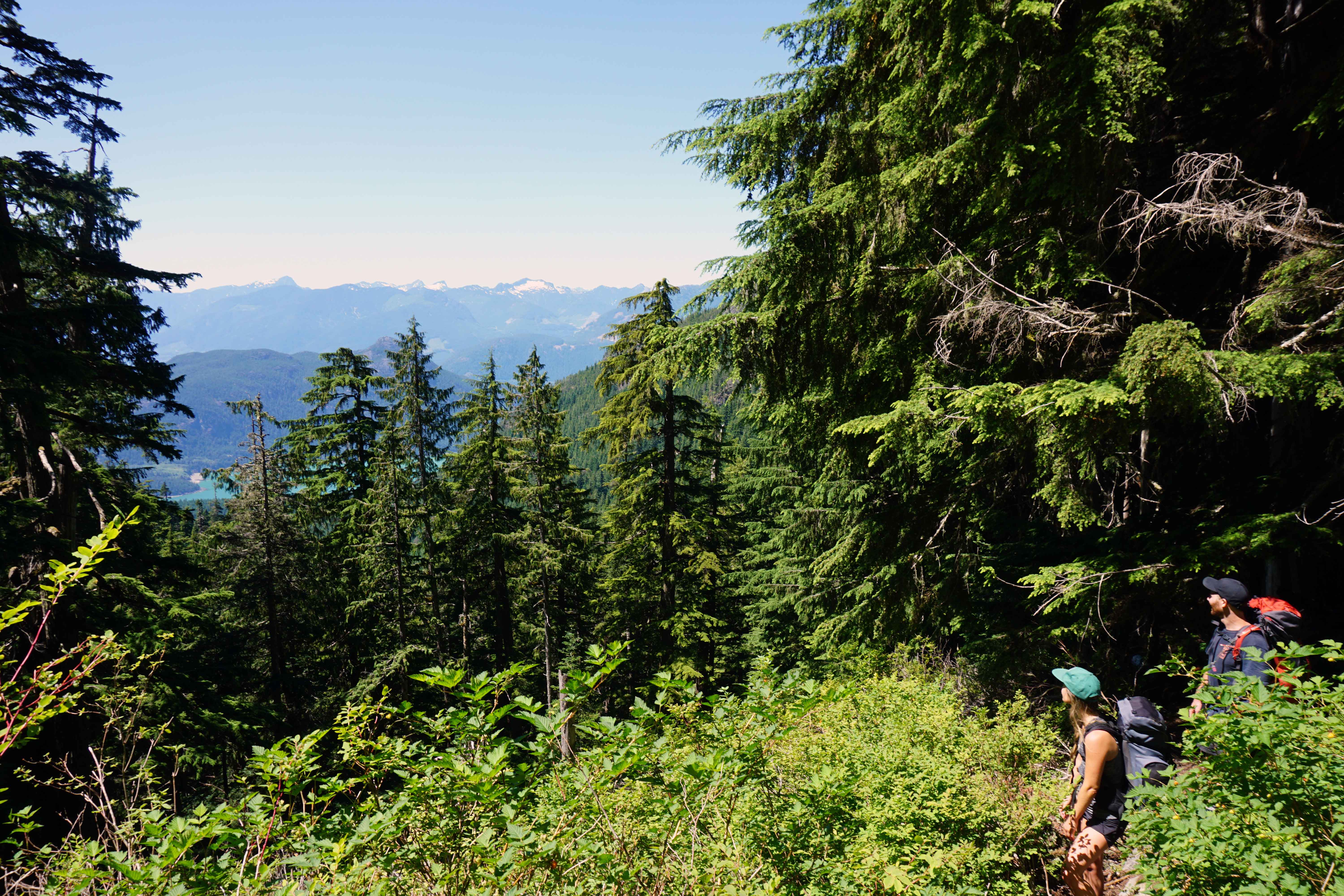
The trail immediately enters the forest. From now you can expect around 6km of switchbacks. The trail isn’t technical and ascends gradually. However, it’s very narrow which makes overtaking difficult. Bottlenecks can form on busy days, especially when there’s a two-way flow of traffic.

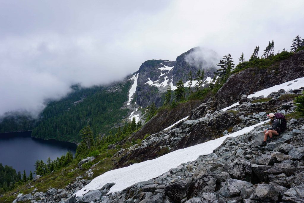
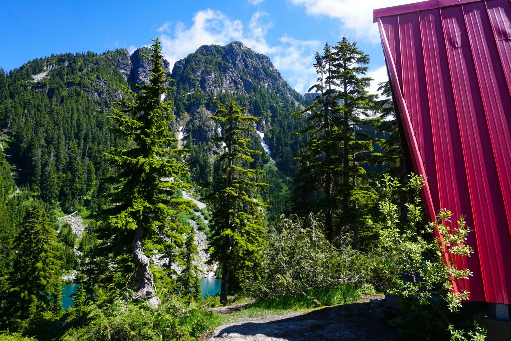
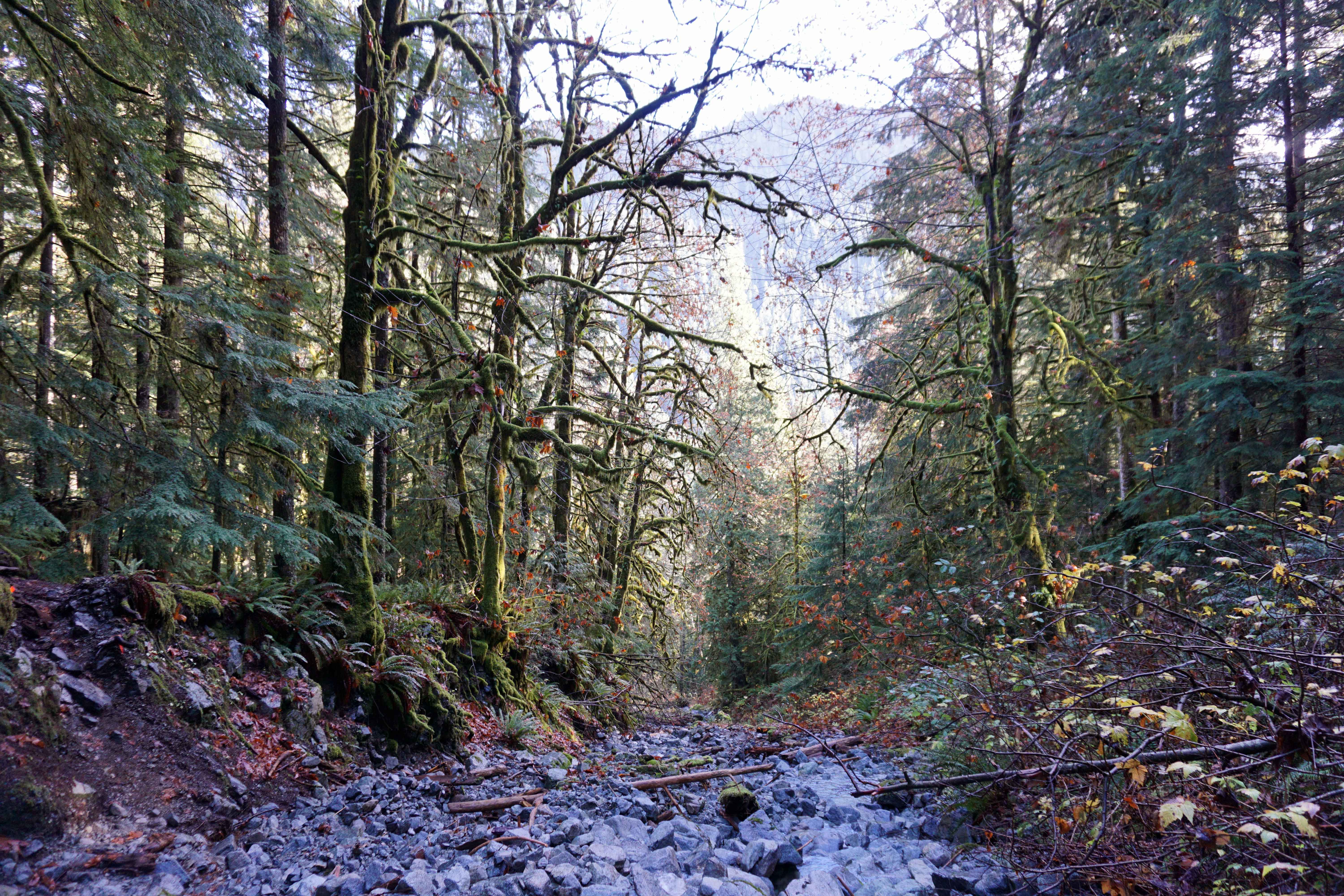
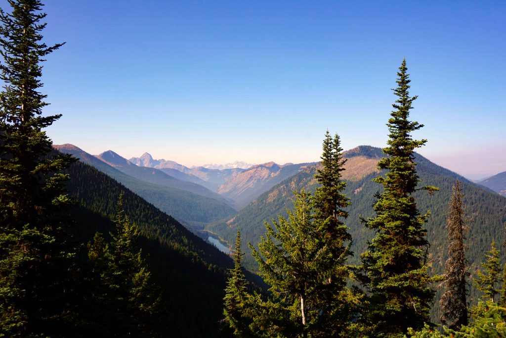
Every now and then the forest opens up and you’ll get a glimpse of Lightening Lake below you and Mount Hozameen in the distance. Eventually the switchbacks end and the trails levels off. You’ll undulate up and down for another 1km or so, after which you’ll reach Frosty Creek Campsite. There’s an emergency shelter, an outhouse and a very small creek.

Manning Provincial Park
Glimpses of Lightening Lake and Mount Hozemeen along the Frosty Mountain trail

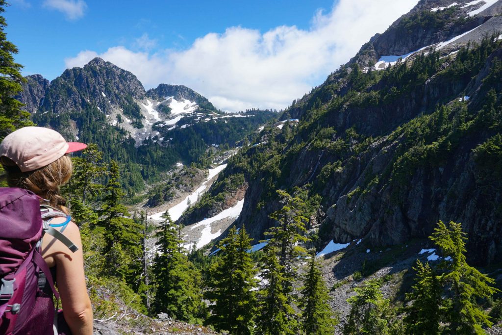
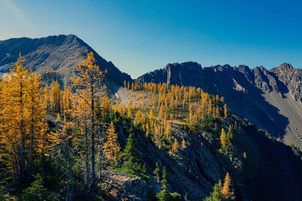
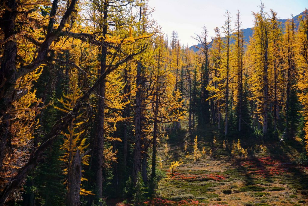
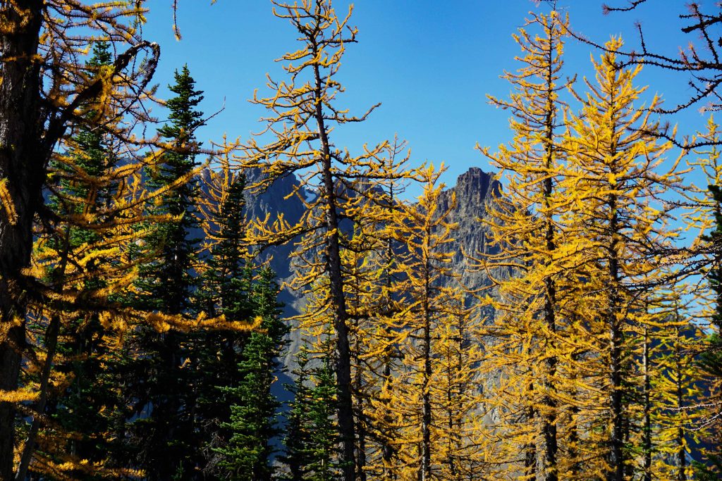
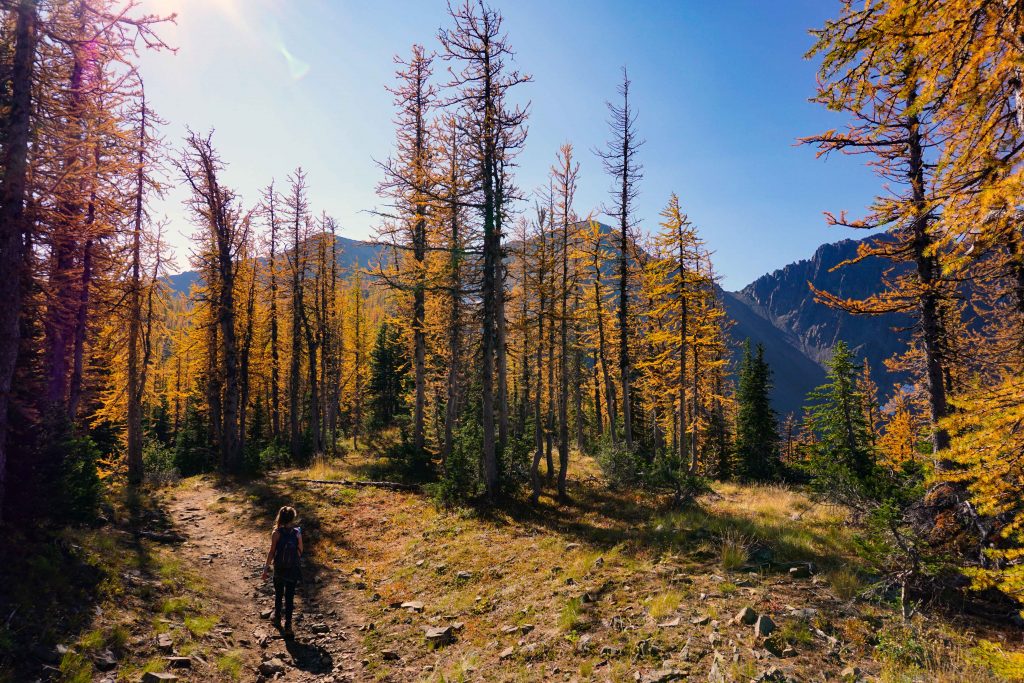
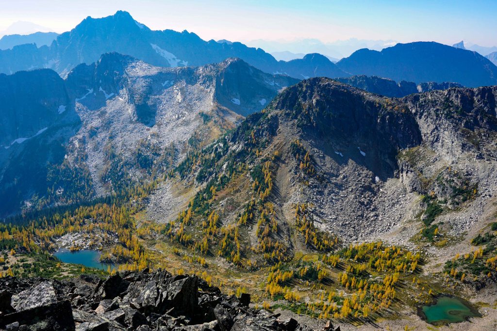
Pass through the campsite and over the creek. Now the trail begins to climb again, but it’s only 0.5km until you get to the larch grove, so keep going! Soon you reach a plaque that tells you about larch trees. Finally, you’ll get your first glimpse of the famed golden larches. Continue walking along the trail, which becomes relatively flat. You’ll find larches all around you for around 1km, set against the stunning backdrop of the Northern Cascades.

Golden larches Manning Provincial Park
The golden larches plateau

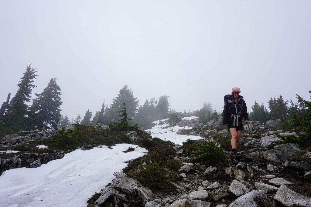
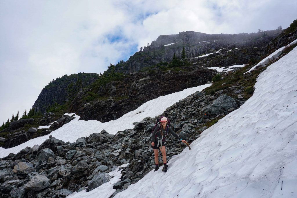
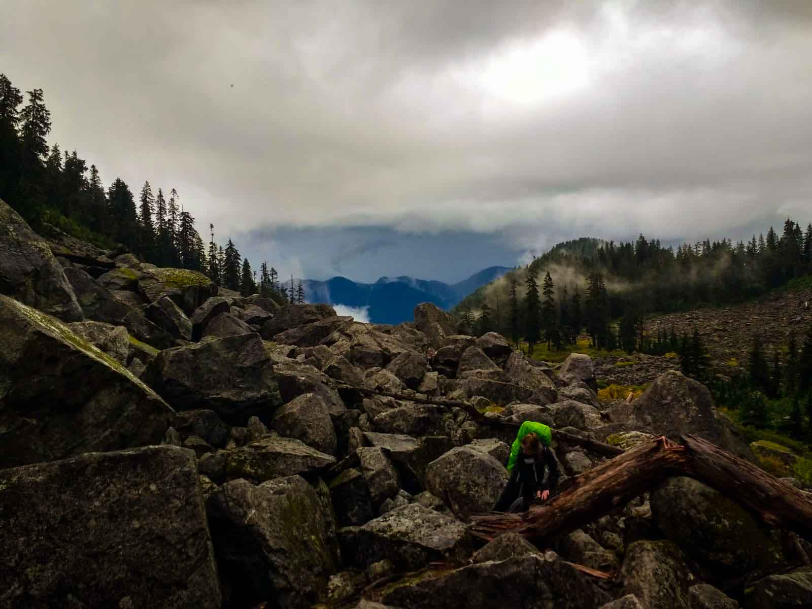
Soon the trail starts to climb once again. Then, the tree line abruptly comes to an end and you’re faced with a scree field. If you don’t want to continue to Frosty Mountain summit, this is the end of your hike. Turn around and return the way you came, taking time to appreciate the golden larches from an alternative perspective.

If you want to keep going, then be prepared for the difficulty rating to increase. Hike up through the scree field, following the pink dots painted on the stones. It’s steep and the scree is loose, so take care.

Manning Provincial Park
The scree field to the ridge. You can see the summit in the distance

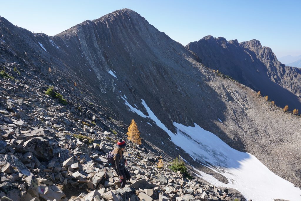
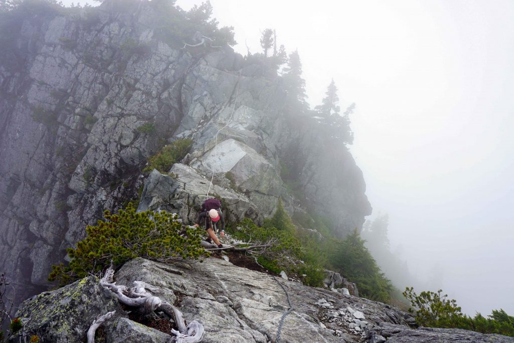
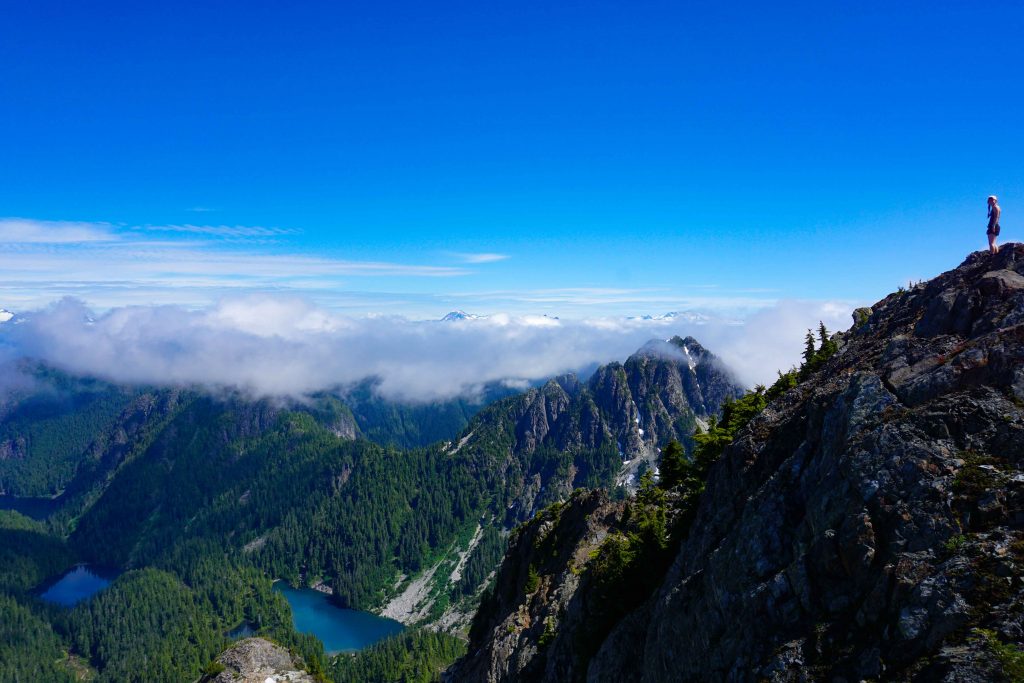
Once you’re at the ridge, turn right and walk along the ridgeline. It remains rocky and the altitude can make it hard going. Keep following the ridge until you reach the east summit.

Manning Provincial Park
Walking along the ridge towards Frosty Mountain

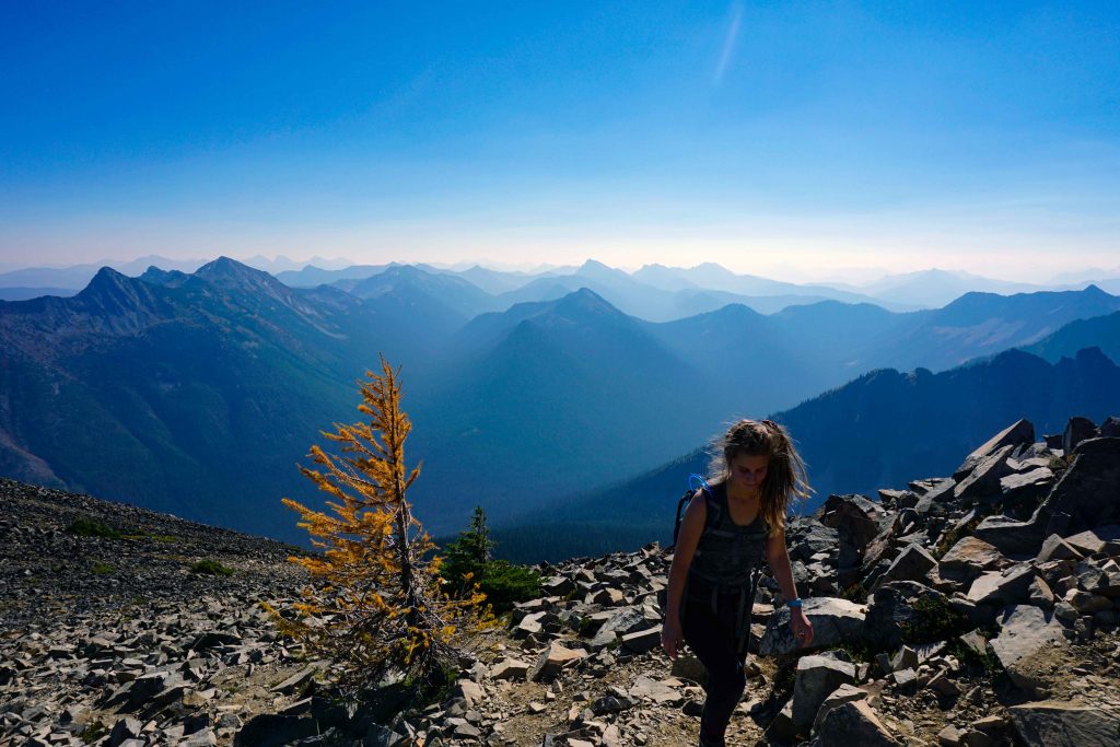
Once you arrive, you can congratulate yourself: you are standing on the highest mountain in Manning Provincial Park!

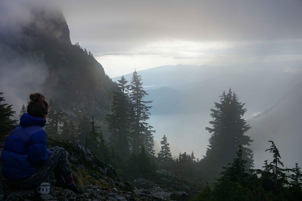
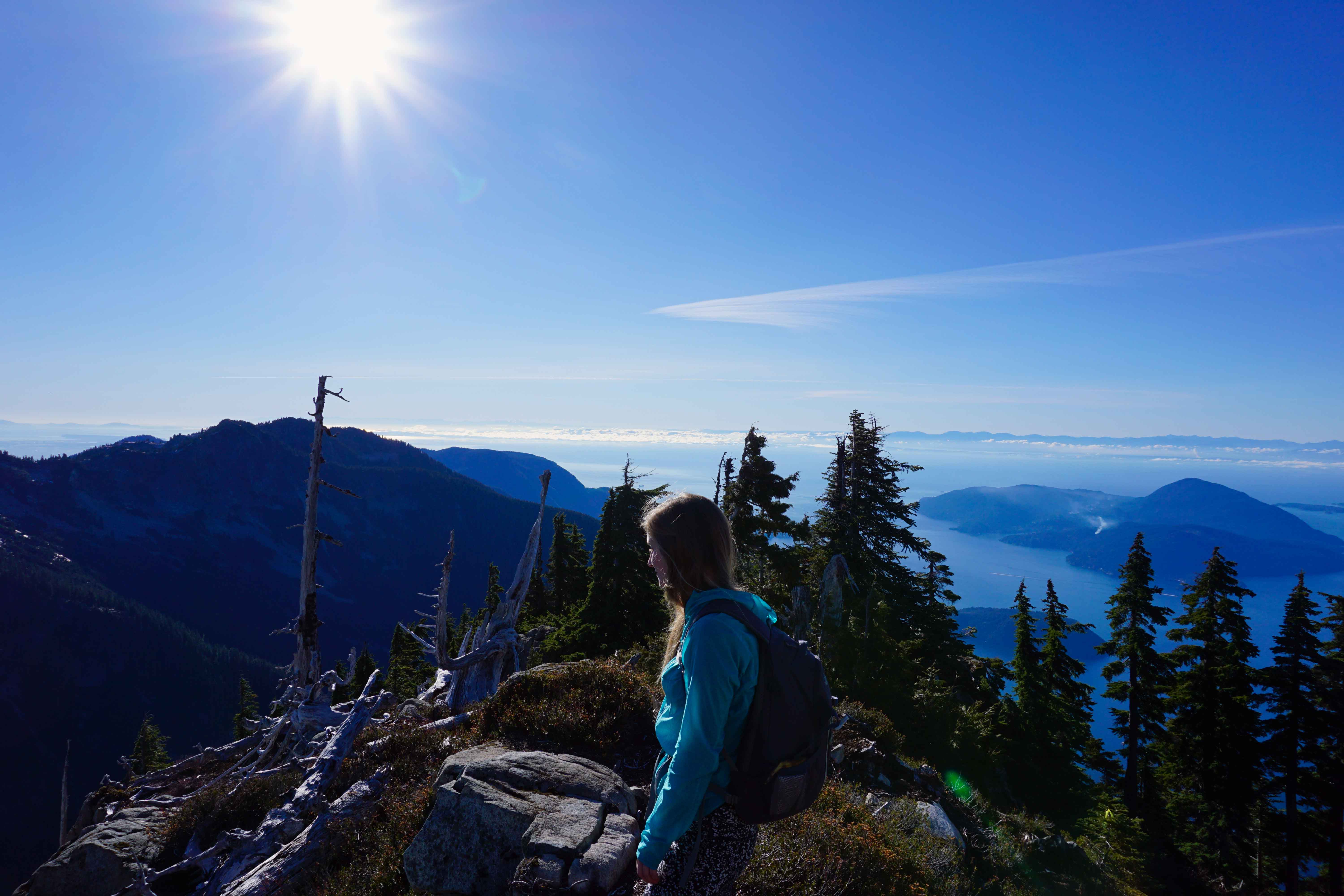
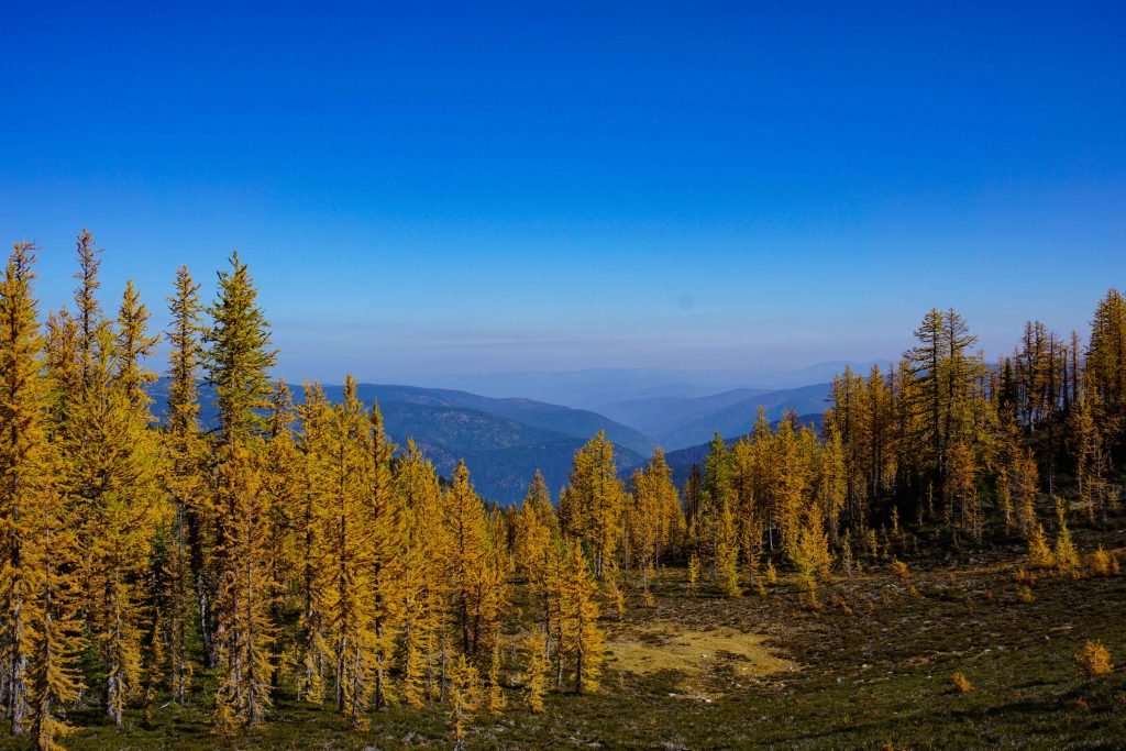
Take your time to soak up the incredible views. To the south is the Cascade Range in the USA, and to the north is a sweeping panorama of Manning Provincial Park in all its glory. Whichever way you look, there’s layer upon layer of mountains.

Manning Provincial Park
Views from the top of Frosty Moutain in Manning Provincial Park

And there you have it: your complete guide to hiking the golden larches in Manning Provincial Park.

Did you like this post? Save it for later!

Howe Sound Crest Trail

Hiking the Howe Sound Crest Trail

Spanning from Cypress Bowl to Porteau Cove, the Howe Sound Crest Trail is one of THE iconic hikes near Vancouver. At 29km long, it’s like a greatest hits list of local peaks, allowing the hiker to bag them all in one fell swoop.

OK, maybe not them all, but your legs will carry you up and over St Mark’s Summit, Mount Unnecessary, The Lions, James Peak, David Peak and, if you want, Brunswick Mountain. Then you’ll skirt round Brunswick Lake, Hanover Lake and Deeks Lake. It’s quite the sightseeing tour. Did I mention the views? They’re spectacular.

If you’re thinking about hiking the Howe Sound Crest Trail (HSCT), here’s what you need to know.

Howe Sound Crest Trail quick facts

  • Distance – 29km, not including a detour to Brunswick Mountain.
  • Rating – very difficult
  • When to hike it – late summer to early autumn, preferably on a clear day when you can enjoy the views!
  • Time needed – two days ideally. Some advanced trail runners tackle it in one day.
  • Logistics – this is a point to point hike. You’ll need to leave a car at either end, or get someone to pick you up/drop you off.
  • Start/end – most people hike the trail from south to north. This mean you’d start at Cypress Bowl (Cypress Mountain Resort) and end at Porteau Road.
  • Camping – wilderness camping is available along the trail. Preferred sites are Magnesia Meadows (14.5km from Cypress), Brunswick Lake (19km from Cypress) and Deeks Lake (22km from Cypress). There are no outhouses, tent pads or bear caches.
  • Water – if you are hiking the trail from south to north, water is scant until you reach Magnesia Meadows. From thereon, you’re never too far from a water source. Boiling or treating drinking water is recommended.
  • Campfires – are not allowed.
  • Dogs – are allowed on leash. However, the section between Mount Unnecessary and Magnesia Meadows is definitely not dog-friendly. There are cables, ropes and steep step-downs. Leave the fur-baby at home.
  • Shorter hikes – you can exit the trail early if you want a shorter hike. Rather than going all the way to Porteau Cove, head down to Lions Bay via the Lions Binkert Trail or the Brunswick Mountain Trail.

There’s some important safety information tucked into this list. For the sake of clarity, I’m going to expand on a few points.

Honestly, it’s very difficult

I hiked the Howe Sound Crest Trail from south to north, stopping at Magnesia Meadows overnight. Honestly, the first day kicked my butt. I don’t want to sound too big for my (hiking) boots, but I’ve done trails rated as difficult before and thought they weren’t so bad. But this was a different story. The first half of the trail sees you scaling up and down various peaks. It’s steep, not only going up, but going down too. There are ropes, cables, boulders, scrambles and sheer drops. The terrain is technical and progress is often slow-going. When you’ve got an overnight pack on, it makes it all the more difficult.

Be warned: the Howe Sound Crest Trail is not for beginners, or indeed intermediate hikers. It’s hard. For fit and experienced hikers, this is a challenging and highly rewarding experience. Be prepared and be sure to carry the 10 essentials with you.

This is a late summer/early autumn hike only

Snow persists on the HSCT well into summer. It may balmy down in the city in June, but up at 1,500m you’ll find yourself knee-deep in the white stuff. “I’m not deterred by a bit of snow”, you might think. That’s all well and good, but the terrain of the Howe Sound Crest Trail means that you’d need avalanche training and mountaineering skills to traverse it safely. There’s a particularly sketchy col in between The Lions which can be covered in a thick slab of compact snow, even when everything else is bone dry. Slip here and you’d promptly slide 50 feet into a boulder field.

You may be itching to tick this one off your bucket list, but be patient and wait for the right conditions. The snow pack changes every year, so it’s impossible to say exactly when the Howe Sound Crest Trail is hike-able. Usually, you’ll be looking from late July to early October.

Howe Sound Crest Trail
Looking across to Enchantment Lake

How long does it take?

If you hike the Howe Sound Crest Trail, you’ll no doubt see trail runners tackling the length of it in one day. You could, in theory, hike the HSCT in one day too. However, you would need to start very early and travel very quickly to avoid being caught out by nightfall. This would be a shame, as the Howe Sound Crest Trail is beautiful. You’ll want to take your time – and hike in daylight – to fully appreciate the views.

So, from a safety perspective, and for your own enjoyment, this is best done as an overnight hike. One night will suffice, but if you really want to savour the scenery, you could stay for two nights.

I’m always wary of disclosing how long a hike has taken me, as everyone’s abilities are different. To give you an idea, we were hiking for nine hours each day. The first day included two short rest stops. The 4km between The Lions and Magnesia Meadows took three hours alone due to the difficulty of the terrain. The second day was more leisurely and included a detour to Brunswick Mountain and multiple stops for lunch and lake swimming.

Howe Sound Crest Trail
Stunning scenery along the Howe Sound Crest Trail

Parking and logistics

This is a point to point hike, meaning a bit of planning is required in terms of logistics. Ideally, your group will have two cars. On the morning of your hike (or the evening before) you can drop one car at your end destination. You can then all pile into the remaining car and drive to your start point. That way, when you finish your hike, you’ll have a car waiting for you. You can collect the other car on your way home.

I didn’t have two cars, so instead dropped my car at Porteau Cove the evening before the hike. My boyfriend collected me in an Evo. In the morning, a friend picked us up and dropped us at Cypress Mountain Resort, where we started our hike.

There is a large parking lot at Cypress Mountain. To save your legs, you’ll want to park as close to the ski lodge as possible. The address is Cypress Mountain, 6000 Cypress Bowl Road, West Vancouver, BC V7V 3N9. Take exit #8 off Highway 1. At the northerly end, you need to park at Porteau Road parking lot. Follow Highway 99 and exit at Porteau Road. The parking lot can be found on the east-side of the highway, up a short hill.

Hiking the Howe Sound Crest Trail – the route

Most people opt to hike the Howe Sound Crest Trail from Cypress to Porteau Cove because the elevation gain is significantly shorter. If you, too, are stomping in this direction, then here’s what you’ll find.

St Mark’s Summit – approx. 5.5km from Cypress

The first hurdle to overcome on the Howe Sound Crest Trail is St Mark’s Summit. From Cypress Mountain Resort, there are plenty of maps and signposts towards the Howe Sound Crest Trail. You can take either the east or west access trail – you’ll end up in the same place. You can veer off the trail to the Bowen Lookout if you want. Otherwise, continue to follow signs for the Howe Sound Crest Trail. As you near the top there’s a series of steep switchbacks. Afterwards, the gradient starts to level out and the trail can be muddy. Soon afterwards, you’ll come to the summit. This is your first real chance to enjoy the stunning views across the Howe Sound.

The hike to St Mark’s Summit is a popular one. From here, the trail is quieter with fewer signposts. Be sure to look out for orange markers.

Mount Unnecessary, north and south peaks – approx. 7km from Cypress

Follow the trail round to the left where there’s a steep drop down the back side of St Mark’s Summit, only to be followed by a taxing ascent through the forest. This section is challenging with a heavy pack on and there are lots of tree roots to haul yourself over. You’ll soon appreciate why it’s called Mount Unnecessary, as you’ll wish this mountain-shaped obstacle wasn’t standing in between you and The Lions.

Finally, you pop out of the treeline and come to a rocky ridge. Follow this and you’ll reach the south peak of Mount Unnecessary, followed by the north peak. There are supposedly incredible views from this vantage point, which at the north peak stands at 1,542m. I say supposedly, because unfortunately when I went, we were shrouded in clouds. Well, you can’t plan the weather.

Woman walks along snowy rocky ridge
The ridge leading to Mount Unnecessary

The Lions – approx. 10.2km from Cypress

From the north peak of Mount Unnecessary, you scramble down some steep rocks with the help of a rope. From here, follow the trail towards The Lions. You’ll come to a rocky slope, at the top of which you’ll see the Search and Rescue Cache. Follow the trail upwards. It can be difficult to navigate this section, but some of the rocks have faded orange paint on. Continue to follow the ridge crest until you come to the base of the West Lion.

Experienced scramblers and climbers may choose to drop their packs here and climb up the West Lion. I’ve not done it myself but I know others who have. They report that it’s a no-fall zone – so it’s best left to those who know what they’re doing.

James Peak

At this point, things step up a notch in terms of fear factor. You’ll drop downwards slightly and follow the trail across the col between the West and East Lions. This is the sketchy section I mentioned previously which is often covered in snow. The trail traverses around the East Lion and is very narrow and exposed. You’ll then ascend upwards, rounding some small peaks – don’t be fooled, this isn’t James Peak!

Instead, you need to descend steeply around the base of Thomas Peak, where you’ll come to a boulder field. This can be covered in snow, making the trail difficult to follow – keep an eye on those orange trail markers. If you’re looking at the boulder field, you need to stay high, keeping to the left.

Woman traverses snowy boulder field
Crossing the boulder field

After a couple of hundred metres there’s an exit that takes you back into the forest. This area is known as Enchantment Pass. Soon it becomes incredibly steep and exposed as you climb the ridge to James Peak. There’s a chain rope to help you.

Woman scrambles up mountainside
Scrambling up the side of James Peak with the help of a chain rope

David’s Peak

Once you’ve enjoyed yet more incredible views, it’s time to descend from James Peak. The terrain becomes more open and meadow-like, but the respite doesn’t last long as there’s one more peak to summit – David’s Peak. Once again, this is a steep climb, followed by a steep descent the other side. By now you’re in the forest and it’s a matter of climbing up and over trees roots.

Magnesia Meadows – approx. 14.5km from Cypress

Once you’re descending David’s Peak, you know there’s not far to go until Magnesia Meadows. However, the going can be slow down the backside of David’s Peak. Once at the bottom, there’s an agonising incline up an old logging road. This section is open, grassy and full of berries – making it a hot-spot for bears. Keep grinding away until you reach a junction. Turn right and you’ll see the Magnesia Meadows emergency shelter in the distance.

Howe Sound Crest Trail
Hiking in to Magnesia Meadows – the red emergency shelter is in the distance

This is a gorgeous place to camp overnight. The views of the Howe Sound are framed by Mount Harvey on your left and the forest on your right. There’s a running stream for water and you can take refuge in the emergency shelter if needed. There’s no outhouse or bear caches, so bring a trowel and bear bag for your food.

Howe Sound Crest Trail
Camping at Magnesia Meadows

Brunswick Mountain – optional

From Magnesia Meadows, the trail continues gently upwards past the emergency shelter and into the trees. The terrain is much more manageable from here and you will cover the remaining distance much faster.

Howe Sound Crest Trail
Views across the Howe Sound

However, you can extend your hike if you want by taking a detour up to Brunswick Mountain. If so, watch out for the trail marker on your right (around 2km from Magnesia Meadows). Stash your bags and continue up the Brunswick Mountain Trail. It’s a scramble to the top but you’ll be treated to incredible views. Return to your bags and re-join the Howe Sound Crest Trail.

Brunswick Mountain
Brunswick Mountain

Brunswick Lake – approx. 19km from Cypress

Back on the Howe Sound Crest Trail, the gradient remains fairly level. Then, you’ll start to drop steadily downwards. This section is full of pretty meadows with tarns. You’ll come to the emergency shelter above Brunswick Lake before descending further to the lake itself.

Howe Sound Crest Trail
The emergency shelter sits just above the lake

The lake is a brilliant blue colour and very cold, as you’ll soon find out when you take your shoes and socks off to wade across to the other side. Take care – the underwater stones are slippery and uneven. I saw one hiker in front of me fall right in. I was glad to have my sandals with me!

This is another great spot to camp, or at least to stop for a sandwich and a swim.

Brunswick Lake
Brunswick Lake

Deeks Lake – approx. 22km from Cypress

From here, a creek runs all the way to Deeks Lake. The trail runs parallel to it. You’ll pass by a waterfall and Hanover Lake, which like Brunswick Lake is bright blue in colour. There are some more creek crossings, so you’ll be taking your socks and shoes off a couple more times. Otherwise, the trail is fairly easy. It undulates up and down with a few rocky sections, plus a slippery section near the waterfall.

When you get your first glimpse of Deeks Lake you’ll start to traverse around the water’s edge. There’s a short uphill followed by a short downhill, after which you’ll come to a log jam across the lake. Cross over here to the other side. There are a few camping spots, and you’ll probably be greeted by day trippers who have hiked up to the lake for a swim. Speaking of which, this is good place to have a dunk and a final pitstop before the long descent to the car.

Woman swims in alpine lake
Deeks Lake

Porteau Cove Road parking lot – approx. 29km from Cypress

Once you set off from Deeks Lake, you are firmly on the home stretch. It’s a long way downhill from here and your knees may start to get creaky. Down you’ll go, past a waterfall, through the forest and out onto a (boring) logging road.

Due to logging activity, there is currently a detour at the end of the trail. This brings you out below the parking lot. Ordinarily, you would continue down the logging road until you reach a yellow gate. The Porteau Road parking lot is just beyond it.

Related: Best Hikes on Vancouver’s North Shore

Did you like this post? Save it for later!

Woman hikes into a forest

Hikes on Vancouver’s North Shore

Vancouver’s North Shore is teeming with hiking trails. In fact, it can be a little overwhelming to know where to start. To help you out, I’ve put together a list of what are (in my humble opinion) the best hikes on Vancouver’s North Shore. That way you can pick and choose depending on your mood.

Where possible I’ve provided links to other sites which provide descriptions of the routes.

Best for little-to-no elevation

Sometimes you want to get outdoors for a good few hours, but you don’t feel up to tackling any mountains. I get it. If so, I recommend the Big Cedar and Kennedy Falls trail on Mount Fromme. This undulating trail is a 10km round-trip, so it’s still a reasonable distance. But with only 150m elevation gain, you don’t need to worry about any thigh-burning ascents.

Dry creek on Mount Fromme

En route to Big Cedar and Kennedy Falls

Another good option is Norvan Falls in Lynn Headquarters Regional Park. It’s very similar in terms of terrain, but is a little longer at 14km.

Woman stands in front of waterfall

Norvan Falls

Both are also great hikes for the winter months, thanks to their low elevation.

Best for steep elevation

On the flip side, maybe you’re keen for a challenge. For some people, a hike ain’t a hike unless there’s a grinding slog uphill. If you’re one of them, I urge you to try Mount Harvey. The hike begins on the logging trail from Lions Bay, then takes a left turn – after which, it’s a steep climb to the top. Once you get there, you’ll be rewarded with some of the best views around. There’s also a secret whiskey stash near the summit!

Mount Harvey summit

Mount Harvey summit

Whiskey stash and note on top of Mount Harvey

The whiskey stash on top of Mount Harvey

If you don’t take the left-hand turn, you’ll end up on the Lions Binkert trail. This is another classic North Shore hike, again with a steep ascent and stunning views.

Because of their high elevation, these hikes are only suitable between the months of July and October (or November if there is no snow). Five hikers died on Mount Harvey in 2017, so please stay safe.

Best for lakes

During summer, you might be keen for a refreshing dunk in an alpine lake. There’s so many to choose from, but I particularly enjoy hiking up to Deeks Lake for a swim. If you start at Porteau Cove then it’s a steep ascent, but that just makes it all the more rewarding. You’ve got to work for it, right?

Two men balance on a log in a lake

Deeks Lake

If you’ve got time, head past Deeks Lake and onto Hanover Lake. It’s not so good for swimming, but the turquoise water set against the backdrop of Brunswick Mountain is beautiful.

Woman looks across blue lake and mountains

Hanover Lake

Remember that alpine lakes are cold! Muscles can quickly seize up, making it difficult to swim. So, stay close to the edge and use a buoyancy aid if needed.

Best for peace and quiet

Despite the abundance of hiking trails near Vancouver, it can sometimes feel like the whole city is out there with you. If you’re craving seclusion, hike to the top of Mount Fromme. You’ll encounter mountain bikers to begin with, but human contact quickly peters out. On a clear day you can see all the way to Mount Baker from the summit.

Woman stands on top of Mount Fromme

Mount Fromme summit

Alternatively, you could make your way to Mount Elsay. Once you get past the turning for Mount Seymour the trail becomes extremely quiet. Although be careful, it can be easy to lose your way. There’s also an unforgiving boulder field to cross. For these reasons, this one’s best left to those with the necessary experience.

Boulder field near Mount Elsay

Boulder field at the bottom of Mount Elsay

Whenever you go on a hike, be sure to leave a trip plan with a family member, friend or colleague. This is particularly important if you’re heading to a lesser-travelled trail.

Best for backcountry camping

If you’re looking for an overnight hike, then top of the charts has got to be the Howe Sound Crest Trail. This 29km trail stretches between Cypress Bowl and Porteau Cove, and takes in a number of the North Shore Peaks. Most people opt to camp at Magnesia Meadows or Brunswick Lake. Take note – this is no walk in the park.

Views across trees and mountains

Hiking along the Howe Sound Crest Trail

Or consider an overnight hike in Seymour Provincial Park. Wilderness camping is permitted north of Brockton Point, although fires are prohibited year round.

Sign towards Elsay Lake

The Mount Elsay Trail is classed as difficult

Don’t forget that snow continues well into the summer months in the North Shore. Hikes such as the Howe Sound Crest Trail and Elsay Lake in Seymour Provincial Park are not do-able until July (unless you are an experienced mountaineer, of course).

Best for foraging

When the forest is dripping with berries, I like to stop for a tasty nibble. In the past, I’ve found the trail to Norvan Falls to be rife with salmonberries, while the trail to Eagle Bluffs offers rich pickings for blueberries. Just remember not to take too much – this is bear food after all!

Woman holds up freshly picked berry

Fresh pickings

It goes without saying that if you don’t know what something is, don’t eat it!

Best for a quick walk

When does a walk become a hike? I’m not sure, but I know that sometimes I just want a little stroll amongst the trees. Nothing too long, and nothing too strenuous. In these situations, my go-to move is either Lynn Loop in Lynn Valley Headquarters, or Rice Lake in Lower Seymour Conservation Reserve.